

The station map adheres to the proven and time-tested design principles that were introduced in the map for cars.
|
|
Official maps: |

|
||||||||
| Task: | to create a Metro map to be placed in stations with information about transport, sights and parks. | |
By the request of the Moscow Department of Transport the official Metro map for stations was created at the studio.
|
The station map adheres to the proven and time-tested design principles that were introduced in the map for cars. |
Release date: September 10 2014 Cast: art director
designers
typesetter
Anna Golovina
translator
Ekaterina Floyd
editor
Katerina Andreeva
proofreader
Aleksandr Nosikov
project managers
Natalya Moskaleva
Varvara Lagutina Andrey Dyakov The studio wishes to thank Vladimir Titov from the Moscow Department of Transport and Road Infrastructure Development for his help with the project
Typeface: Direct |
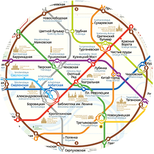
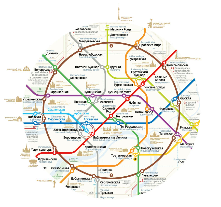
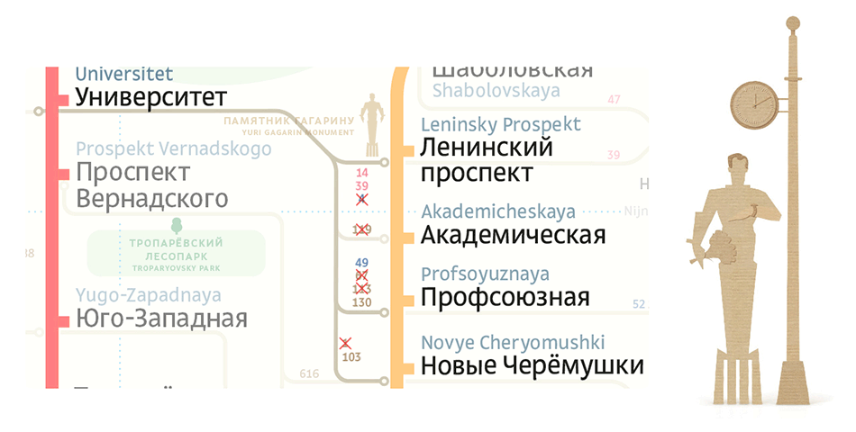
Uniform density of objects and captions is maintained inside the Circle line |
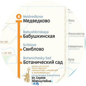
Stations outside the Circle line are given in an easy to read list without geographical features
|
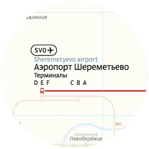
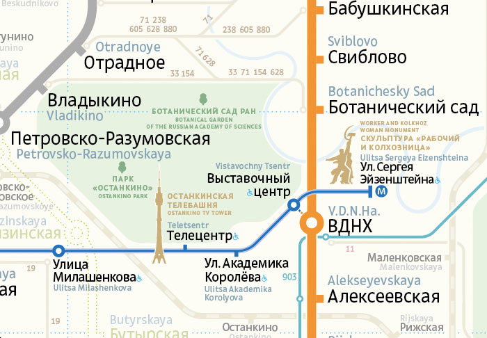
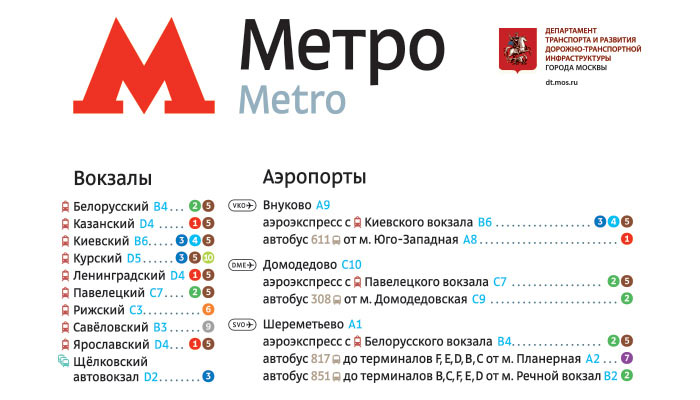
The map can easily show the way from any airport to the city and back. All railway terminals are also marked
|
Russian station names are carefully aligned with marks on the map, while the English names are secondary
|
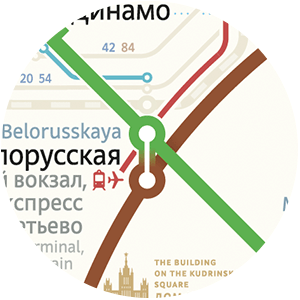
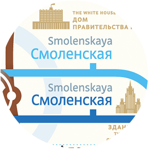
Design of transfer stations
|
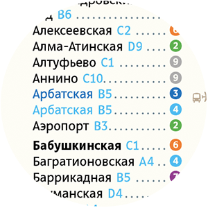
Station index
|
Ground transport
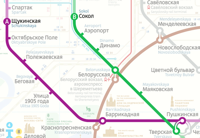
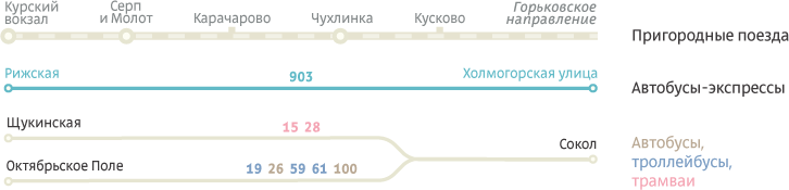
One of the ideas of the new map is to increase the role of commuter trains and surface transport in the Moscow transportation system. Using surface transport reduces the load on the Metro and is often faster and more convenient. For example, getting from Schukinskaya to Sokol via Metro requires traveling through 11 stations and a transfer, while taking the tram is faster and easier.
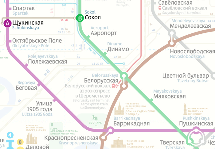
The map shows the routes that connect neighboring Metro lines, but does not include any details or intermediate stops. Only the routes with waiting time of less than ten minutes are chosen, as the main aim is to provide passengers with a faster travel alternative.
Transfer stations of commuter trains and bus stops are marked with circles, just like Metro transfer stations. Aeroexpress, trolleybus, tram and bus (including express bus) routes also maintain this style.
The index includes a separate block listing different ways to get to airports.
The sights
To help tourists, the station map includes main Moscow sights.
Main city parks are also marked on the map.