The making of the Moscow Central Circle navigation
The project starts in June, the Central Circle opens in the beginning of September. Plus at least two more weeks to print the signs. Which means all in all we have a month. In that time we need to prepare the concept, plan sign placement at stations and create all mock-ups.
This isn’t the project where we can go down into the smallest details. Here we need to act fast and solve all problems at the same time. We need a strategy.
Creating a list of materials that we will need to submit to production and describing tasks so we can get results for each type of work.
General project goals:
- Prepare the navigation concept
- Place signs on station plans
- Prepare the numbers and dimensions for all signs for production
- Create mock-ups of the signs
- Double-check everything while the signs are produced
Quick start
It’s easy to get bogged down in the concept, so we have a quick look at all the details, get a feel for potential problem areas and start tasks that almost entirely don’t depend on the concept:
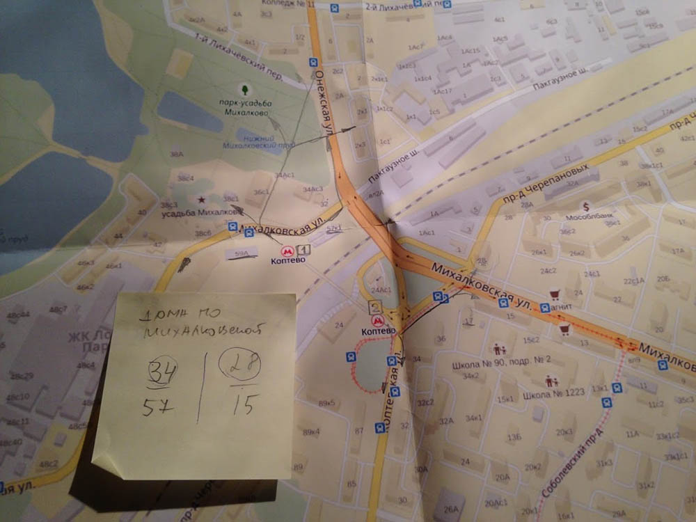
- Gather information about the location of the stations in the city and their surroundings
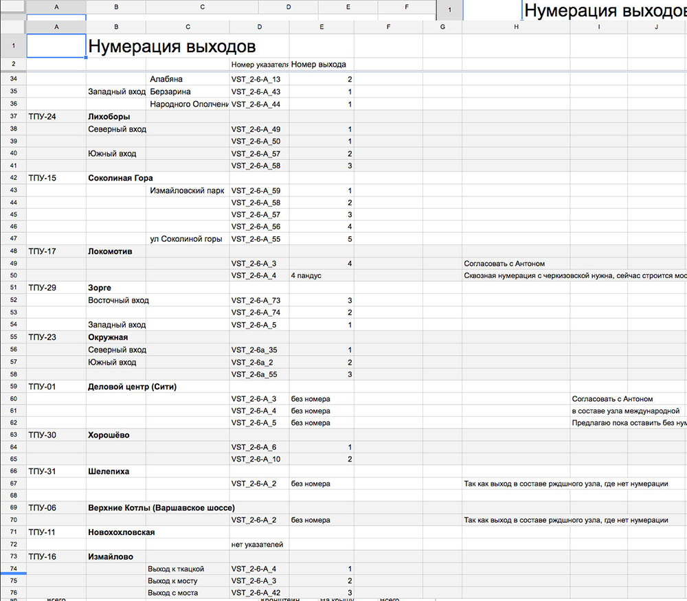
- Number the exits
- Analyze connections with other modes of transport
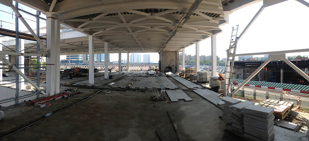
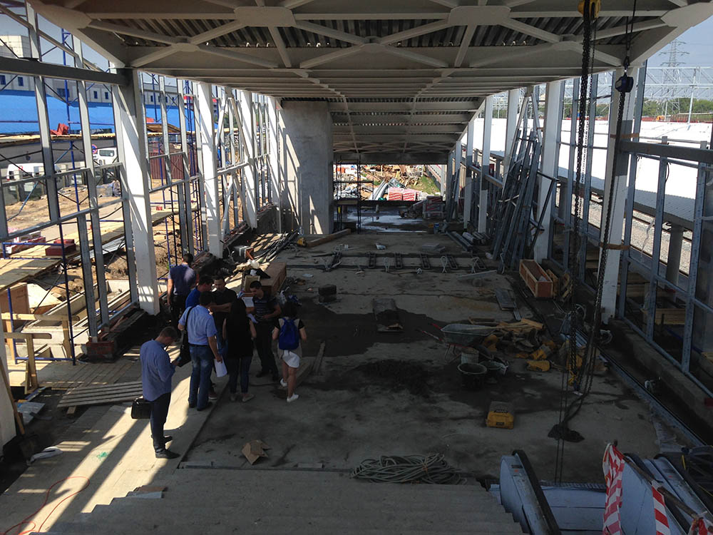
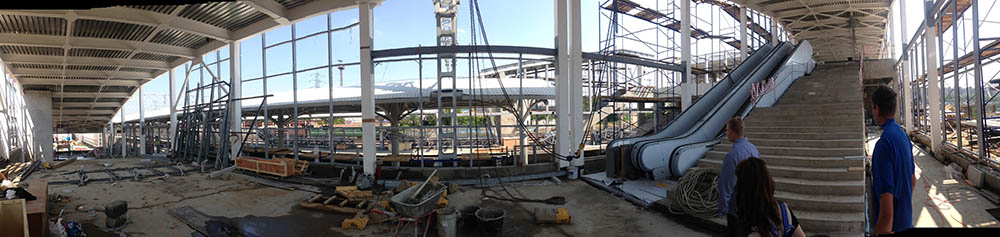
- Go over all blueprints for stations and their premises
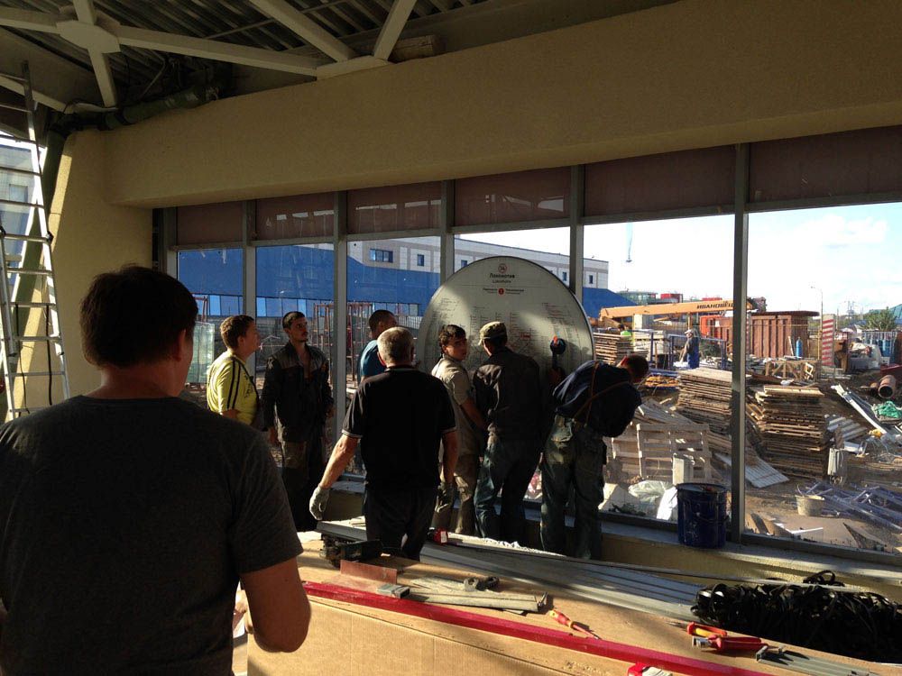
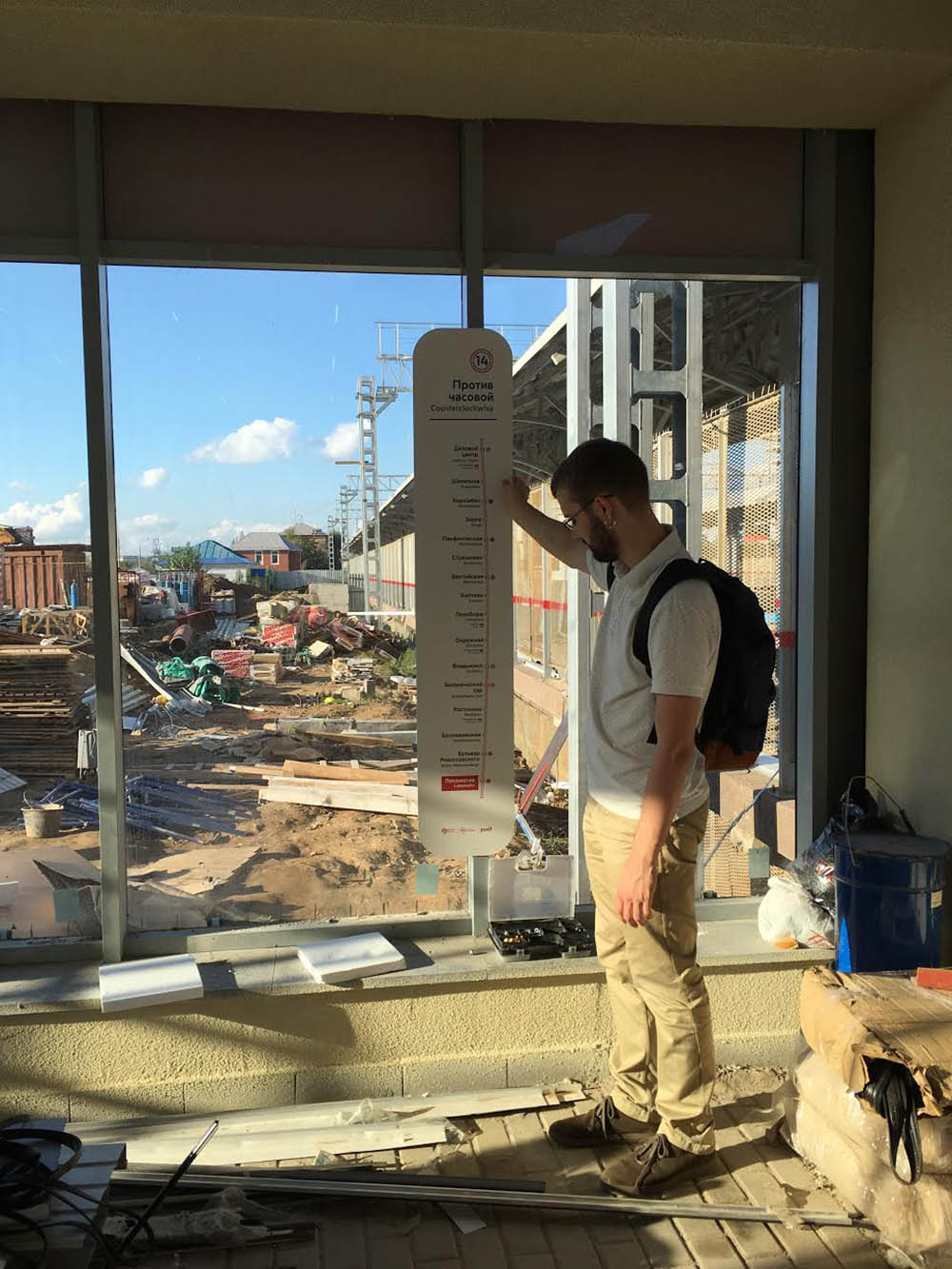
- Take a look at the stations while they are being built
Task: to make a first cut of the concept
We need to carry the concept through a number of checks: testing, mock-ups and temporary implementation. Using the progressive JPEG method: giving progressively more details to graphics and placement after every test, sketch, incoming information about streets and the architectural situation.
Following the plan:
- Untangle passenger flows using the example of a couple of standard stations
- Estimate the number of service facilities (washrooms, ticket offices) and their location
- Explore station layout and structure
- Use quick sketches to test different ways of grouping signs and arranging information on them
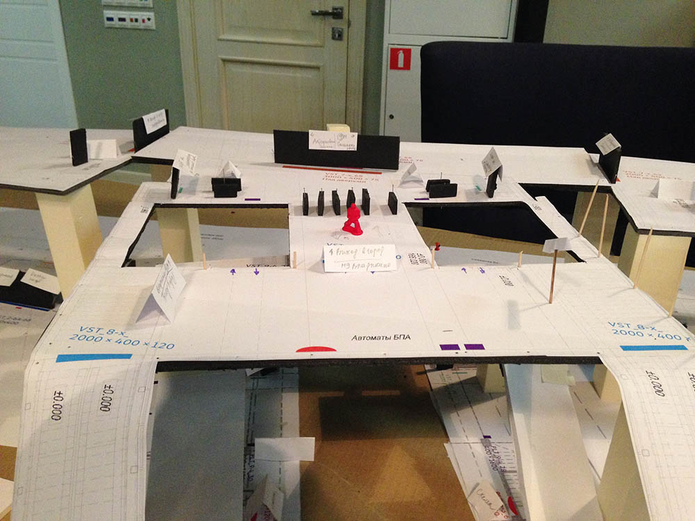
- Move the design onto a paper mock-up, “walking” along the mock-up, testing user scenarios
- Get a rough idea about the appearance of the signs, amount of information and directions
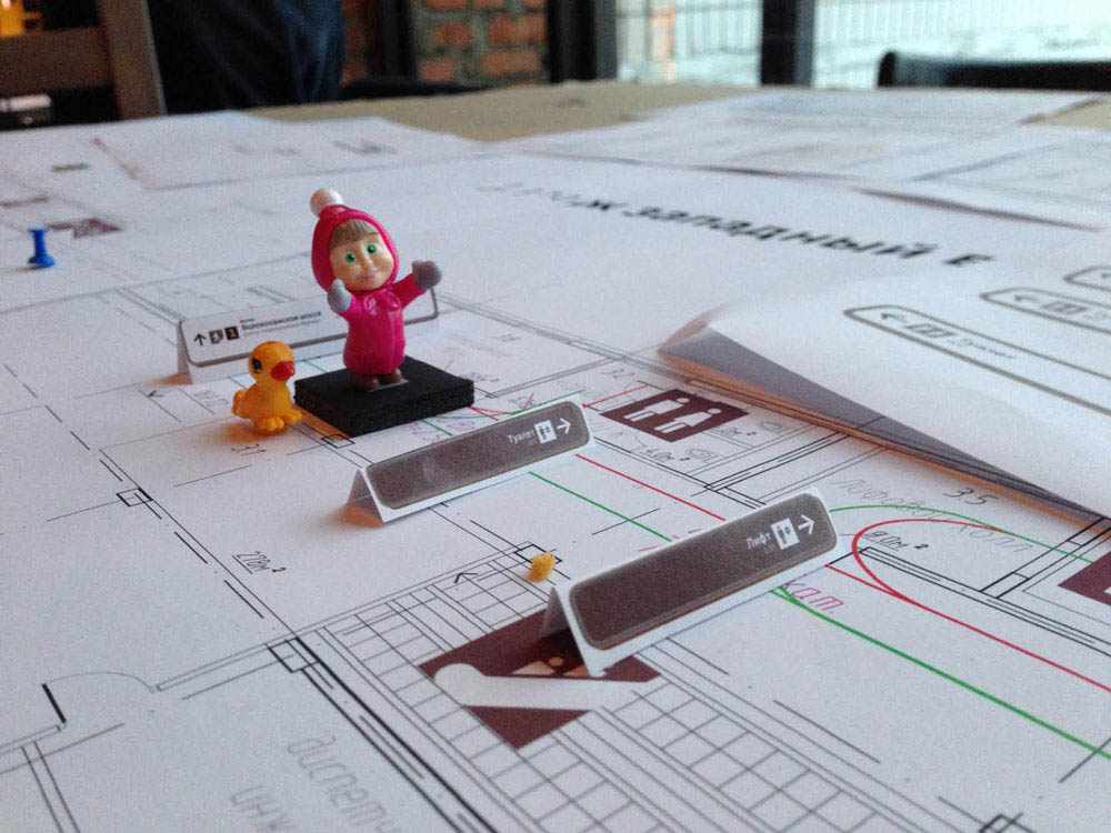
This is enough to start making templates and conducting test installations.
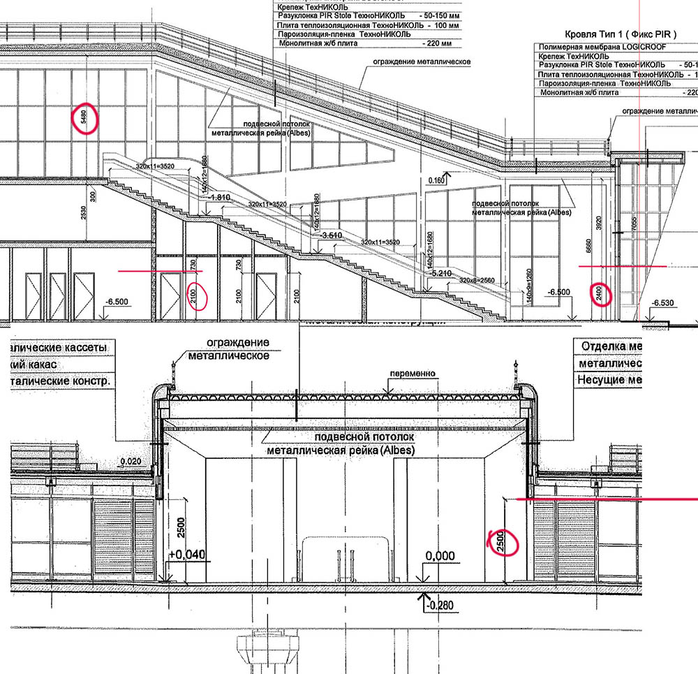
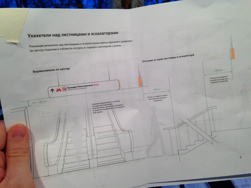
Task: to determine dimensions of all signs for production without waiting for the templates to be typeset
Taking the information we gathered about landmarks surrounding the station to understand the maximum amount of information on the signs and moving on to using real data.
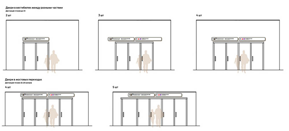
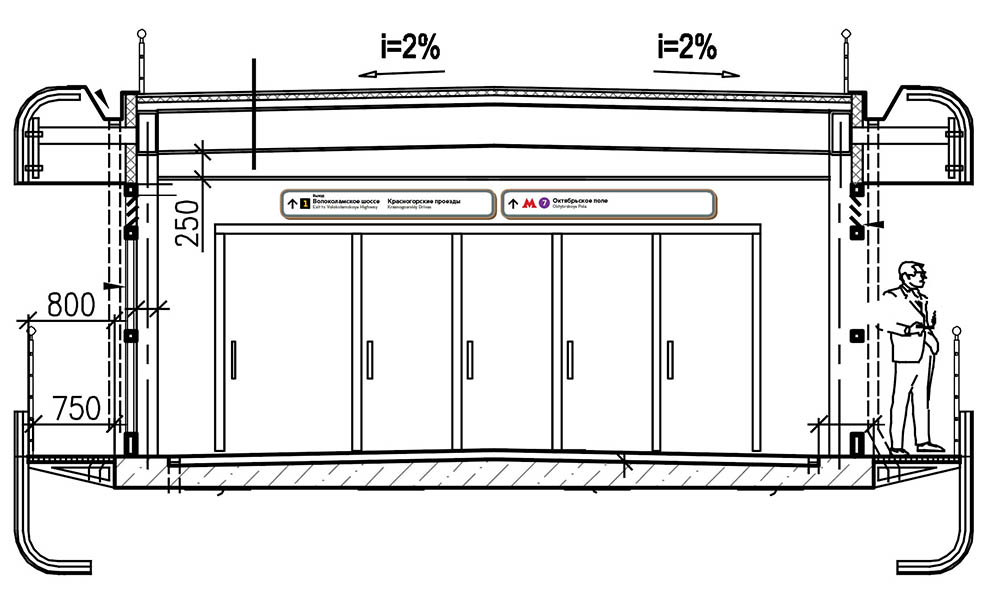
Gathering information about physical limitations at the stations: ceiling height in entrance halls, on overpasses, in passageways, dimensions of escalators, width and number of doors, available surfaces on the walls and above doors.
Next we need to:
- Determine sign reading distances and choose an approximate typeface size
- Get a rough layout for the most difficult signs with long names and a large number of objects
- Create a preliminary size guide
Printing dimensional mock-ups and testing them at a real station.
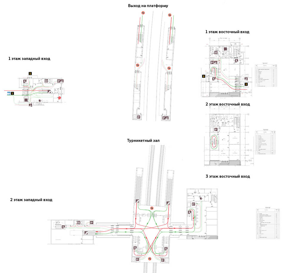
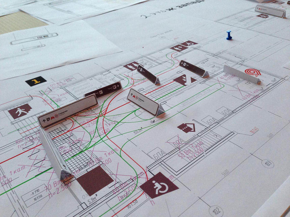
Task: to determine placement of signs at the station
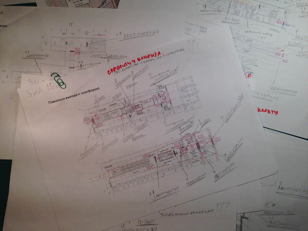
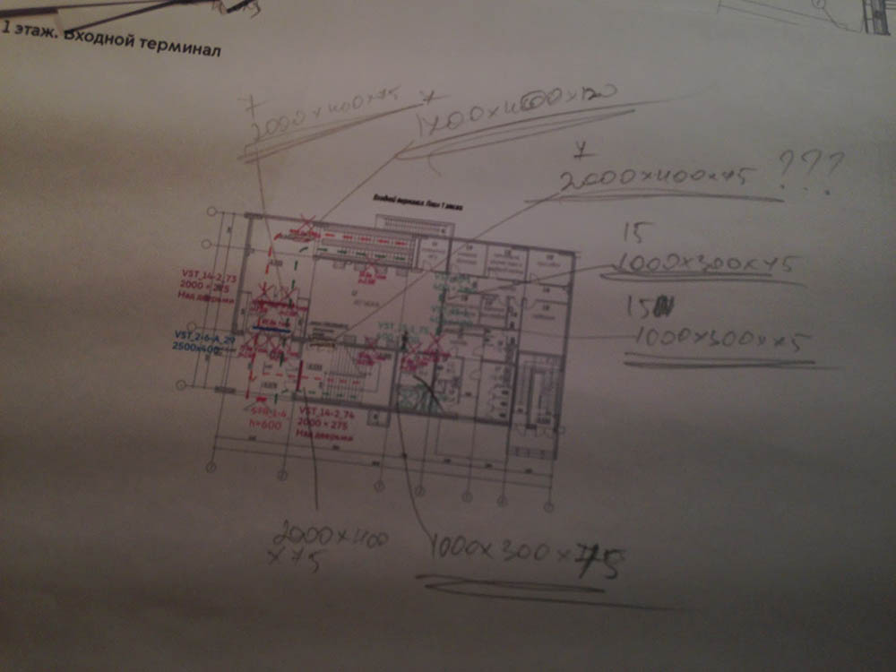
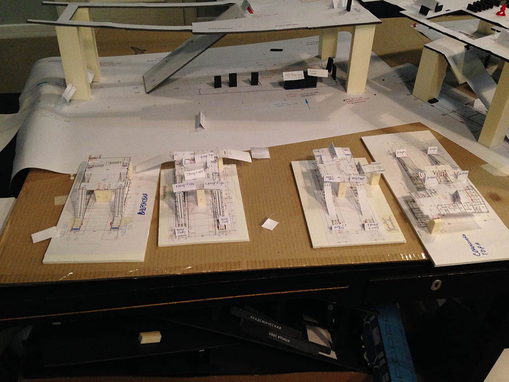
For this task we already have station plans in an easy to use format. Each sheet has a single floor, sheets are signed and numbered. Technical information is removed.
To determine sign placement we need to:
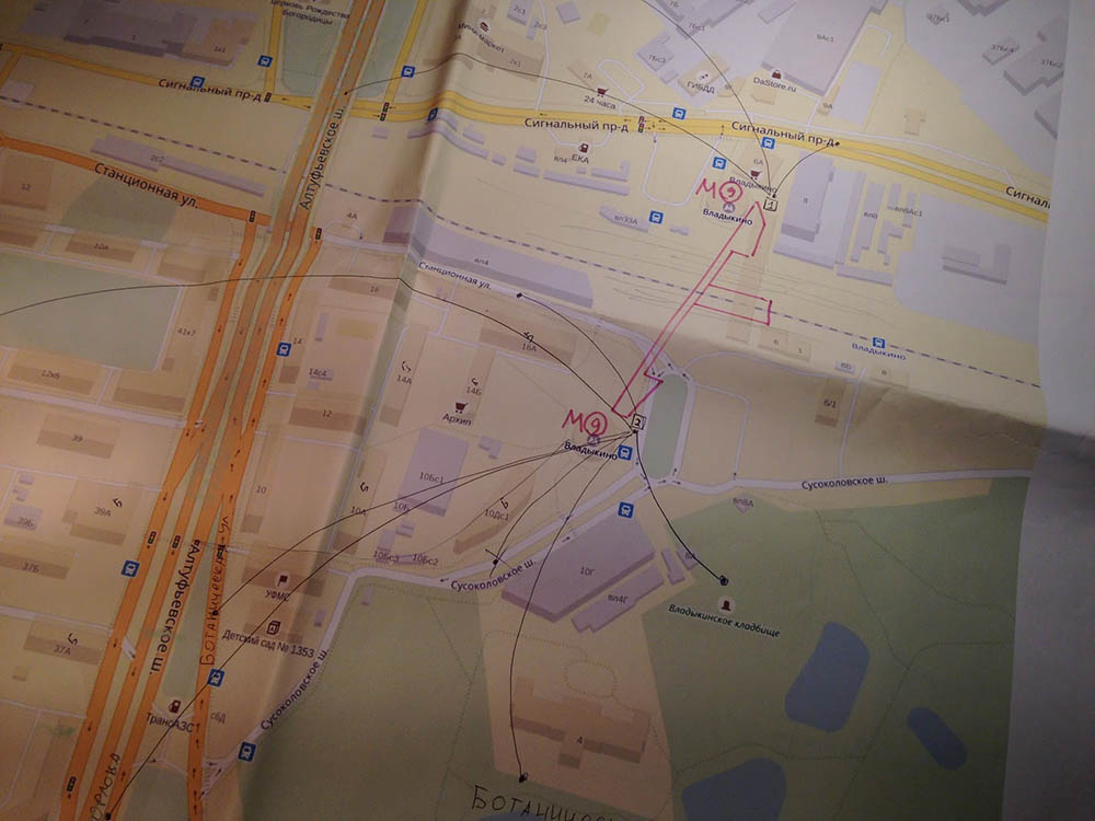
- Deal with possible passenger flows using the plans
- Visit several standard stations to understand distances, viewing angles, scales and test passenger flow hypotheses
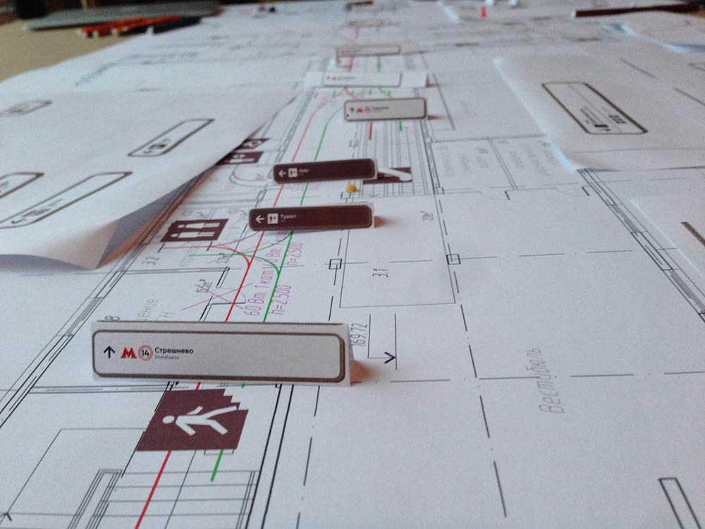
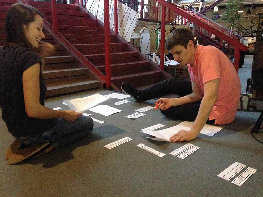
- Mark all signs on the plans with a pencil so we can see the entire picture
- Most likely we’re going to need an algorithm for choosing formats so several people can test and add signs to floor plans
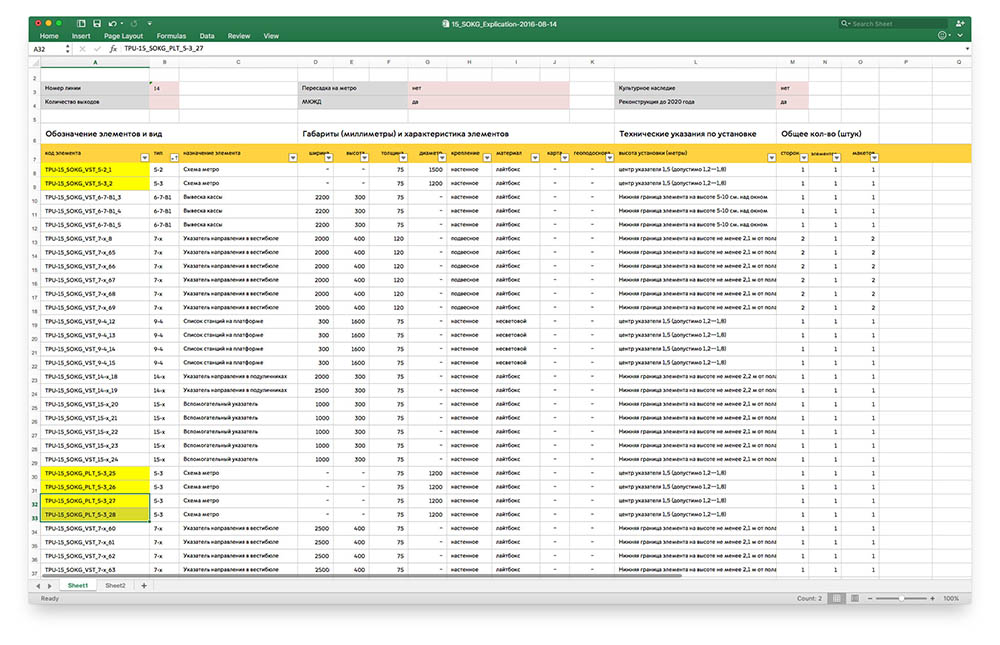
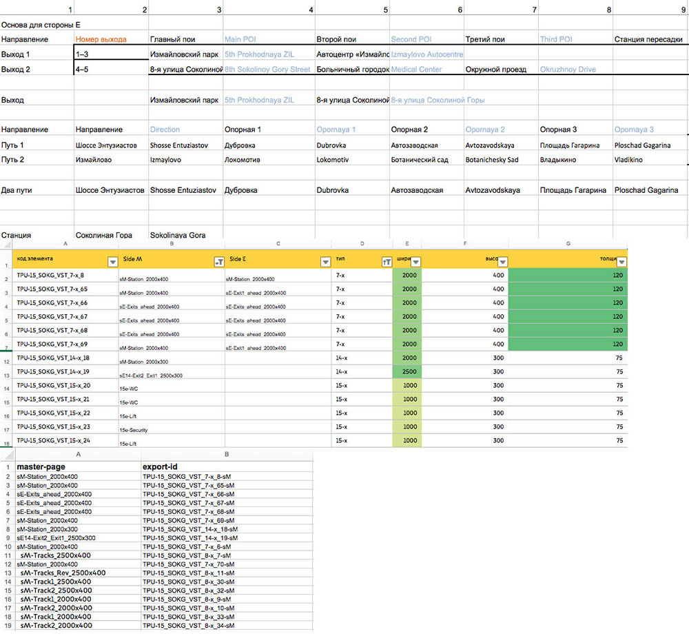
- Next we need to convert everything to an electronic format and create sign lists for each station in Excel
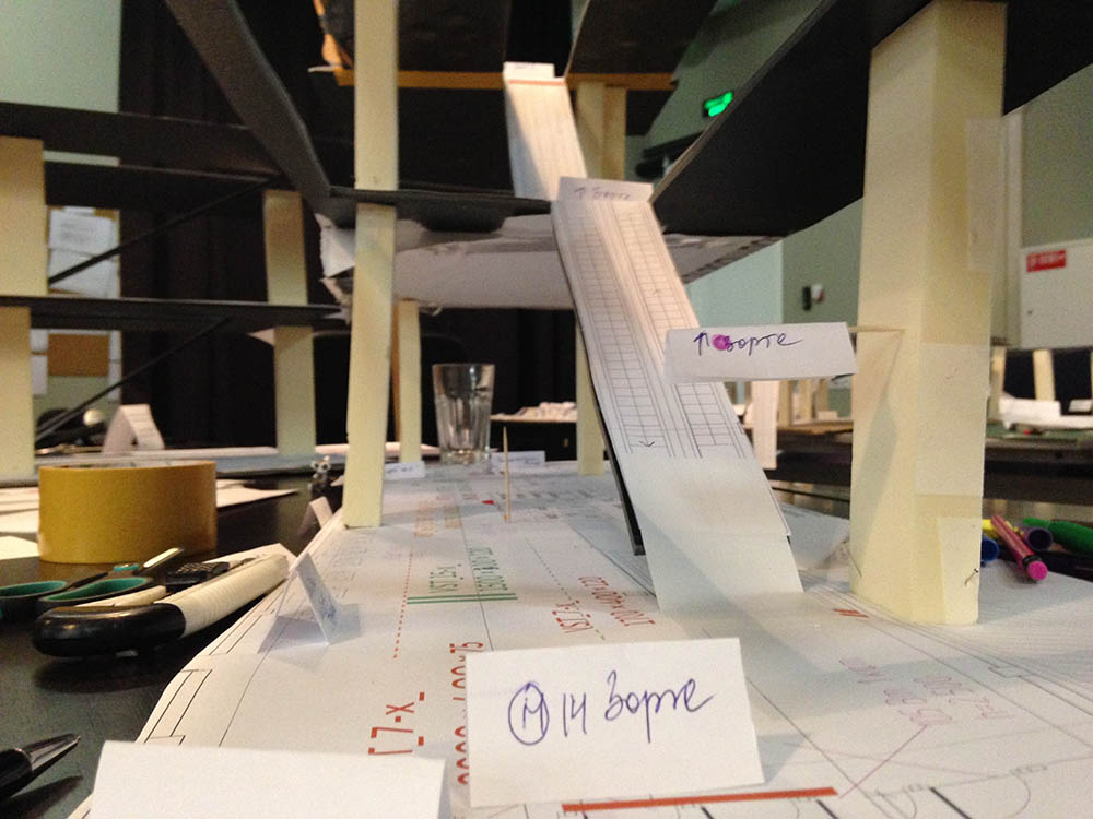
Checking ourselves, creating paper mock-ups of the main spaces to clarify visibility and distances using mock signs.
While working on the task, recording all standard cases in different structures and creating a database of similar spaces on all stations. When placing signs on plans, making sure that similar locations have a similar solution.
Some areas give food for thought after the project is complete: for example, some signs in similar areas are slightly different in details or layout. The next stage is implementing temporary plastic navigation and that’s when we’ll know which problems we weren’t able to solve and maybe have time to fix something before the final signs are ready.
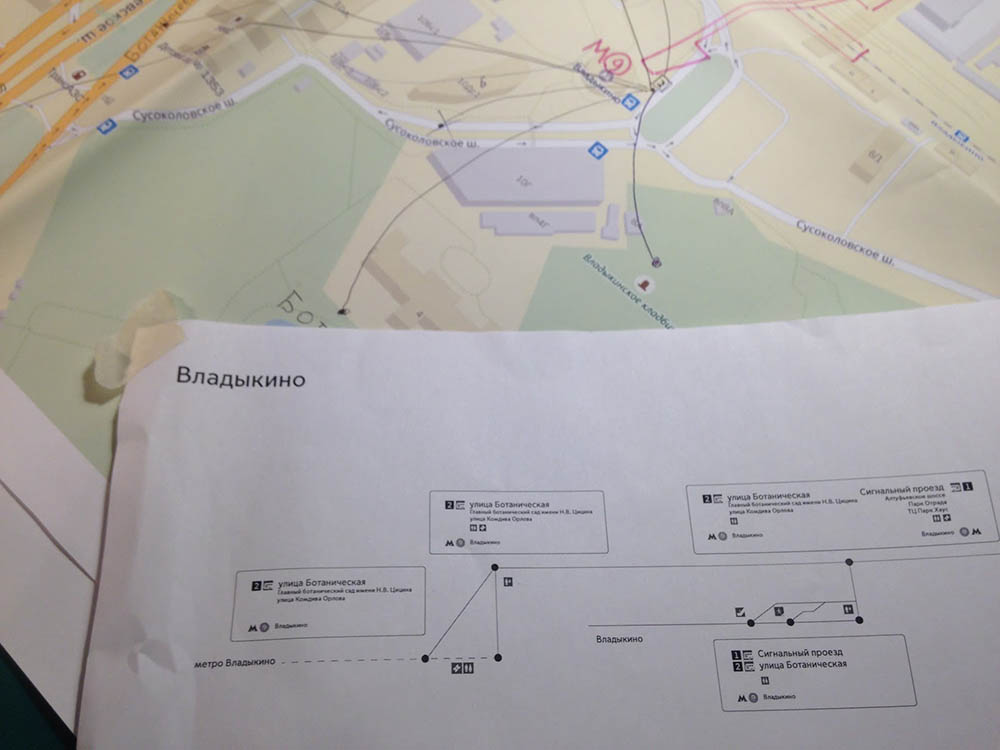
Task: to determine information content of the signs
Materials for this task were also gathered beforehand, long before the appearance of the templates was finalized: exits were numbered, important landmarks and streets were captured and marked on maps.
Now that we have station floor plans and sign placement plans, we can start preparing work documentation.
We need to:
- Prepare information “trees” for each station, from the platform to the exit
- Link transport interchanges to relevant exits
- Determine the minimum information required to describe station surroundings
- Determine the location of service objects inside the station
- Create a template spreadsheet with station names and objects which we can give to the translator and the editor even before the typesetting begins and then use it to generate the signs automatically
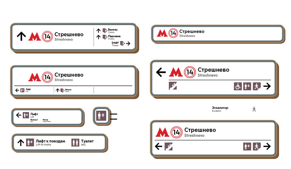
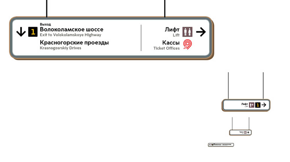
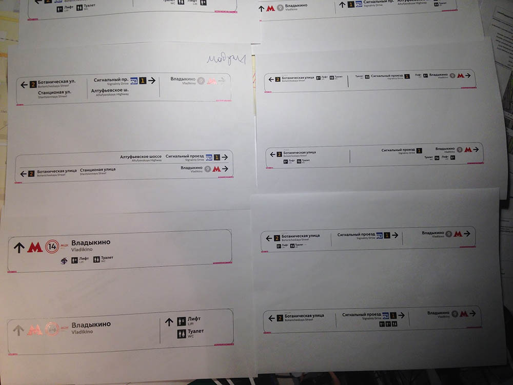
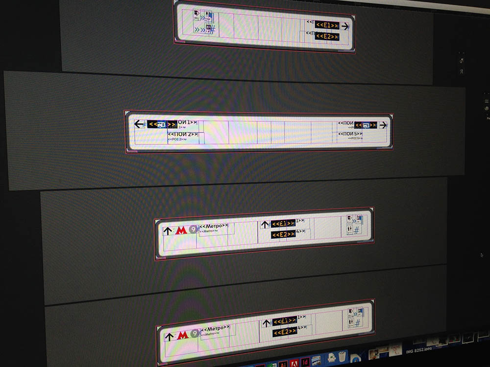
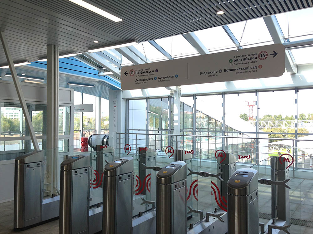
Task: to create layout templates
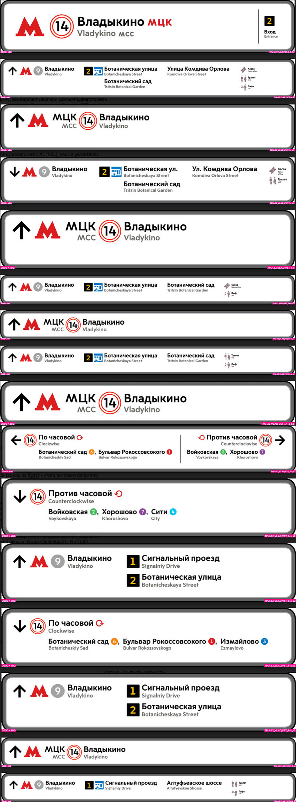
We start preparing the templates after the first presentations of the concept to the client. At the same time, gathering information about streets, dimensions and possible combinations of directions on signs is coming to an end. The designer in charge of creating the size guide keeps the primary versions of the signs in his head and without wasting time to craft a beautiful letter with pictures simply draws all combinations on A4 sheets and sends them for typesetting.
To create the templates we need to:
- Clarify typeface size based on complete data about the length of street and landmark names
- Determine styles and placement of primary and secondary objects
- Choose the style of service pictograms
- Create templates for signs of different formats that have the same logic
- Set up style hierarchy in project files
- Ensure interchangeability of pictograms and typeface symbols in all mock-ups at any project stage
- Prepare mock-ups for automatic generation from information spreadsheets
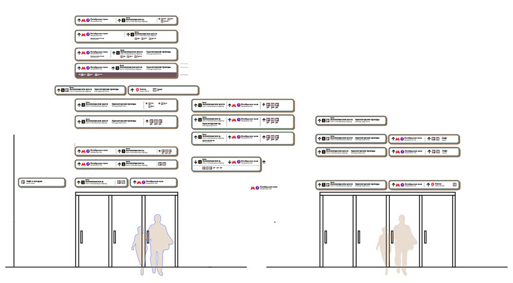
Task: to start generating signs automatically
The automatic generation is behind schedule and at one point it starts to seem that the amount of work required to set it up will exceed the effort required for manual typesetting. Deciding to write our own scripts to save time. Meanwhile, the decision is made to start manual typesetting of the most complex and non-standard cases on which automation will inevitably fail anyway.
The source of information for automatic generation are the spreadsheets we created for manufacturing which already have all formats and sign names as well as data about station surroundings that was checked by the editor and the translator. All that’s left is to find a way to use it.
To do this, in Excel we need to:
- Regroup information so it can be consumed by the script
- Match each sign with a relevant template
- Export the spreadsheets in the required format
And in InDesign we need to:
- Set up generation of pages from different templates and substitution of the sign name in the special field
- Make sure templates can accept information about train travel directions (it was a big problem)
- And the most important thing: each sign needs to be numbered and exported from InDesign with the same file name that it has in production spreadsheet. Of course, this also has to be done automatically
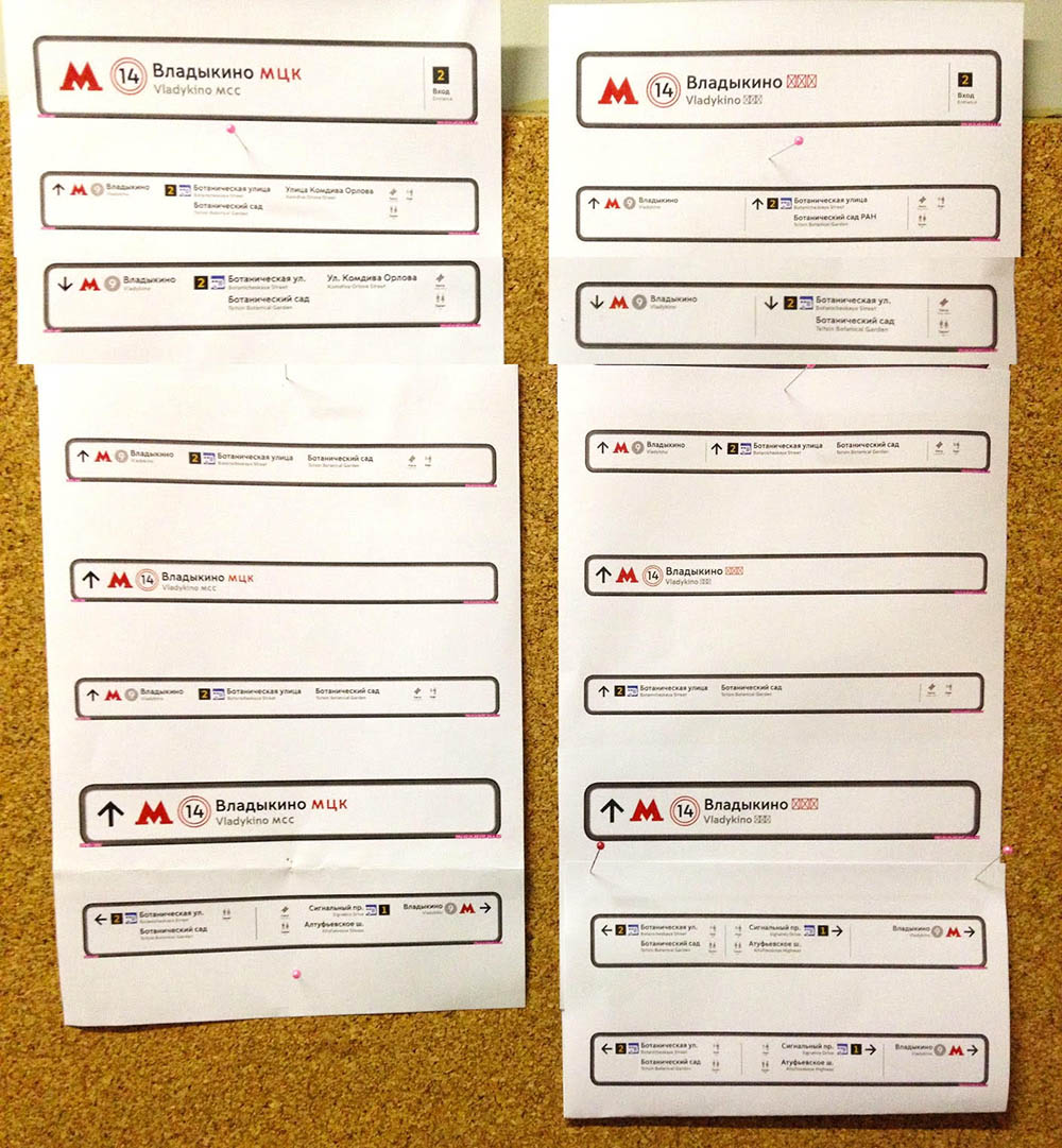
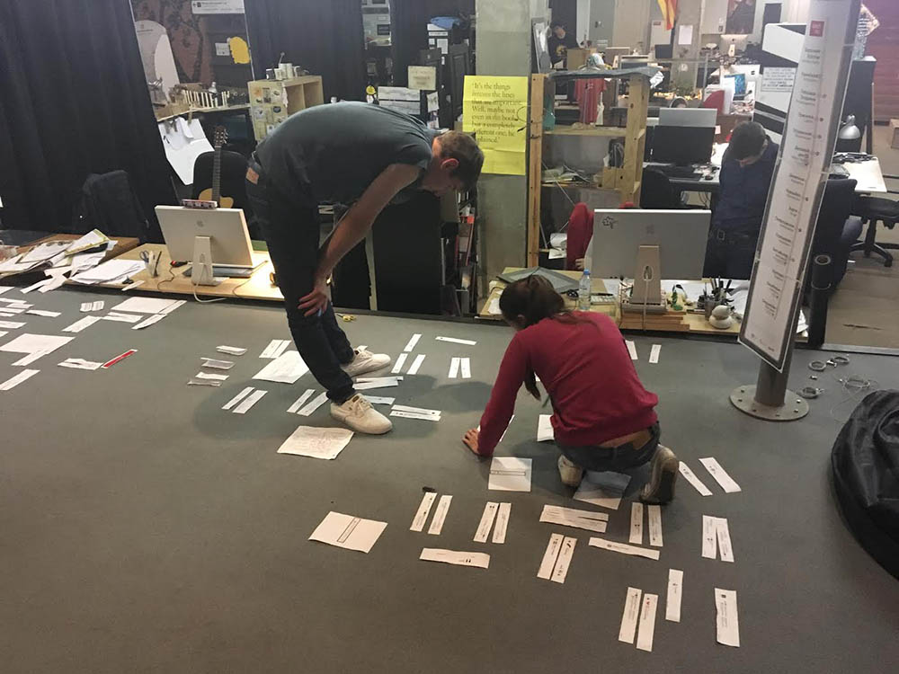
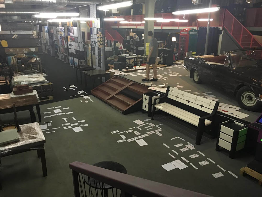
Task: to test the result
The quick templates we created for automatic generation of signs are pretty basic which means most of the signs need to be manually fine-tuned (to make sure arrows point in the right direction, to move or rearrange something, etc.) and logically tested to ensure everything points where it should and passengers are guided all the way from the entrance to the exit.
For this we need to:
- Finish typesetting of the missing signs
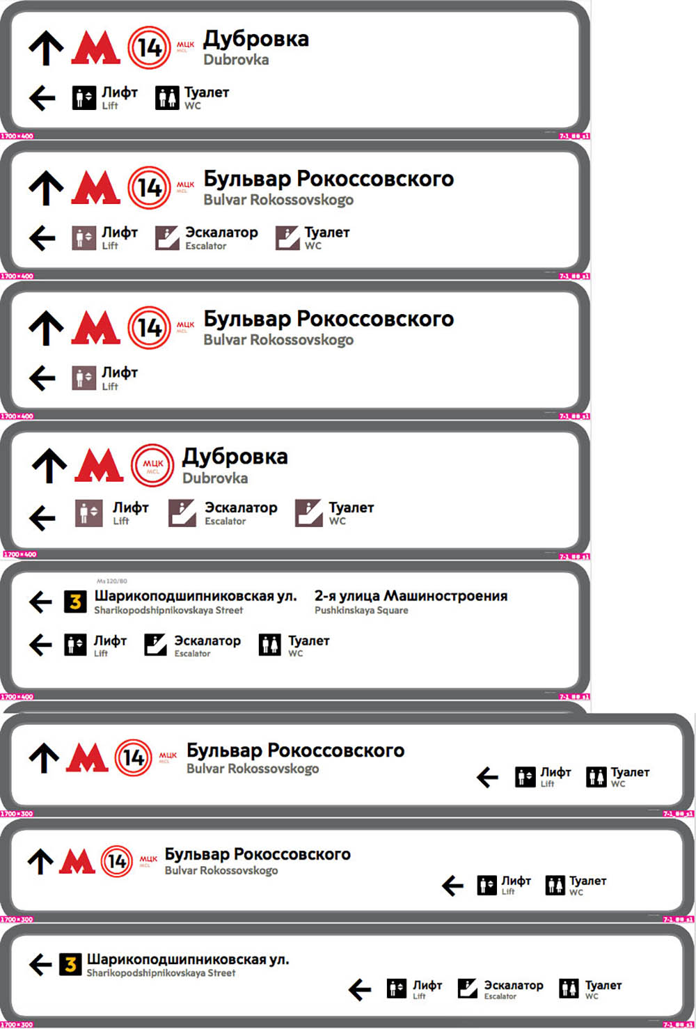
- Check the content logic by printing out all signs and ordering them in the order they are going to appear at the station
- Have the editor and the translator check everything again
- Make all the changes
- Send files for production
- Place all mock-ups on floor plans for the second check
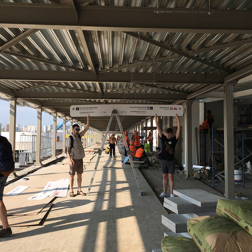
But of course, this isn’t the end of the process yet. After careful consideration the client and the production contractor decide to use temporary plastic navigation for the Moscow Central Circle opening. It means we’ll have a chance to visit all stations and observe the behavior of real people and then make changes to the mock-ups, create an installation manual and submit mock-ups that were tried by real people.
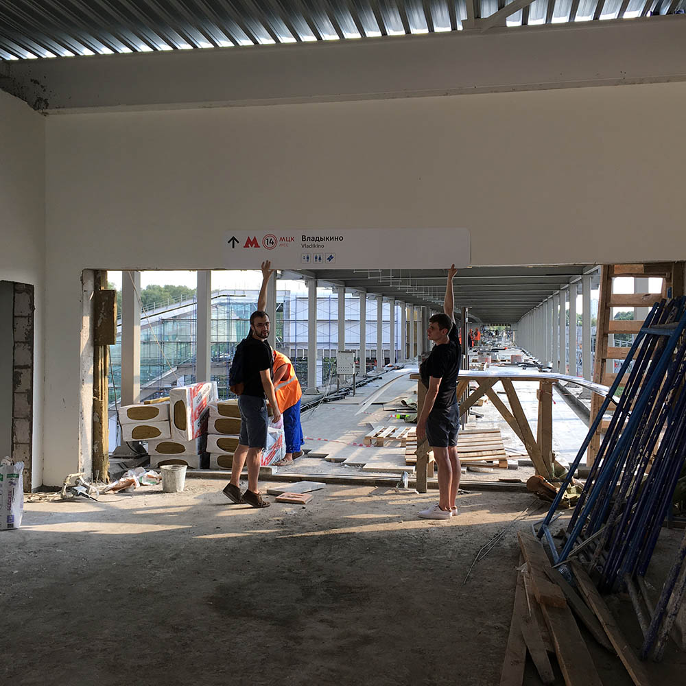
Task: to update placement plans
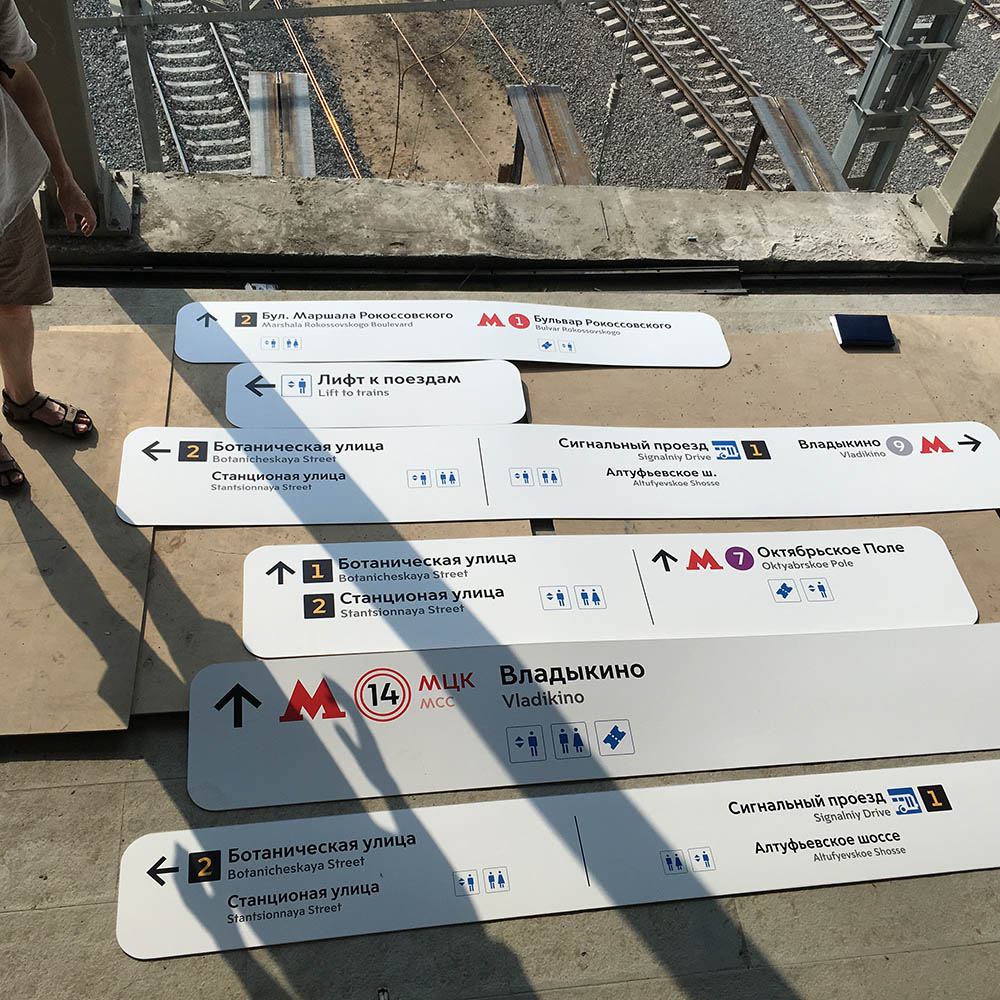
In September we start visiting the stations with representatives of the client and the manufacturing contractor.
Subtasks:
- To adjust sign placement on location (for example, in some cases signs physically could not fit in the proposed location due to the properties of the ceiling)
- To determine the height of each sign and record it on the plan
- To clarify the location of washrooms, ticket offices, police stations, etc. (at some stations these objects are not located where they originally had been placed)
- To check the logic of temporary navigation signs and fix errors
- To create installation instructions
Only after all this is done can we consider the first stage of implementation of the navigation system at the Moscow Central Circle complete.
The next stage is analyzing the navigation in real life, adding missing maps to the stations and creating permanent navigation between Metro and Central Circle stations instead of the temporary one.
