A Unified System of City Navigation has been in development in Moscow since 2013. The project comprises several areas: the Metro, ground transport, pedestrian streets and transfer junctions. One of the stages of the project is the installation of navigation in Metro passageways. Based on the concept developed by the Moscow Department for Transport, mock-ups of navigation elements for Metro stations and a guide on designing maps and preparing texts were created at the studio.
Exit numbers
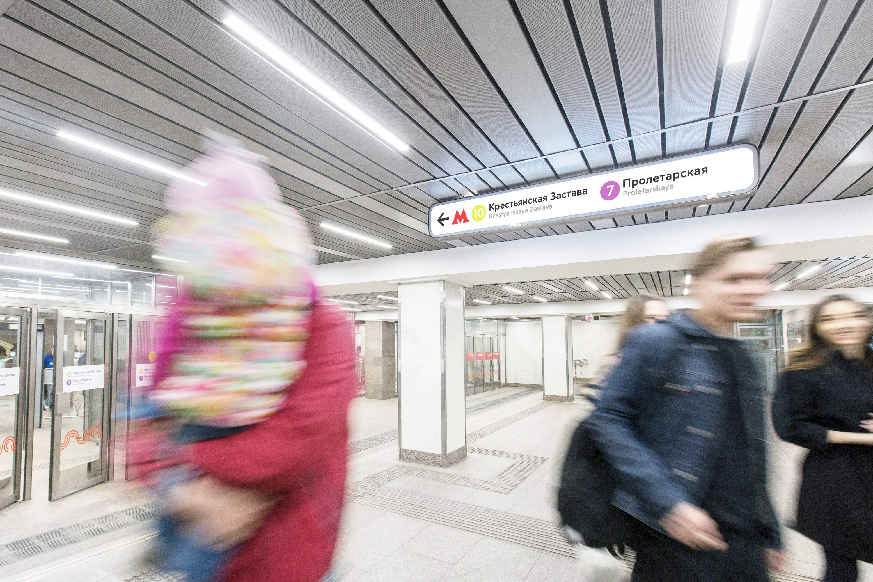
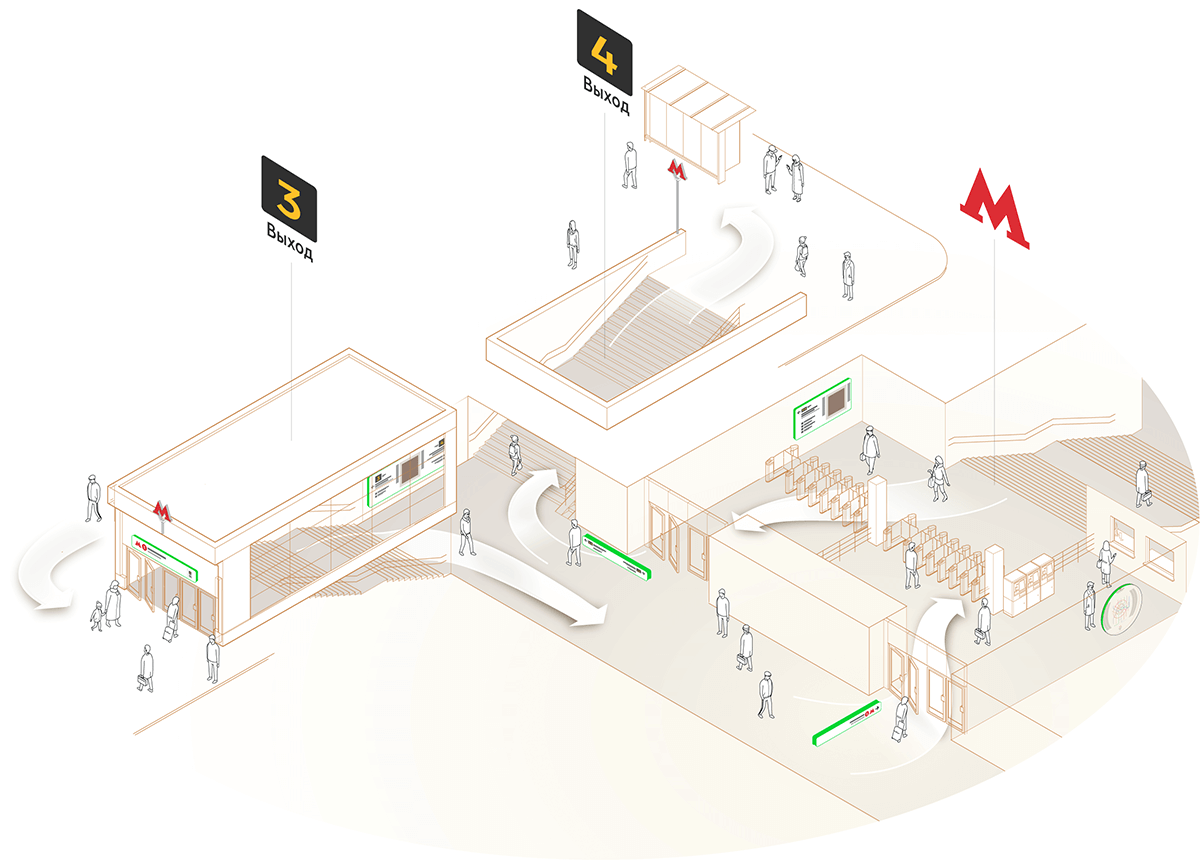
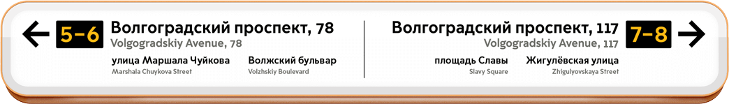
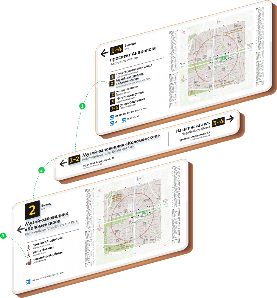
Underground passageways are connected with exits from Metro stations. Their layout is complex, some of the stations have up to ten exits. To make it easier for passengers to find their way, the exits are now numbered.
Exit numbering was suggested by City ID as part of the Unified System of City Navigation. Similar exit numbering can be seen in Tokyo and Hong Kong.
Information signs
When we started adding information to navigation signs, we ran into a problem. In the ideal world each navigation sign is big in size, beautifully illuminated, located in the most visible area, contains a single word and has elves fluttering around.
The reality is a bit different. We have a passageway two inches high and one inch wide and we need to place a sign there in such a way so that passengers don’t hit it with their head. And very close are eight churches, forty six historical monuments, fourteen shopping centers, five libraries, three parks and one small but very proud country. Get to work!
This is where information planning begins.

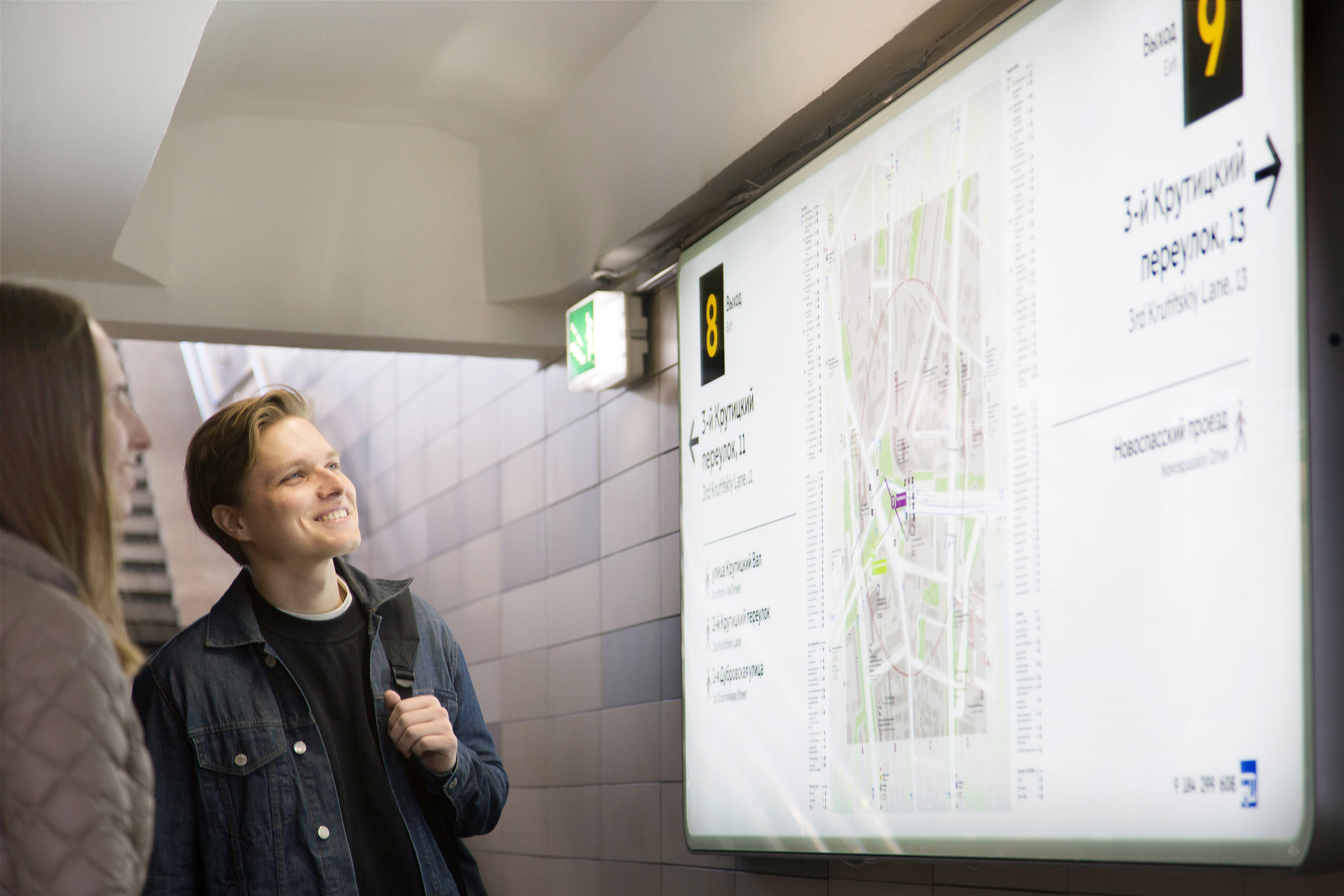
Ranging nearby streets and landmarks
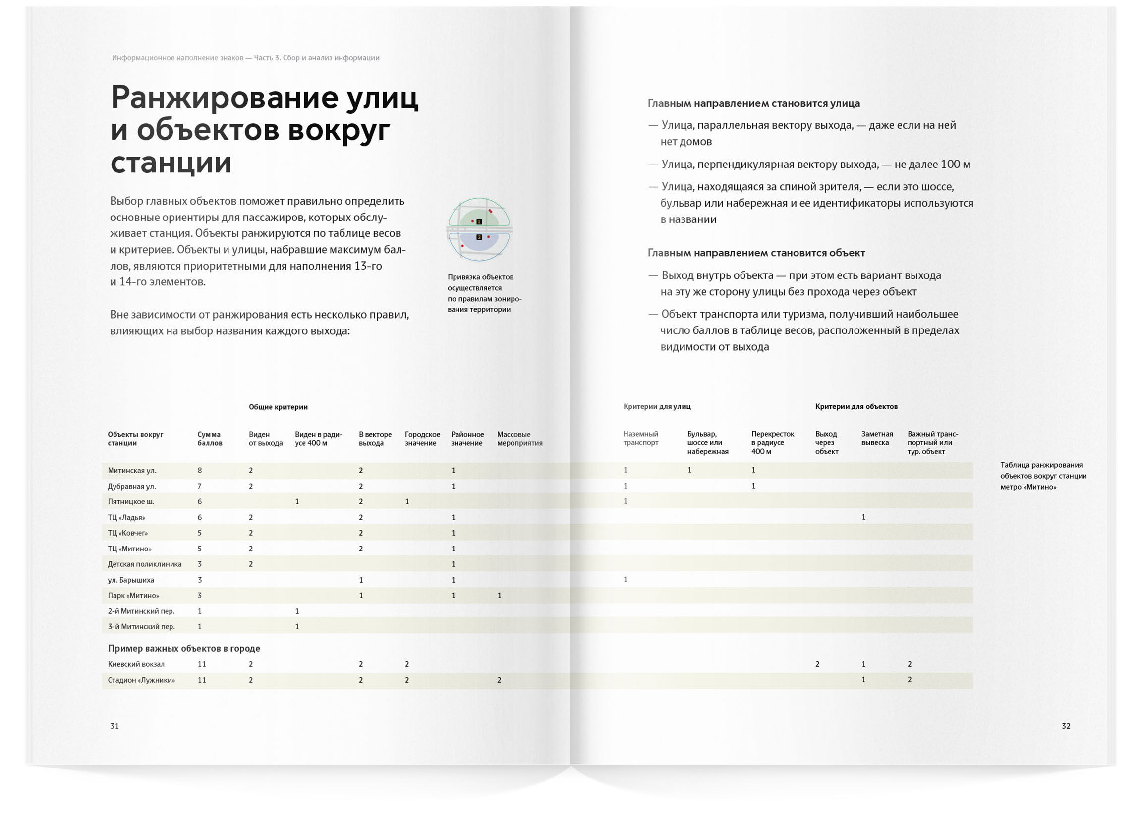
90% of information planning involved efforts to keep only the most important information on the signs. A carefully designed system was created that automatically determines what qualifies as the most important information.
Landmarks are awarded points based on a variety of parameters. Can it be seen from the Metro exit? Add a point. Does it have high urban value? Add another one.
The ranging removes any subjectivity and human interference.

Previously, navigation at the outskirts of the city was arranged following the best traditions of municipal formalism. All fourteen exits could easily lead to the same Profsoyuznaya Street and the signs were quick to offer helpful information: Left for Profsoyuznaya! Right for Profsoyuznaya! Do what you will.
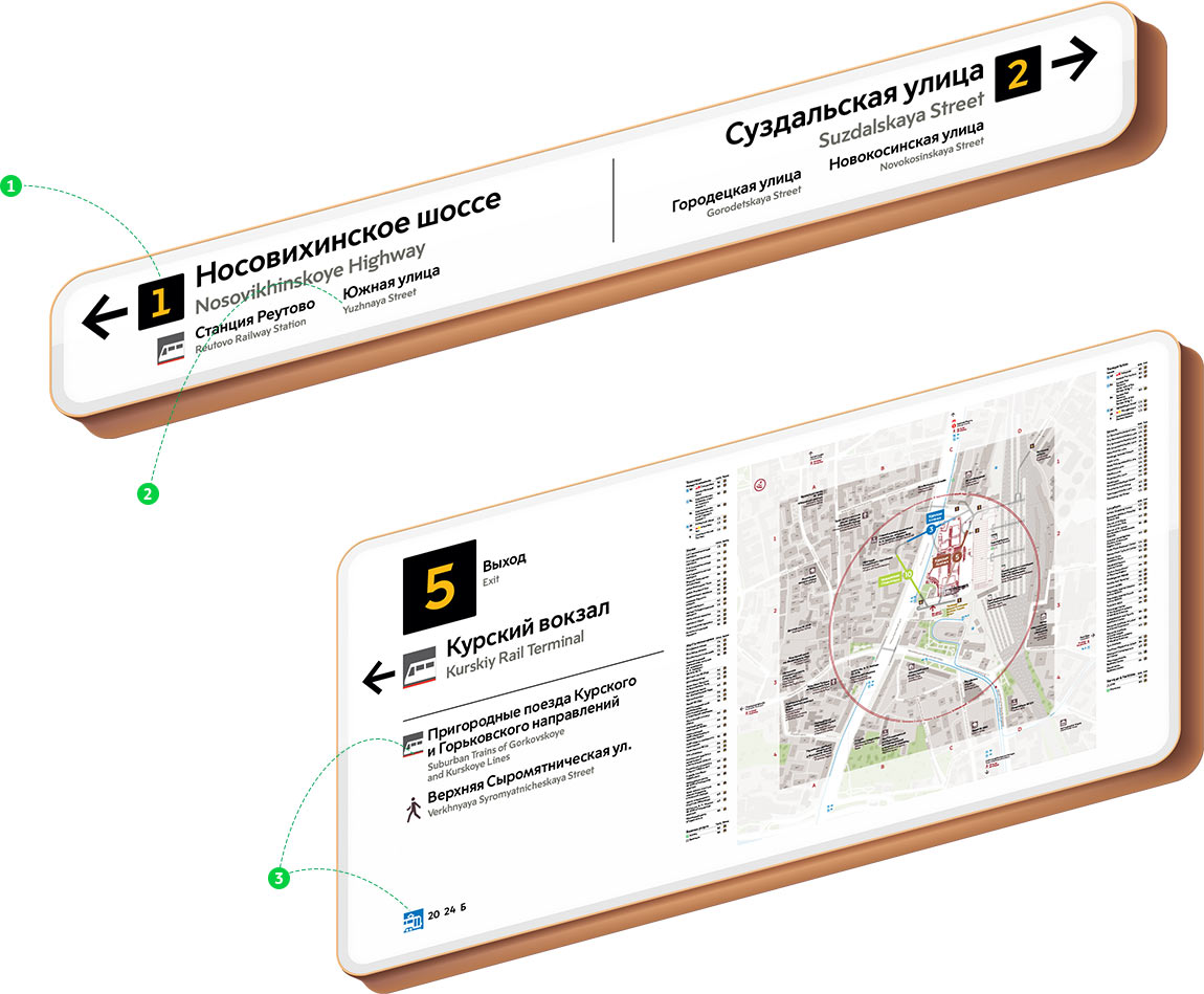
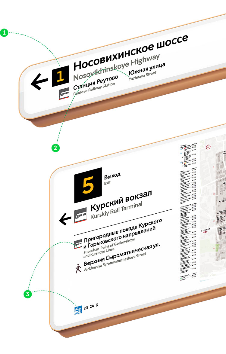
We started displaying building numbers for the closest buildings and directions to the nearest streets on signs. This helps find your bearings and distinguish one side of and endless avenue from the other.

Comfort
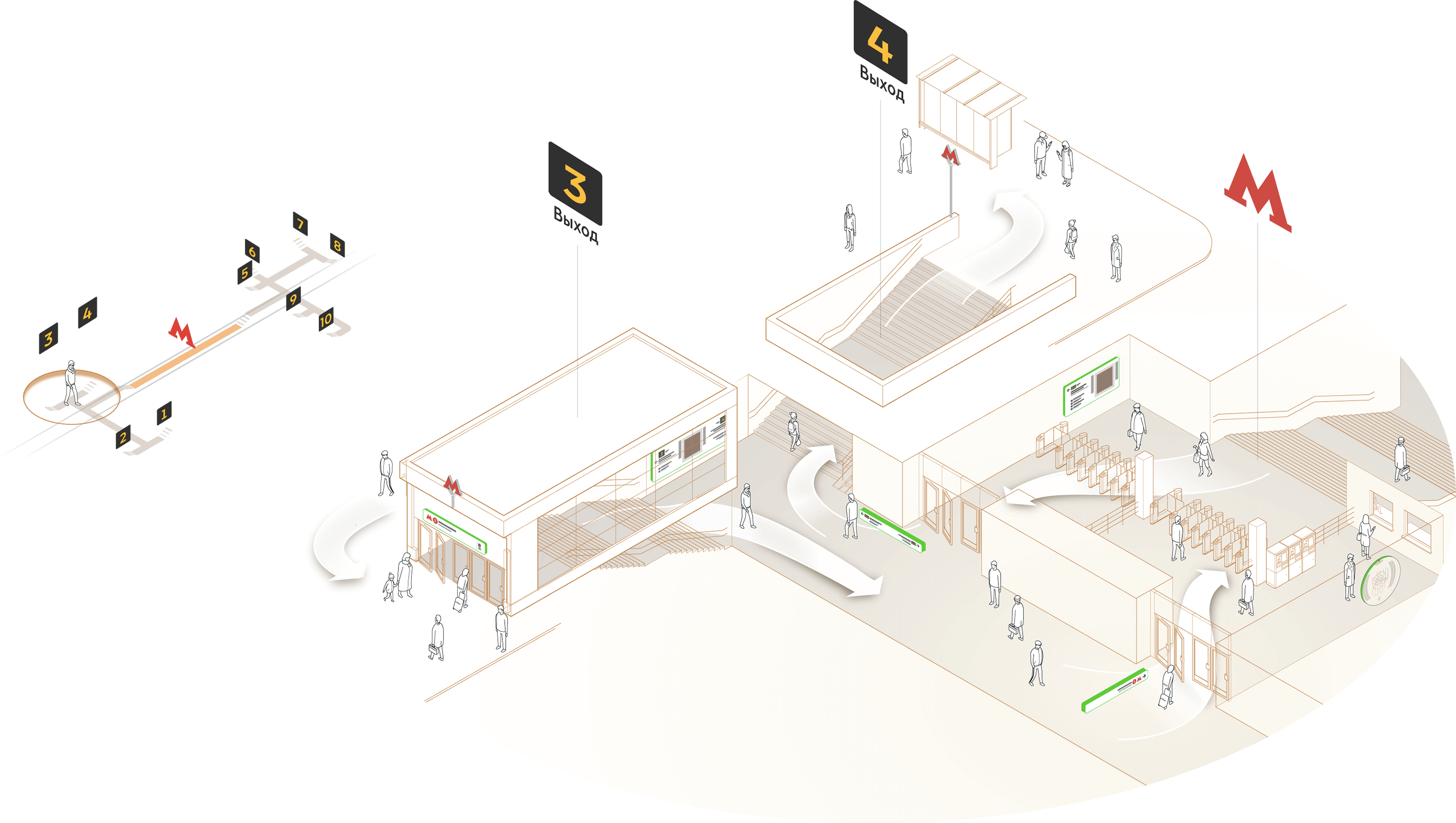
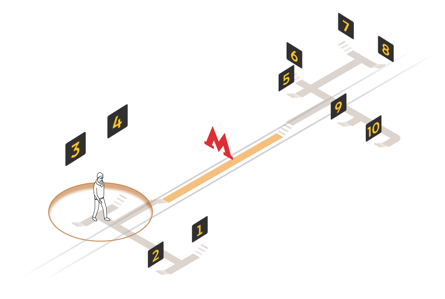
Passengers read different types of signs from different distances, which is why a special typeface size was chosen for each sign type.

Passengers read the sign at the fork by the station exit on the go, from a very short distance, roughly 5–7 meters (16′–22′)
Passengers read the sign with the exit name while moving in the flow, gradually getting closer to the fork, from a distance of about 10–12 meters (33′–40′)
The sign marking the entrance to the station should be visible throughout the entire passageway, on average starting at a distance of 20–23 meters (66′–75′)
Predictability of information on signs
In long passageways pedestrians often get the feeling they got lost and are moving in the wrong direction. Even if they just saw a sign, a couple of minutes later they get the same anxiety: “What if I missed my turn?”
That’s why the information on navigation signs is duplicated and repeated. The closer to the exit, the more detailed the list of the nearest streets and landmarks becomes.


Maps and indexes
Stations now have maps with a detailed alphabetic index. Map graphics and index layouts were improved at the studio.
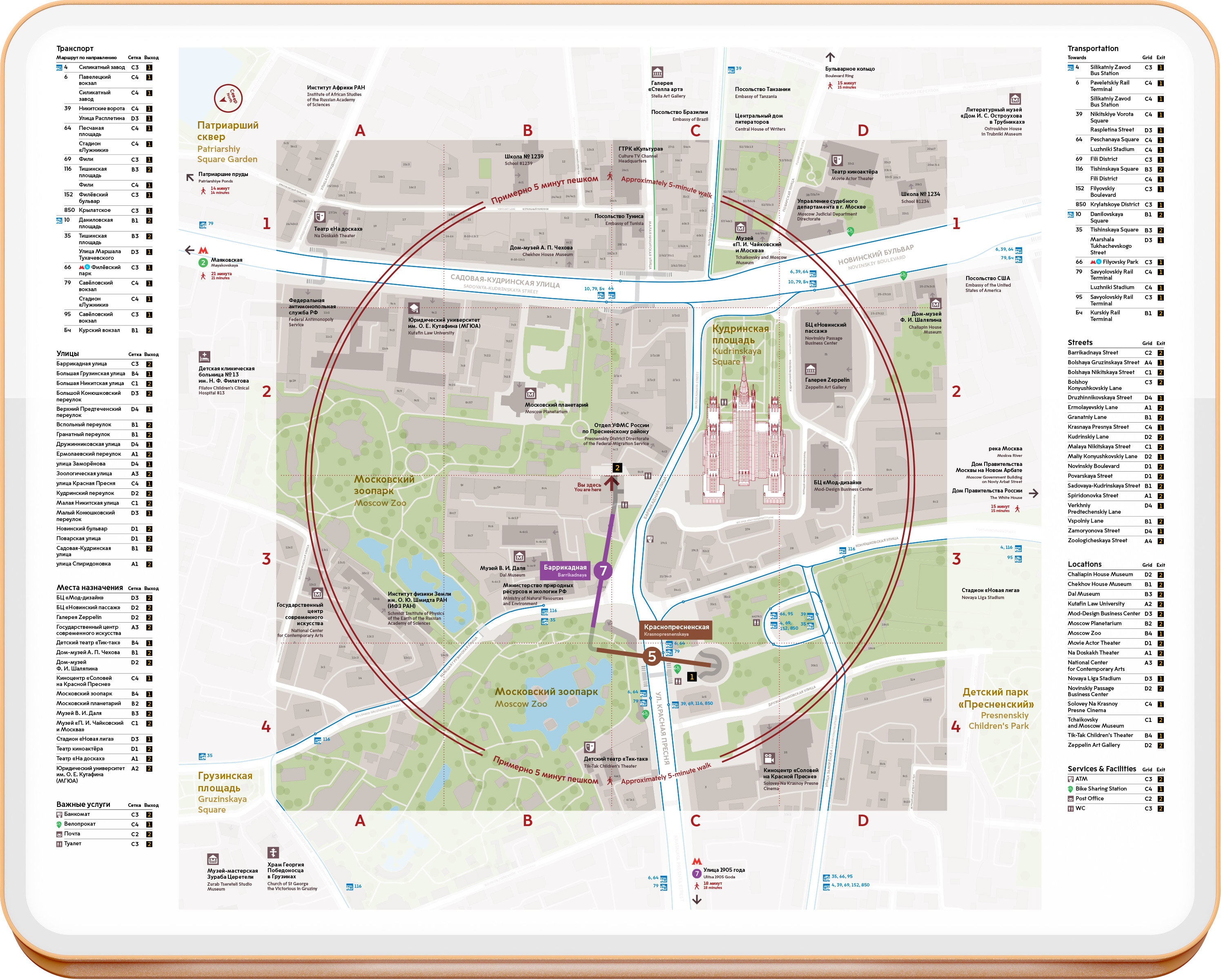

Rules for drawing maps and adding information to them are collected in a separate guide.
Language
Special attention was given to the Russian and English wording for navigation media. A detailed guide was created with rules of spelling, translation, transliteration, abbreviation and typography of names of all possible city objects and place names used in navigation.
Overall, 2500 sign mock-ups and over 500 maps for 96 stations were created for the project.
Frunzenskaya
Sportivnaya
Vorobyovy Gory
Yugo-Zapadnaya
Troparevo
Rumyantsevo
Salaryevo
Zamoskvoretskaya line
Rechnoy Vokzal
Vodny Stadion
Kolomenskaya
Tsaritsyno
Orekhovo
Domodedovskaya
Alma-Atinskaya
Arbatsko-Pokrovskaya line
Pyatnitskoe Shosse
Mitino
Volokolamskaya
Strogino
Krylatskoe
Park Pobedy
Pervomayskaya
Filevskaya line
Vystavochnaya
Delovoy Tsentr
Kaluzhsko-Rizhskaya line
Medvedkovo
Sviblovo
Alekseevskaya
Rizhskaya
Sukharevskaya
Turgenevskaya
Kitay-Gorod
Tretyakovskaya
Shabolovskaya
Novye Cheremushki
Konkovo
Yasenevo
Novoyasenevskaya
Planernaya
Skhodnenskaya
Tushinskaya
Spartak
Oktyabrskoe Pole
Begovaya
Barrikadnaya
Kuznetsky Most
Kitay-Gorod
Proletarskaya
Kuzminki
Vykhino
Lermontovsky Prospekt
Zhulebino
Kotelniki
Kalininskaya line
Marksistskaya
Novogireevo
Novokosino
Serpukhovsko-Timiryazevskaya line
Altufyevo
Bibirevo
Otradnoe
Petrovsko-Razumovskaya
Timiryazevskaya
Dmitrovskaya
Savelovskaya
Mendeleevskaya
Tsvetnoy Bulvar
Polyanka
Serpukhovskaya
Tulskaya
Nagornaya
Nakhimovsky Prospekt
Sevastopolskaya
Chertanovskaya
Yuzhnaya
Prazhskaya
Annino
Seligerskaya
Verkhnie Likhobory
Okruzhnaya
Fonvizinskaya
Butyrskaya
Maryina Roscha
Dostoevskaya
Trubnaya
Chkalovskaya
Rimskaya
Krestyanskaya Zastava
Dubrovka
Kozhukhovskaya
Volzhskaya
Lyublino
Maryino
Borisovo
Shipilovskaya
Zyablikovo
Kakhovskaya line
Kakhovskaya
Varshavskaya
Butovskaya line
Lesoparkovaya
Ulitsa Starokachalovskaya