User-friendly navigation system doesn’t make you study its manual for hours. Functional navigation system doesn’t draw your attention away from the road. Considerate navigation system keeps handy info and settings easy for you to access. Interactive navigation system indicates traffic flow and your friends’ locations, and allows storing useful driving notes and places to stop for hot French pastries. Shturmann navigation system offers all these advantages.
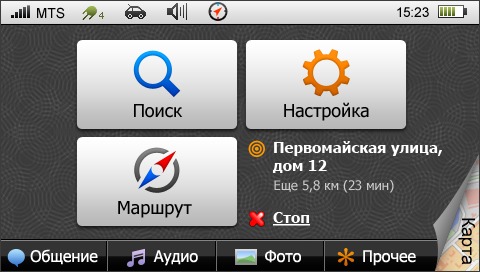
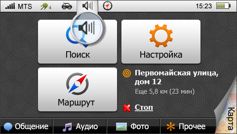
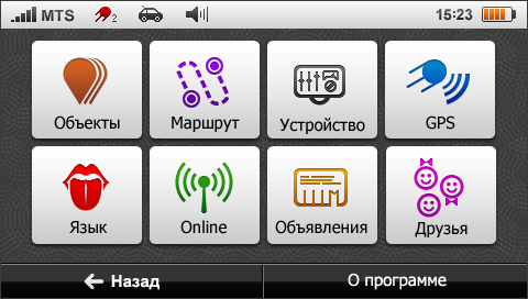
The main menu includes two major groups of functions: Navigation (find location, driving route, settings) and Accessories (mix with friends, music, photos, etc.). The menu page always keeps you notified of your current destination status.
Map
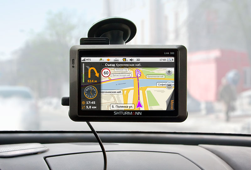
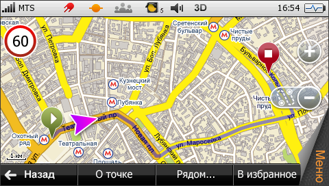
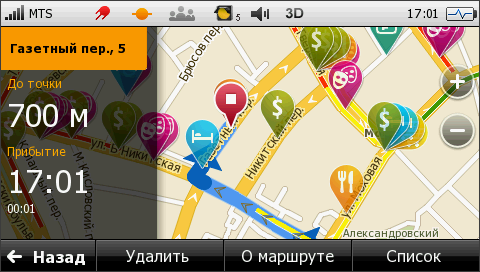
Map is the basic element of the navigation system. It shows your current location and driving direction, route legend, next turn info and how far it is, time and distance to destination, and speed limits (optional).
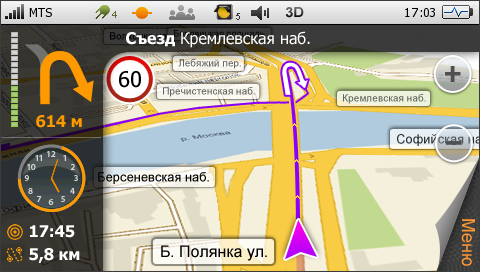
The system provides voice instructions for every turn. When driving at a high speed, you receive directions early enough to prepare to make a maneuver.
When the vehicle is approaching a turn, the system clearly indicates its progress. For those who wish to have exact figures, there is an option allowing to see distance and time to the next turn. When driving through a complex interchange, you can temporarily open a window with information on the next turn. With the difficult part already passed (or after a certain amount of time), the system returns to the map mode.
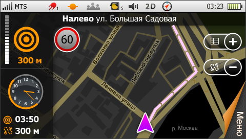
The top menu features a clock (none of the navigation devices available at the moment display current time). The analog clock indicator shows both current time and time to destination—during the last hour, the orange bar shrinks as you approach the end of the route. Below the clock, there are estimated time and distance to destination.
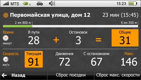
Statistics
Shturmann stores your car trip data: distance, time and speed, and the number of stops.
Scale
You can scale and study the map in detail using the specially designed grid tool. In this mode, the grid in proportion to the screen is laid over the map, and enables you to zoom in on the selected area.
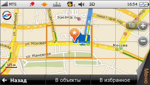
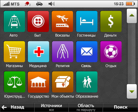
Objects on the map
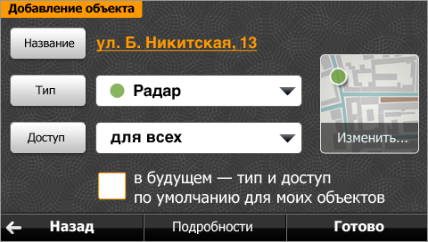
The system shows various objects and interesting places on the map. These include gas stations, home food restaurants and best cafes, hotels and stores, car services and so on. Many such places are already marked on the map that comes with the device. Nevertheless, you can add more items to this list as you travel.
Interesting places are marked with different color petals. They are large enough, so you can easily recognize the icons, and transparent, so you don’t have problems using the map.
 |
 |
|
A petal marks a place of interest. It clearly points to a location and doesn’t get in the way. |
For more detailed information or tracing the route, you should open a pop-up menu by clicking on the petal. |
On the map several petals get folded together. When you click, they unfold into a nice fan. |
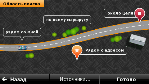
Search settings allow you to select the area in which you wish to find the marked objects—for example, only close to your current location or the final destination.
If you discover a good restaurant or get stopped by road police somewhere, you can immediately save and and share this useful information with your friends.
Indicators
Many pages feature status bar—you can see how the system is doing and what modes are currently active.
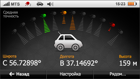
Satellites
The satellite info page displays available satellites and signal strength for each of them. Currently used signal sources are marked with different colors depending on reception quality, and the length of the band shows how strong the signal is.
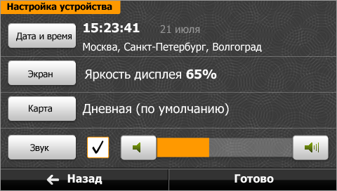
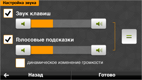
Settings
There are dozens of options to configure your device and the system, conveniently grouped according to purpose.
Main options are displayed below the parent group button.