Meeting the client. Among other things, BTI 24 creates custom 3D models of real estate items. Today, cadastral organizations of many countries including Russia are working to support 3D models.
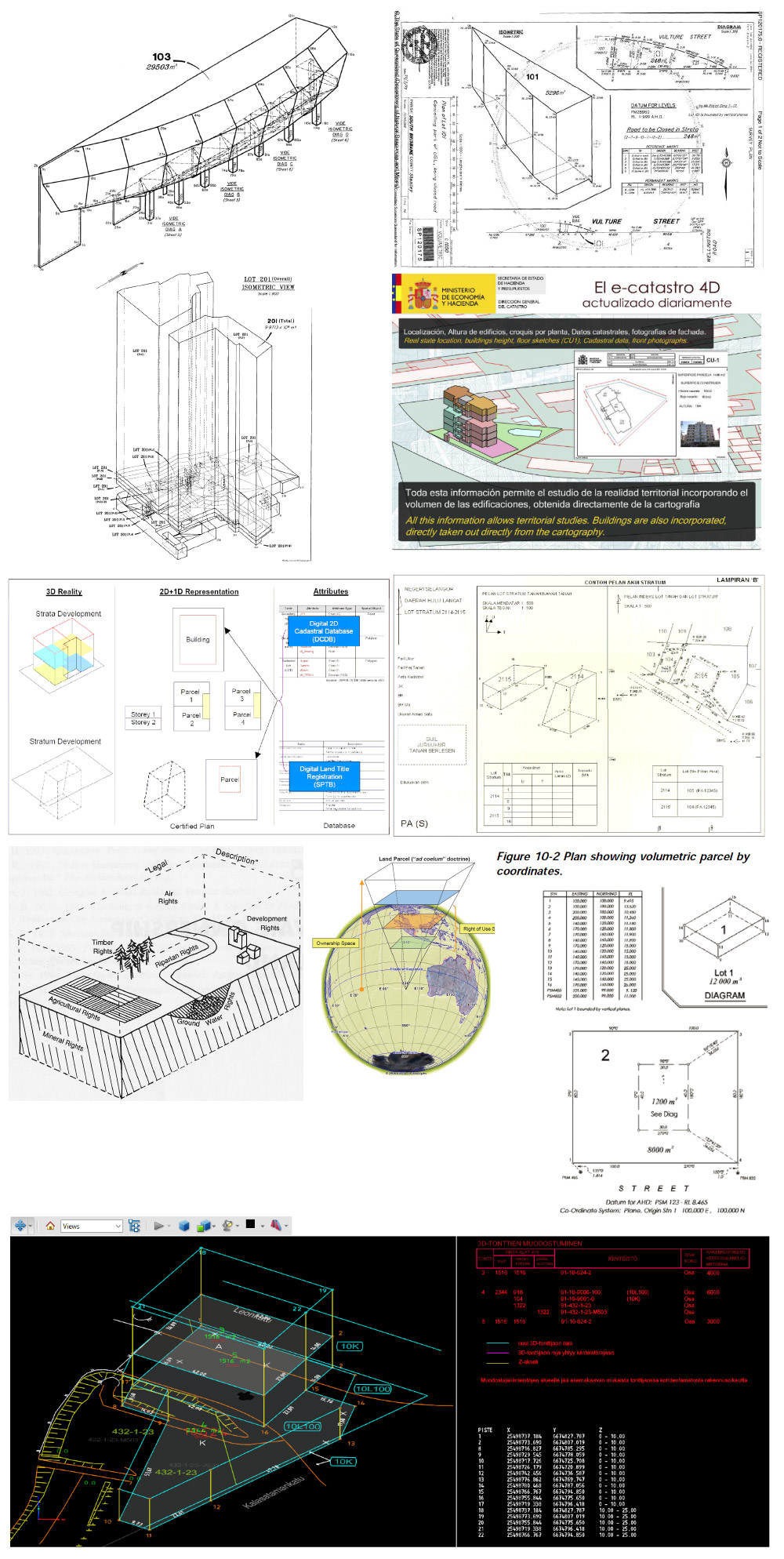
Russia’ current cadastral index is two-dimensional, which means that drawings contain only width and length of structures, while their height needs to be indicated separately. This does not allow to accurately index structures that overlap in height for example when they are located on different levels of the same building.
Among other things, introducing 3D cadastral passports will help to: more precisely record parameters of multi-level structures (right now their height is not registered properly because it’s not measured accurately) as well as underground and overground structures; record property rights for the entire volume of a structure, not just its area, including the «right to air» (expanding property rights to external volumetric space related to the structure); control intersections of complex borders taking the height into account.
Russia’s Ministry for Civil Defence, Emergencies and Elimination of Consequences of Natural Disasters recommends creating 3D models for anti-terrorist defense passports of all public services buildings: hospitals, schools, stadiums, etc. In 2018 three-dimensional descriptions will become mandatory for all types of buildings.
The client wants to create a service that would store information about structures, show 3D models and allow to download isometric drawings. We will have to invent the design of these blueprints, then our work will be reviewed by architects, interior designers, engineers and other experts.
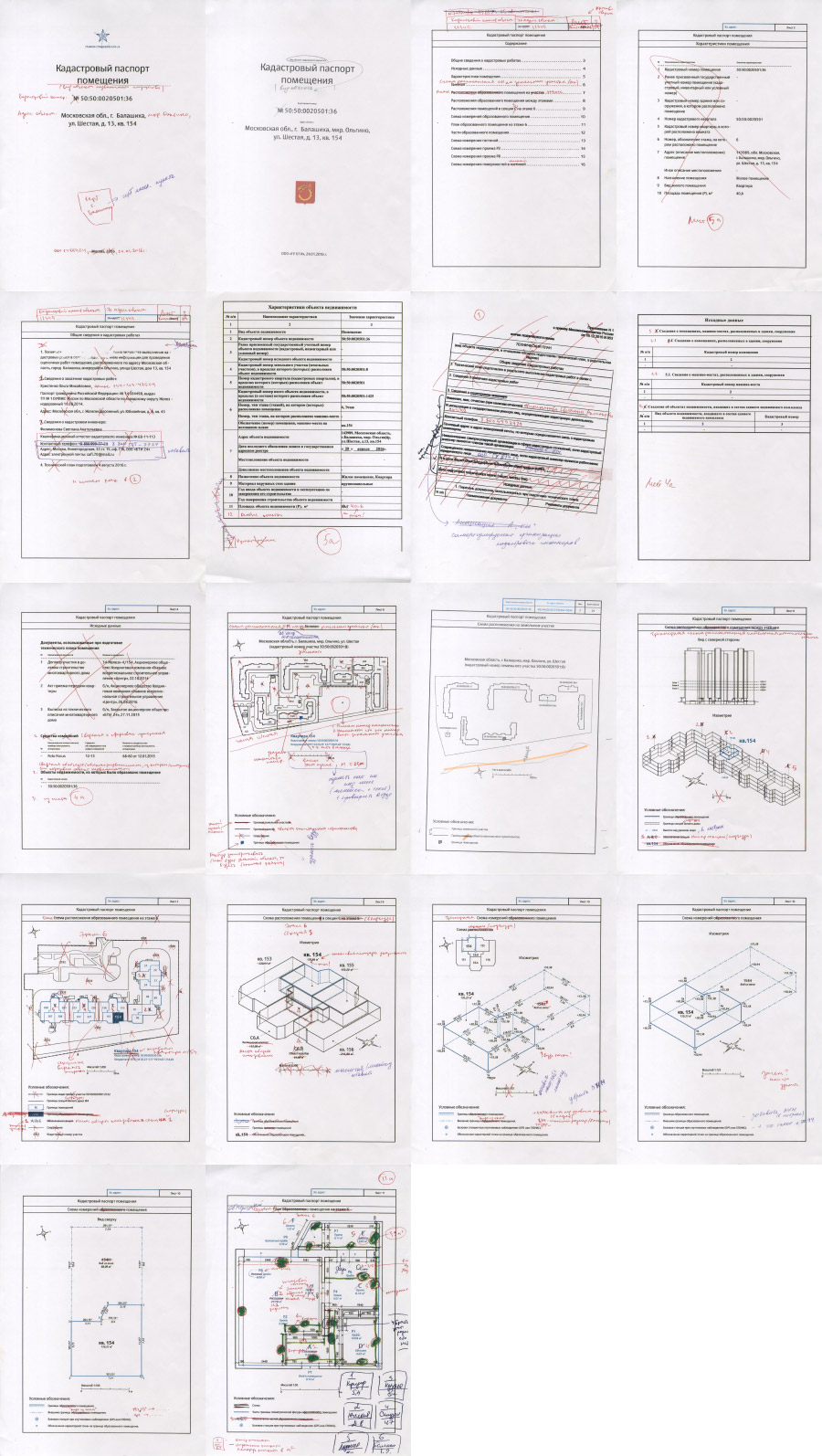
Before we start, the client asks us to carefully study the available documentation for 3D cadastral passports as well as foreign experience in the area.
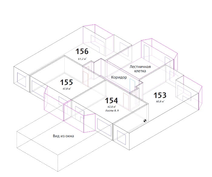
As a result, we should present a prototype of a 3D cadastral passport that would satisfy the requirements of modern Russian cadastral registration. We also need to try to implement features that make drawings more useful for renovation contractors and interior designers, for example including wall elevation drawings.
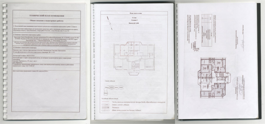
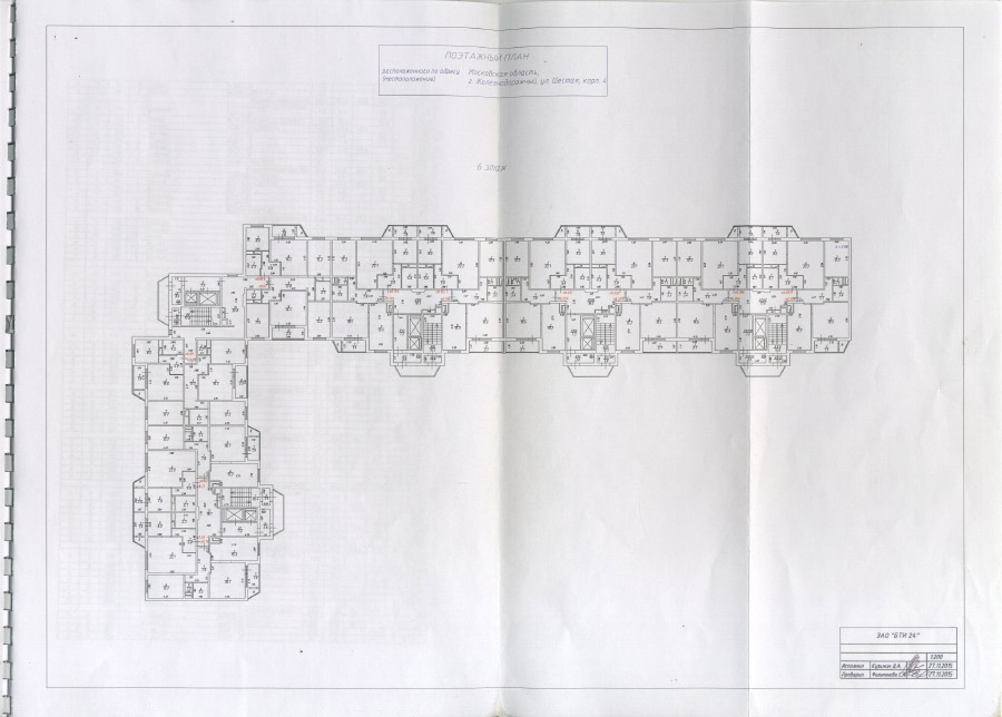
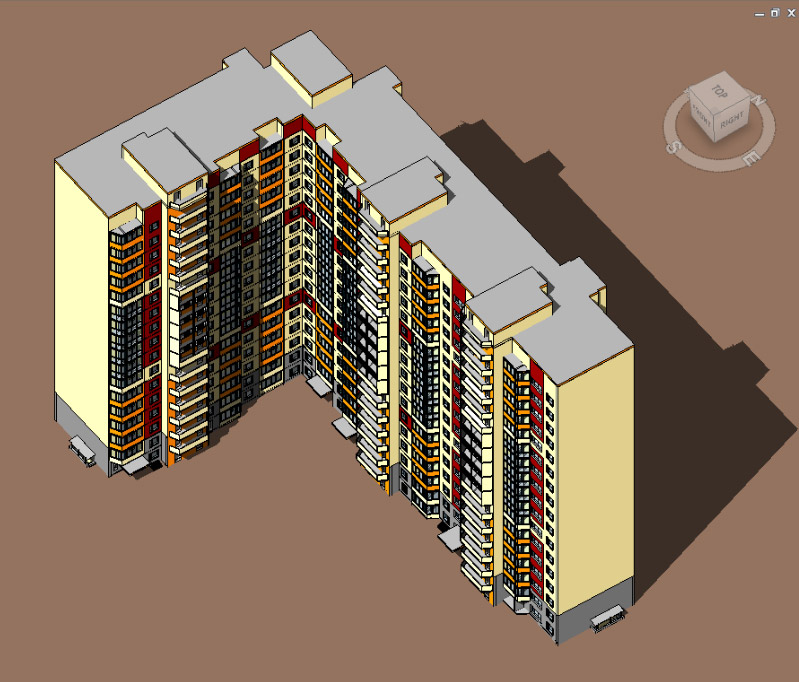
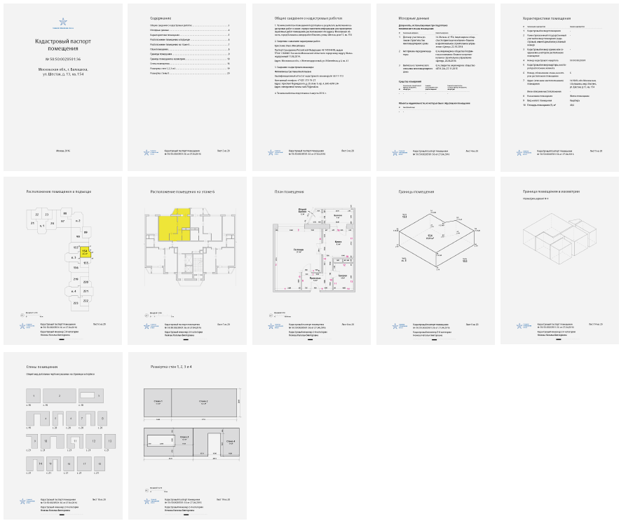
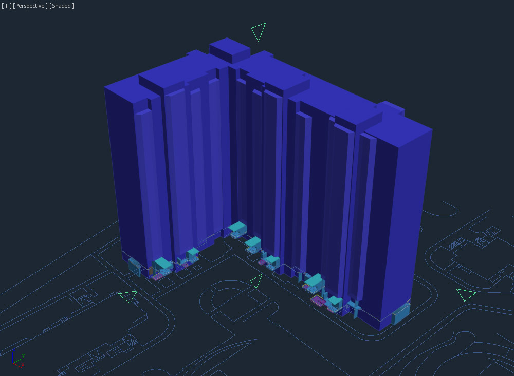
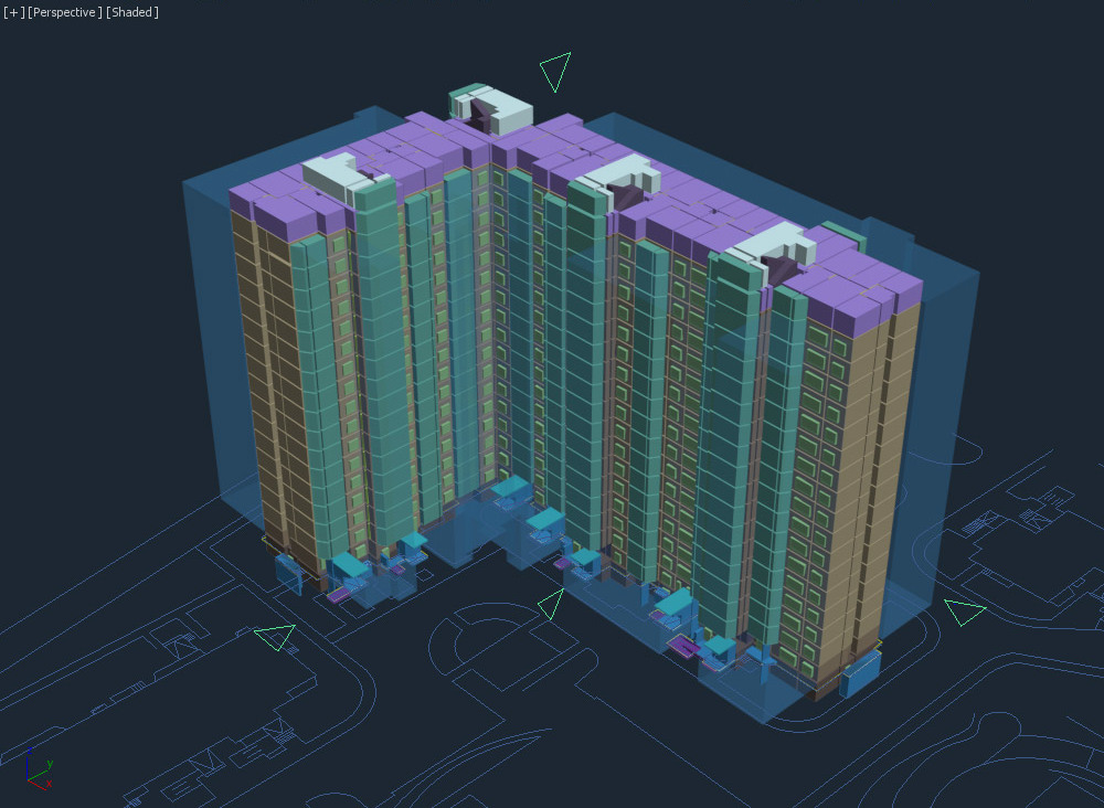
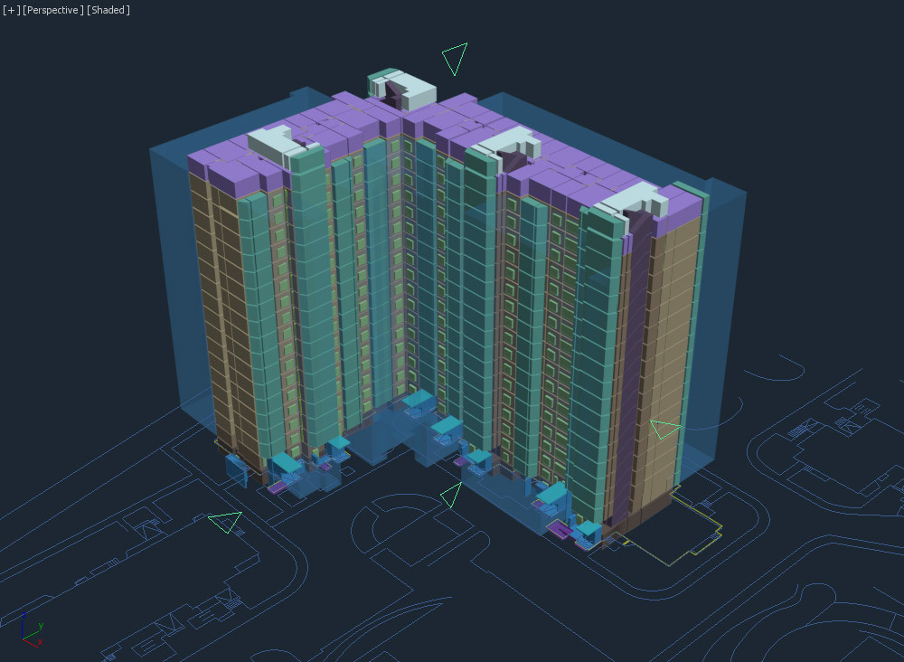
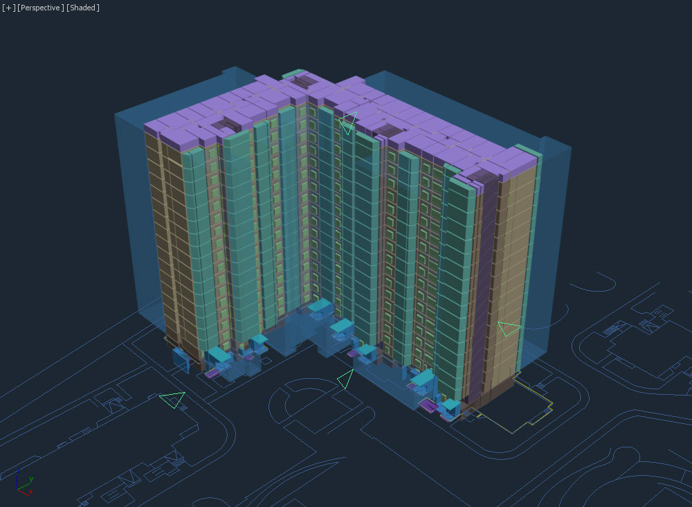
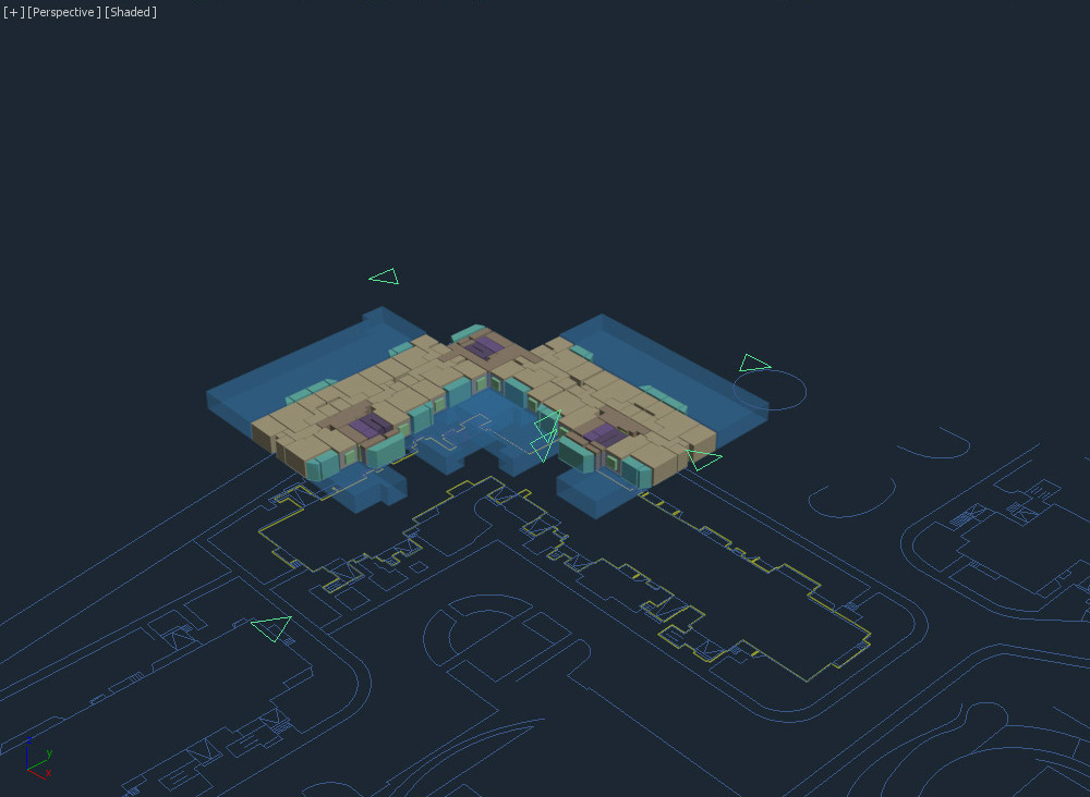
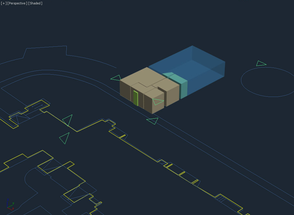
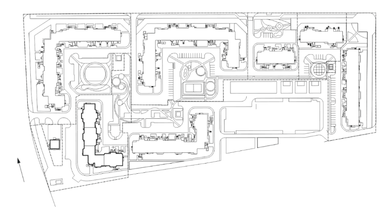
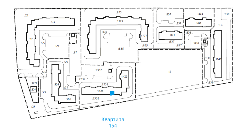
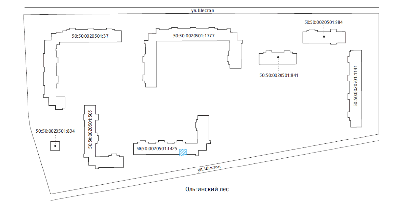
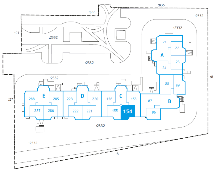
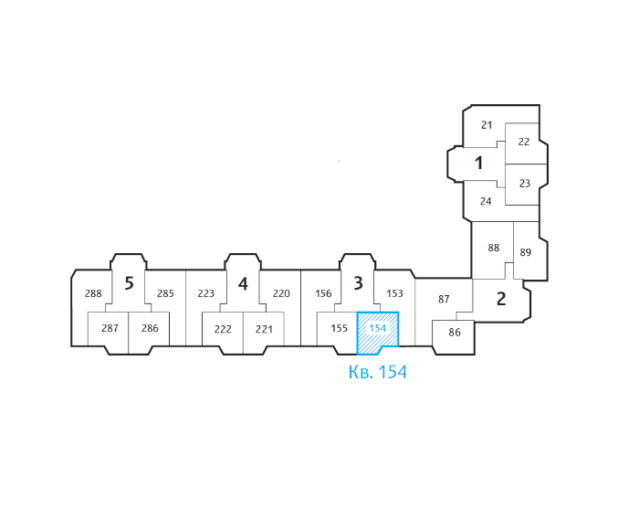
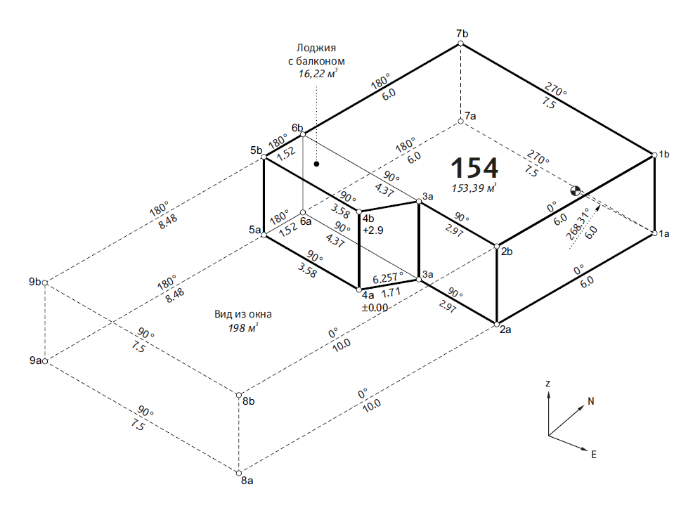
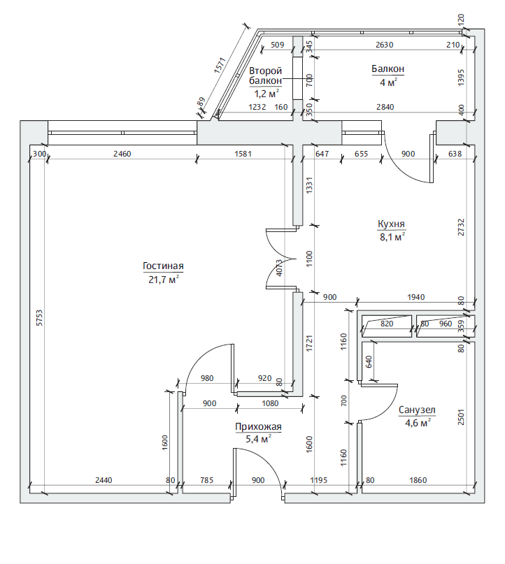
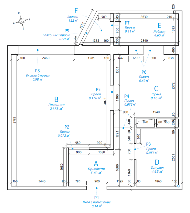
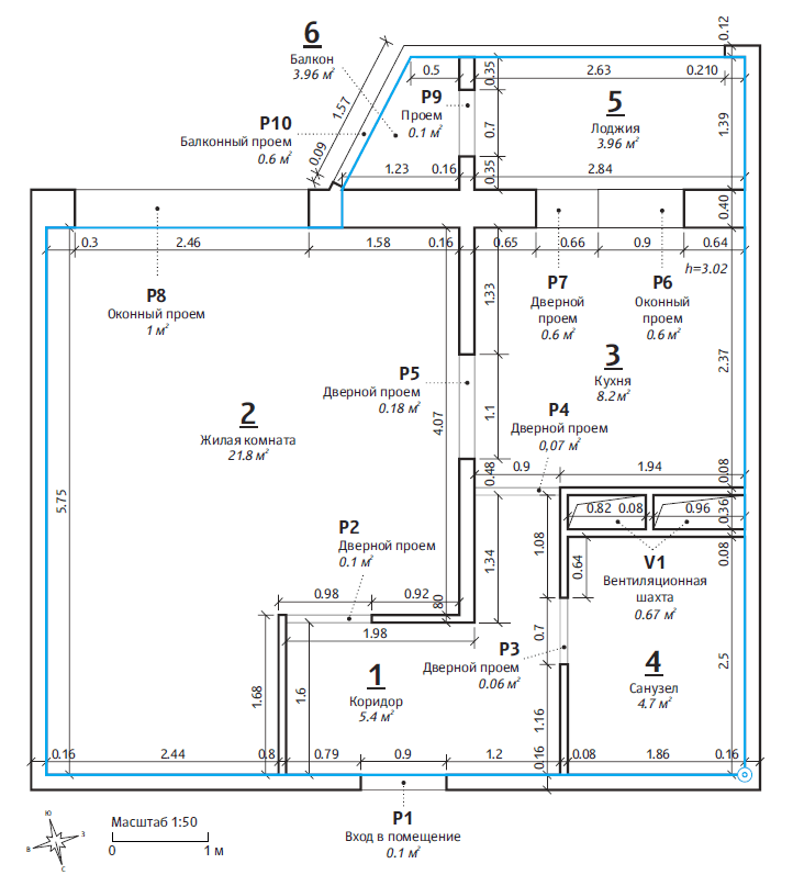
The client provides a technical plan of an apartment and a 3D model of a house where it’s located for us to use as an example.
Making the first sketches of the passport and clarifying project details.
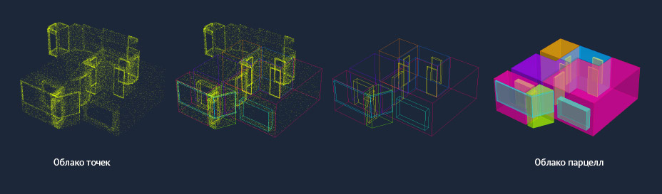
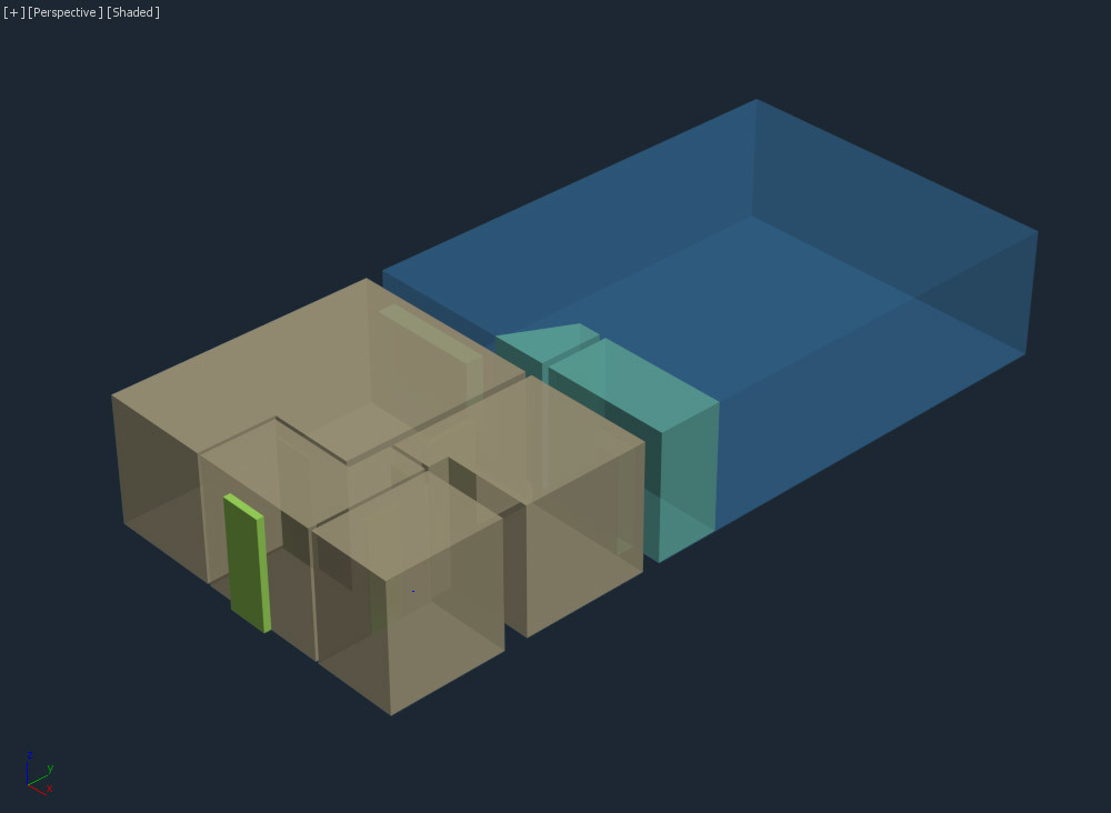
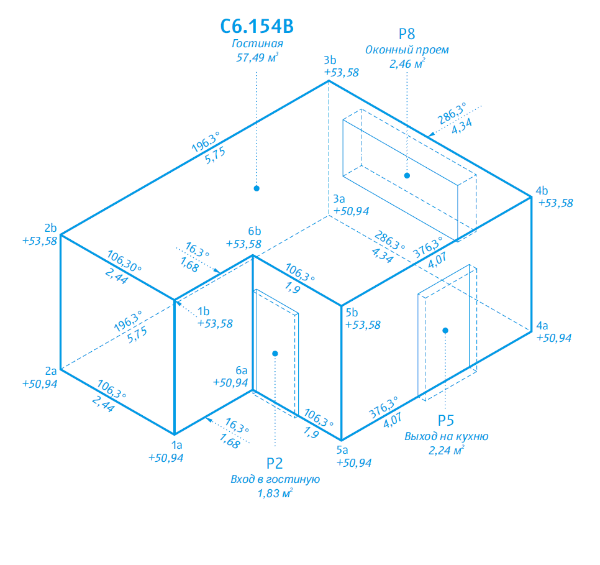
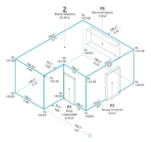
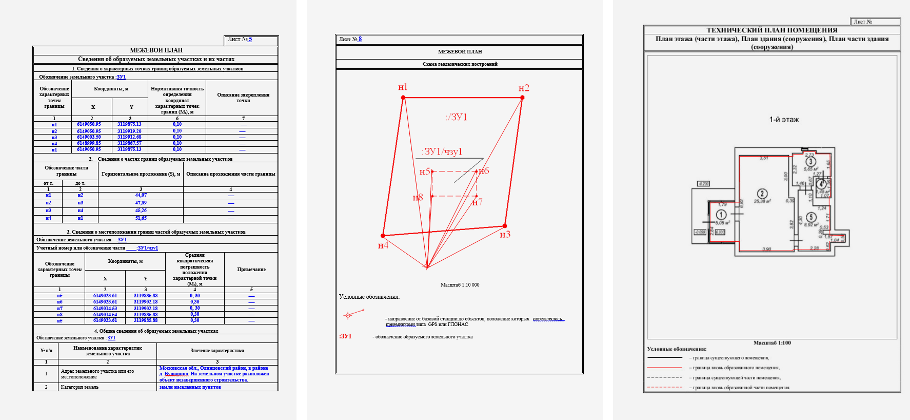
The documents provided by the client mention that 3D cadastral passports use the notion of parcels, legal entities that are used to display space sections. This definition hardly explains anything, so we clarify how a parcel would display a part of a space.
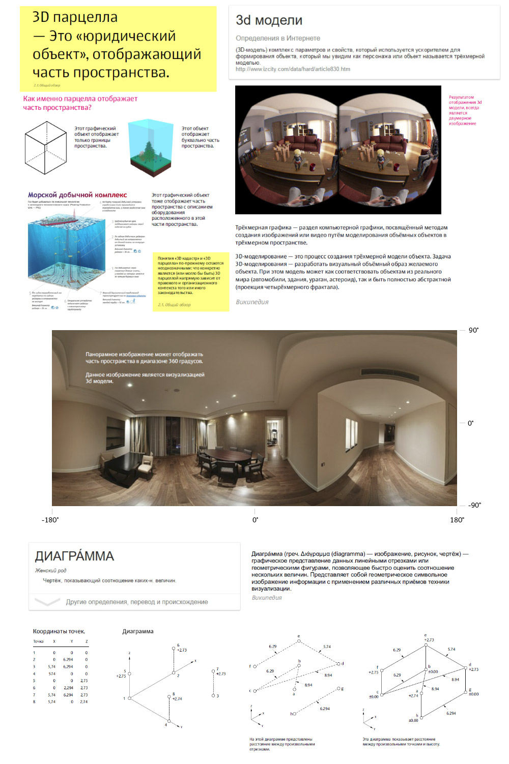
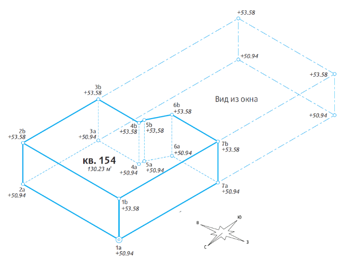
Noting that all cadastral drawings of land lots and geodesic maps use polygonometric diagrams. Cadastral engineers use these diagrams to show parts, or parcels, of real property.
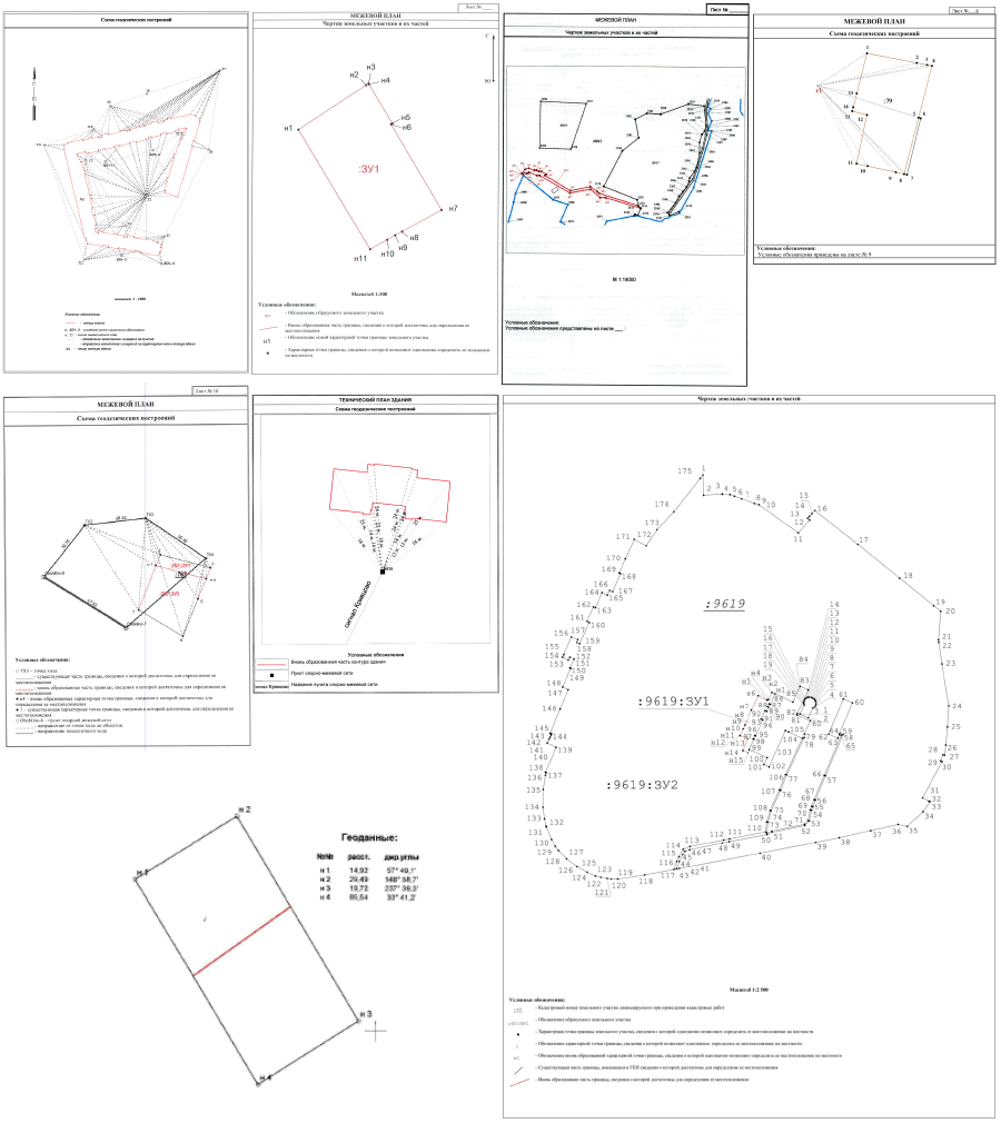
If we were to create a 3D version of such a diagram, we would get a three-dimensional parcel.
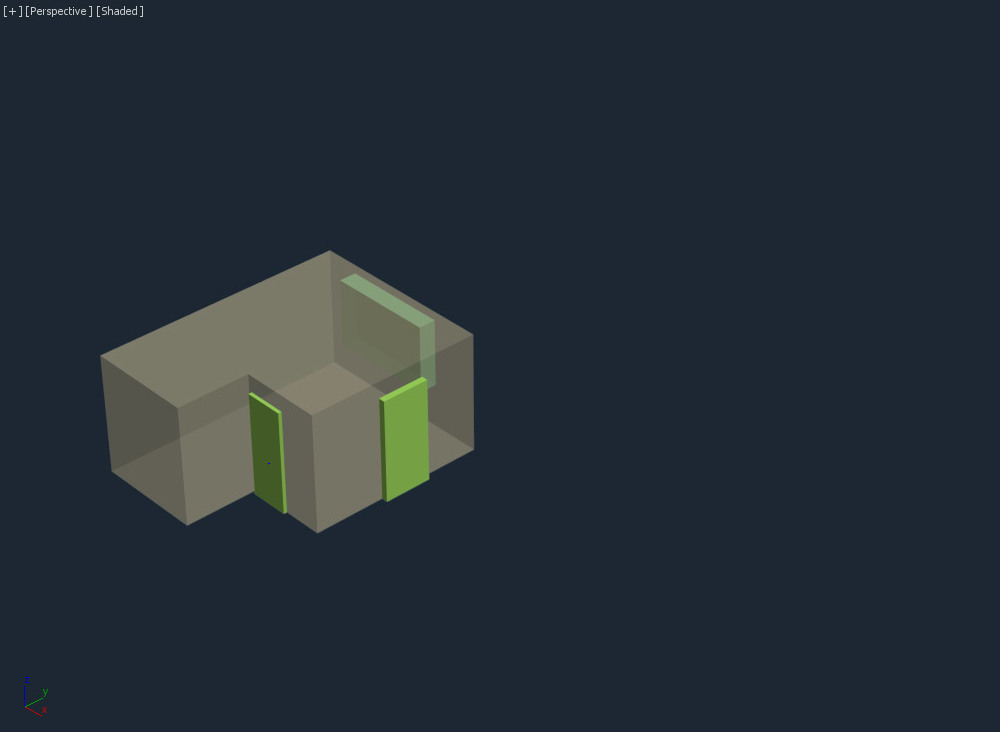
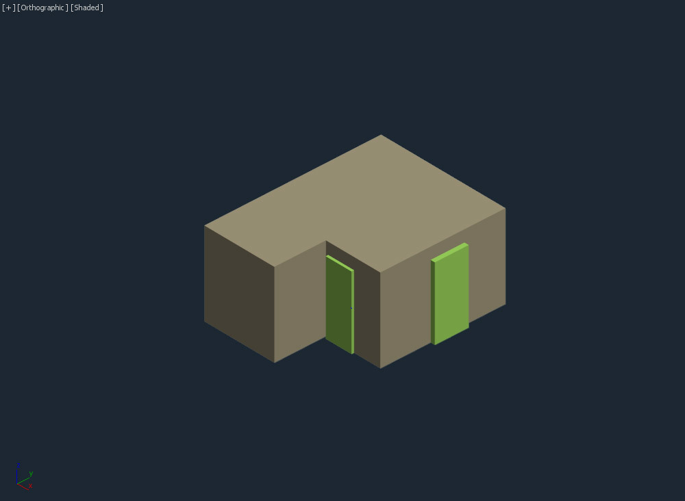
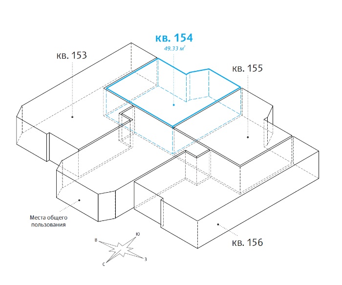
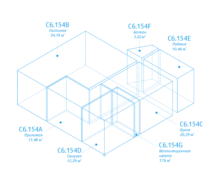
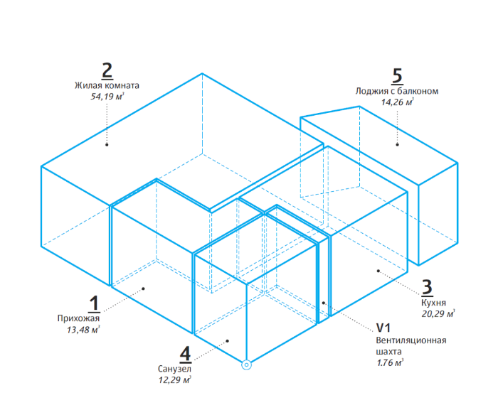
Parcels can be used to denote any parts of real property, such as internal parts of structures, rooms, balconies, walls, door and window openings, «rights to air,» etc.
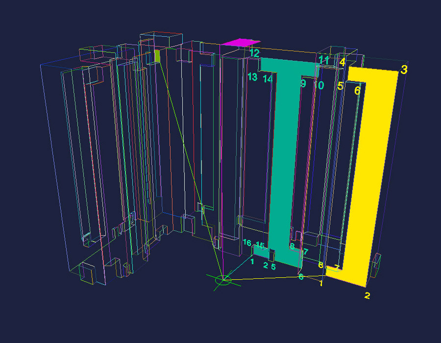
Experimenting with designating and presenting data on drawings, trying to model different situations.
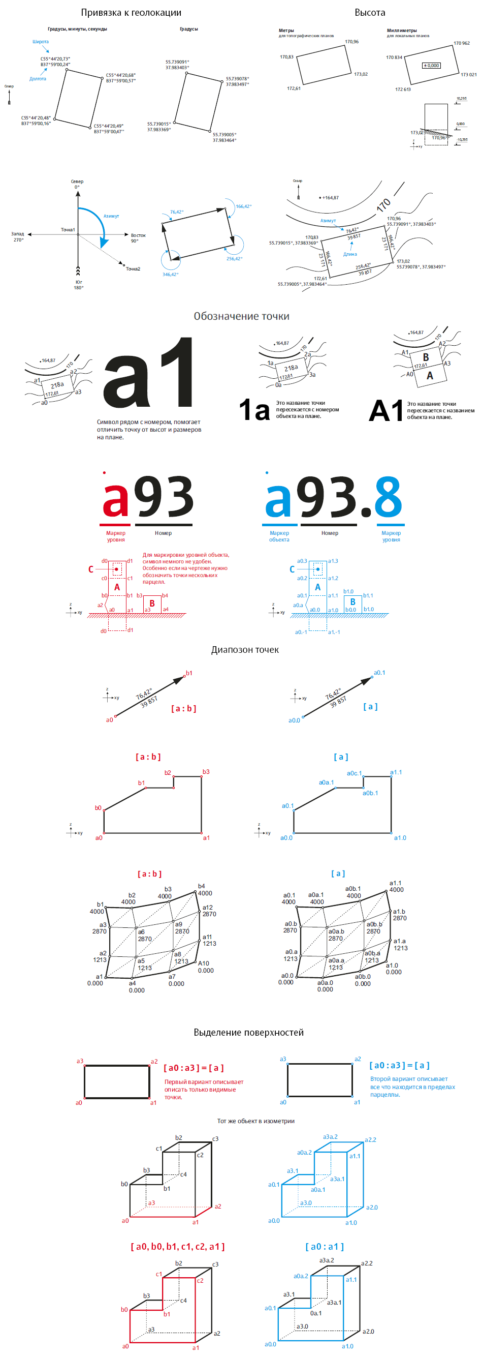
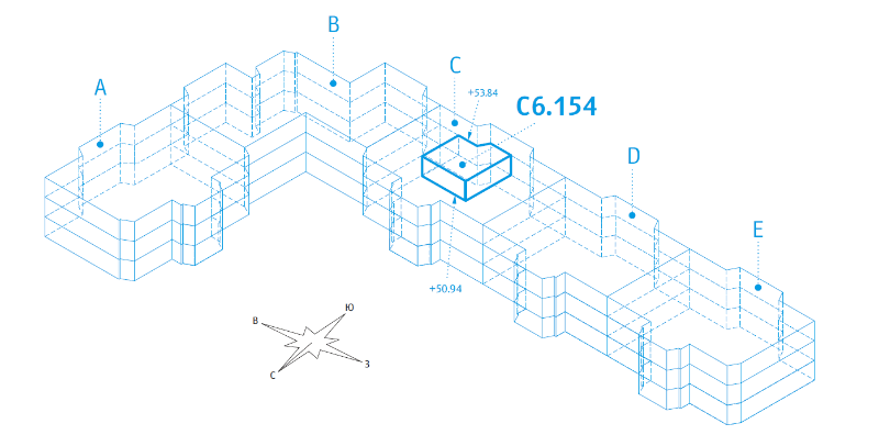
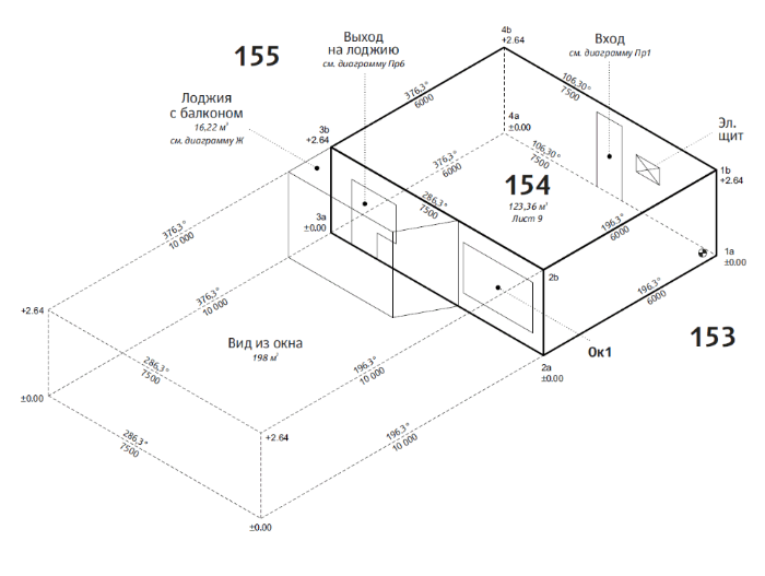
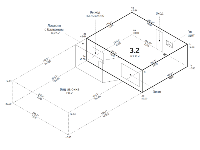
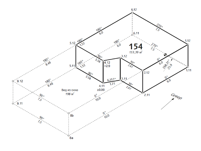
Paying special attention to vertices.
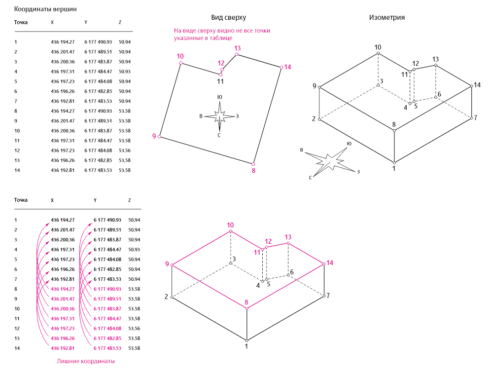
Correct designation of vertices makes reading drawings and tables more convenient and cuts down the number of variables stored in a database by half.
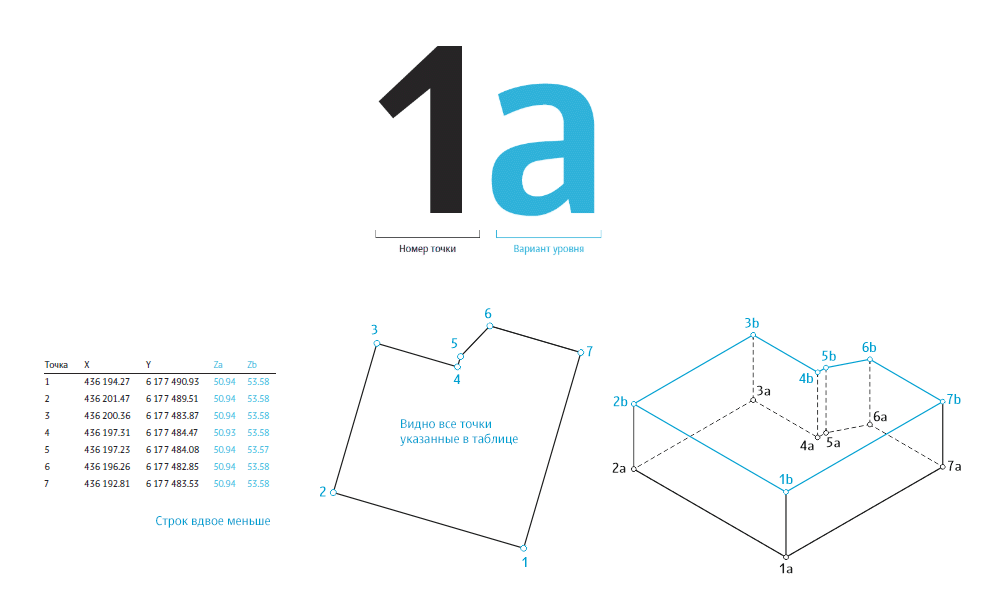
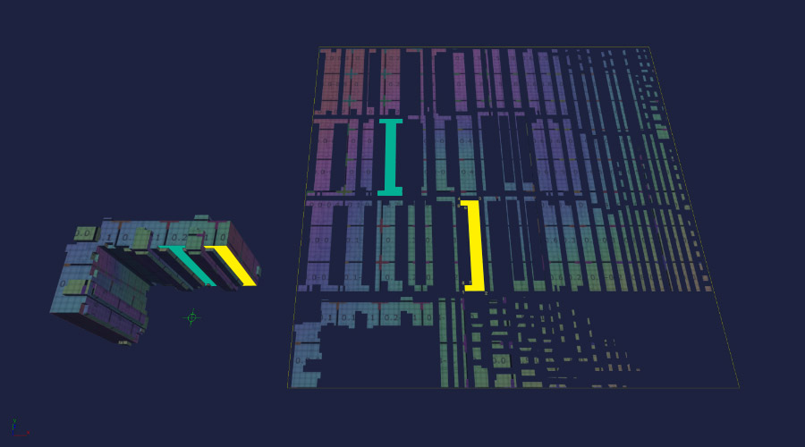
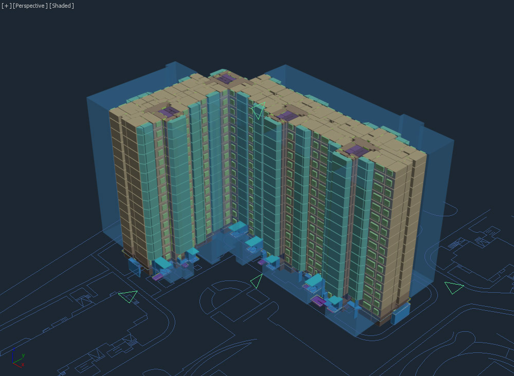
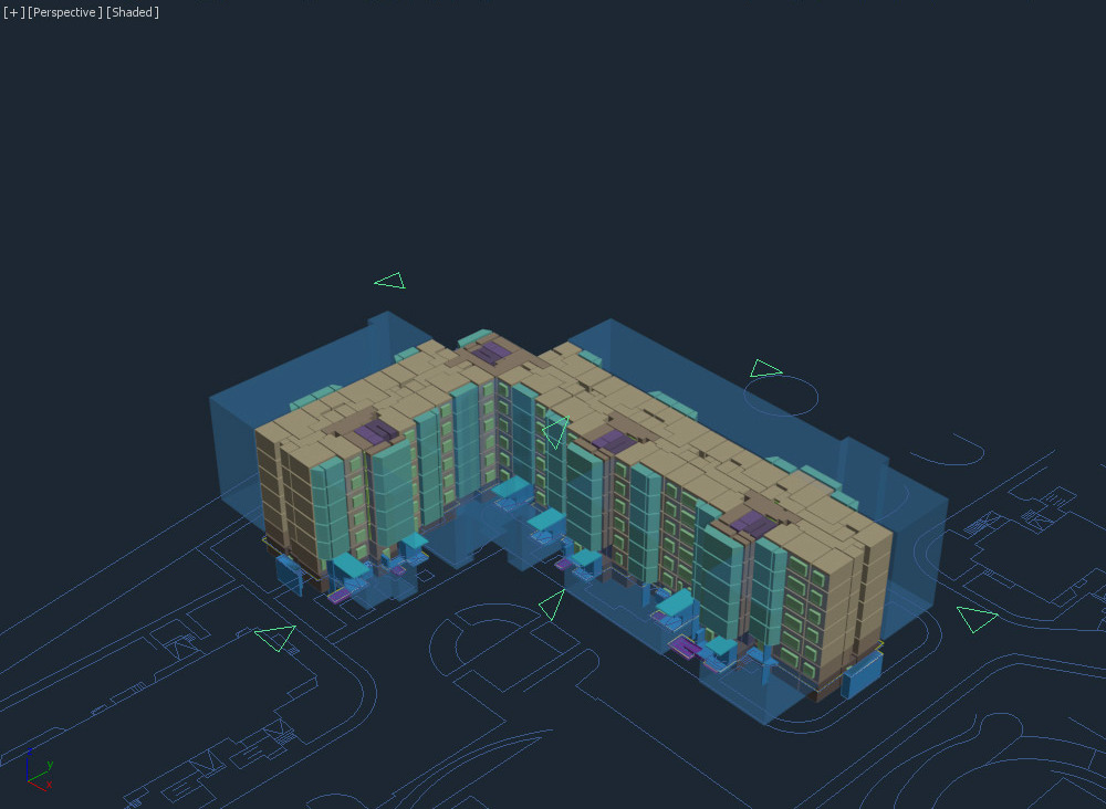
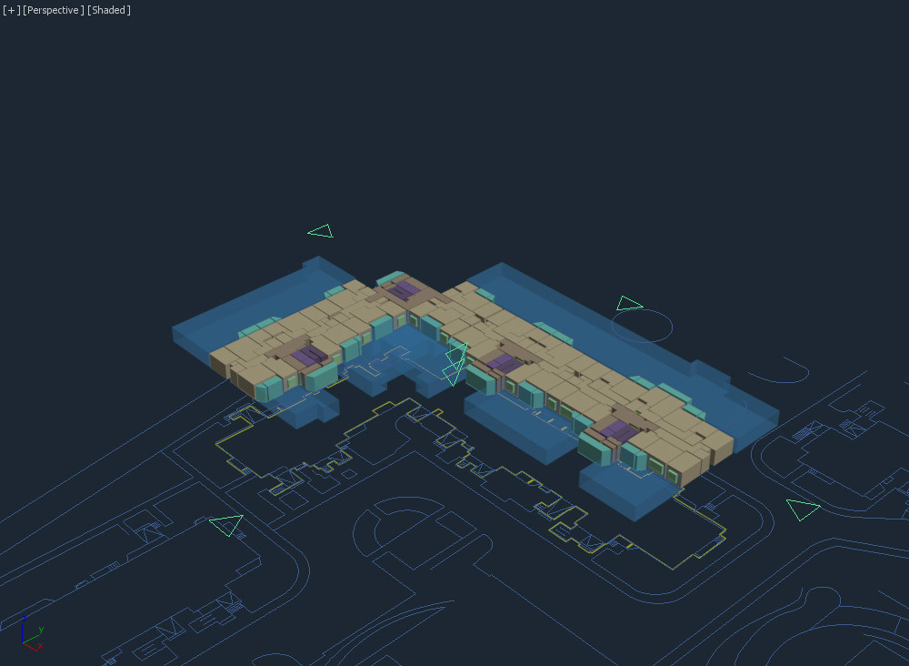
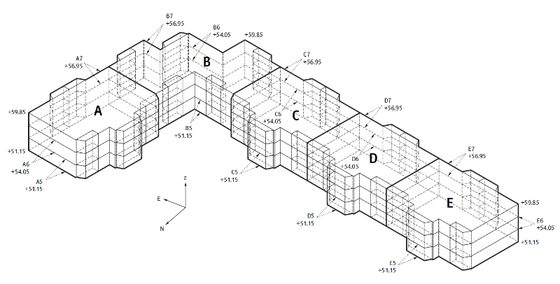
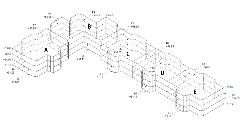
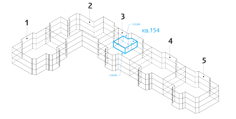
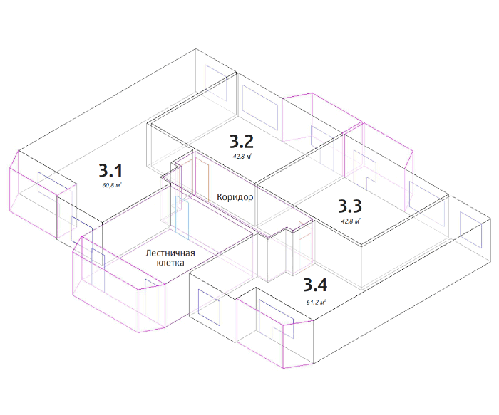
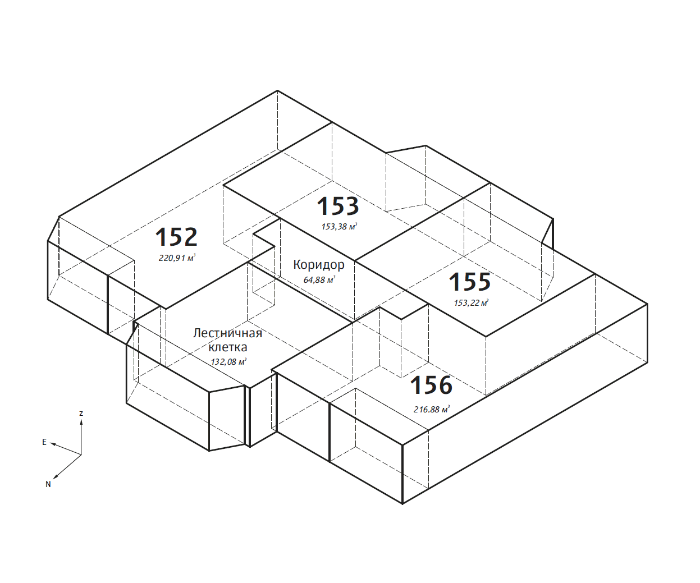
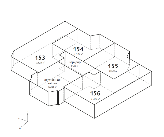
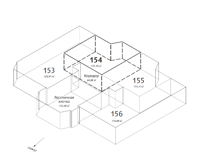
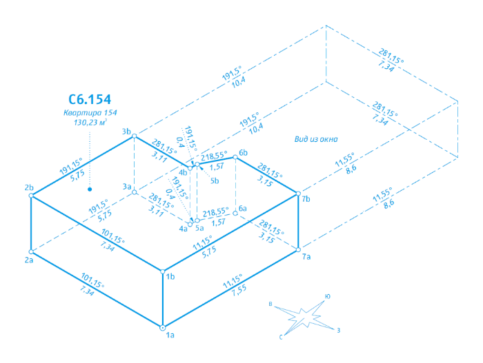
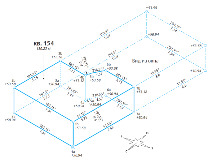
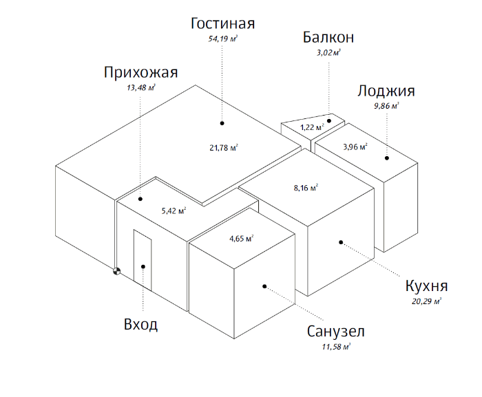
Breaking down the entire house into parcels.
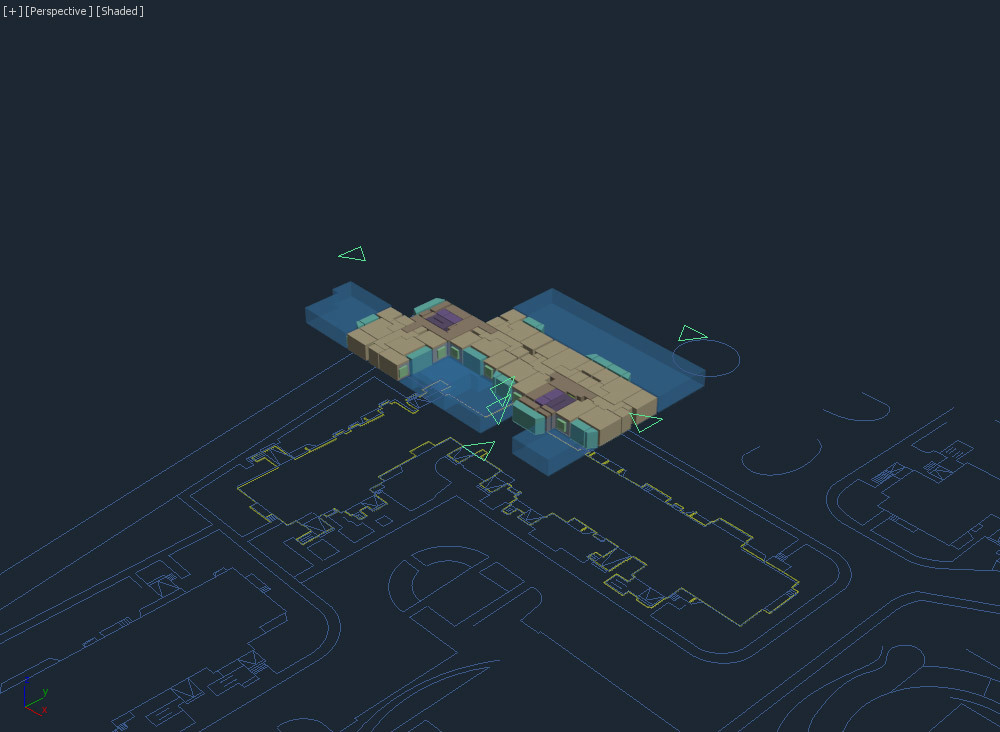
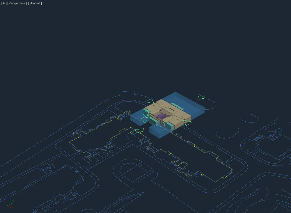
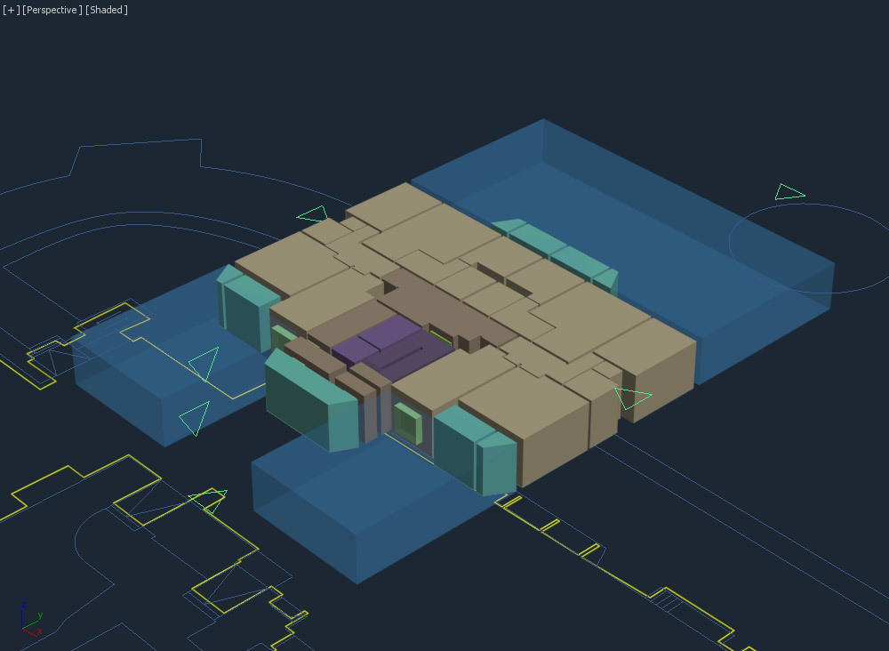
Creating drawings for parcels and views.
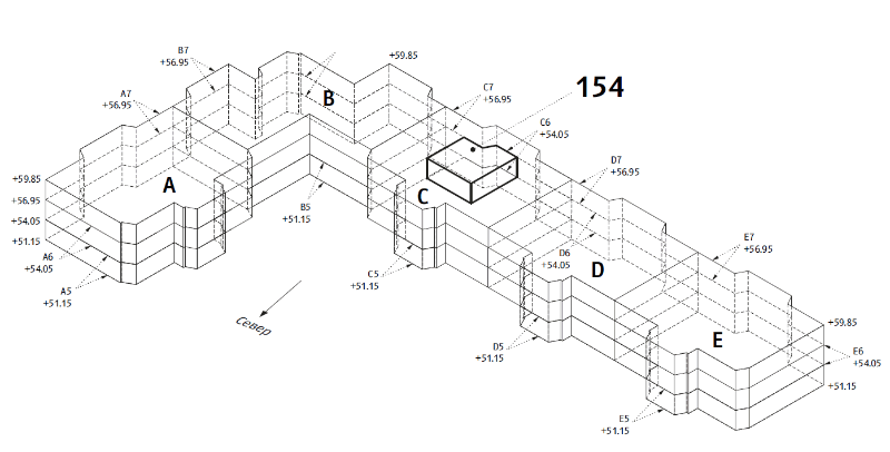
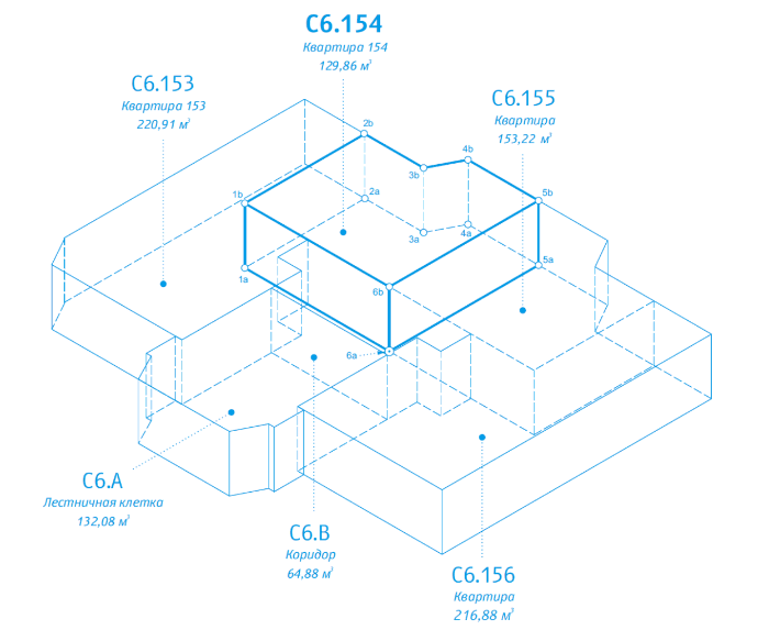
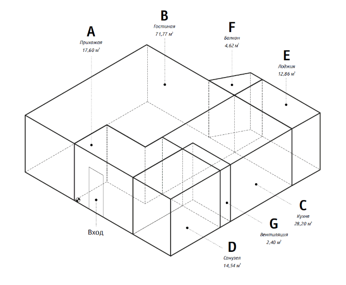
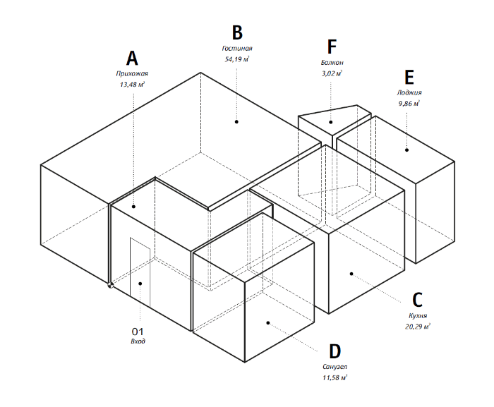
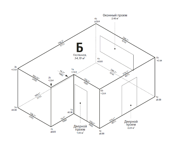
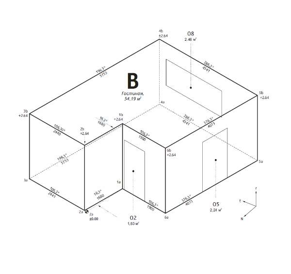
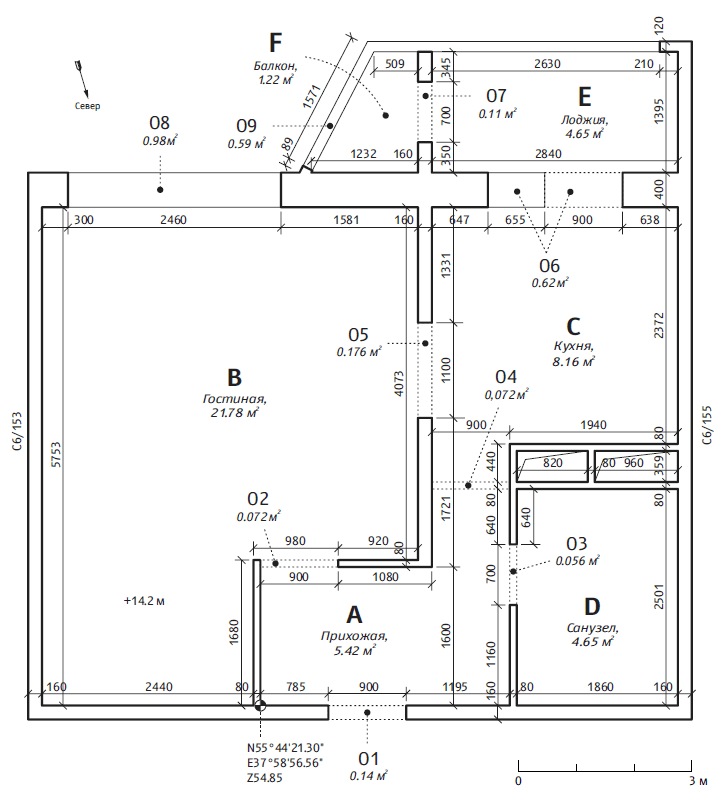
At this stage the client asks us to use standard cadastral forms for drawings.
Typesetting the passport: getting advice from architects and engineers, making corrections based on the client’s feedback.
Creating a guide on reading three-dimensional parcels.
