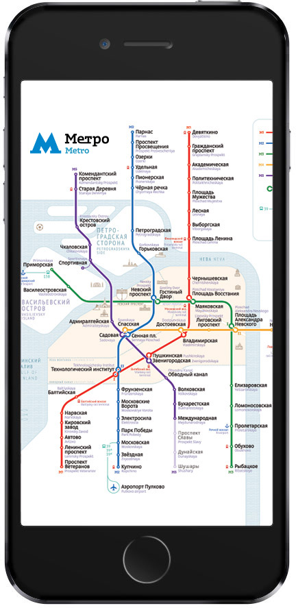
The Metro is the most important part of the transport system of Saint Petersburg. More than five million people live in the city permanently and six more come to visit every year. To allow local residents and tourists navigate the Metro easily, a simple and clear map of the Metro was developed at the studio.
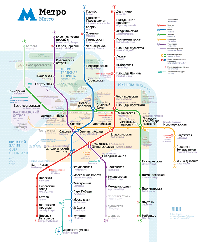
The scale of the map allows to clearly display a large amount of useful information while also increasing the overall legibility. The map easily accommodates important landmarks and sights making it an indispensable navigation tool both of a local resident and a traveler.
Canals and islands
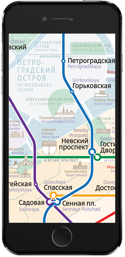
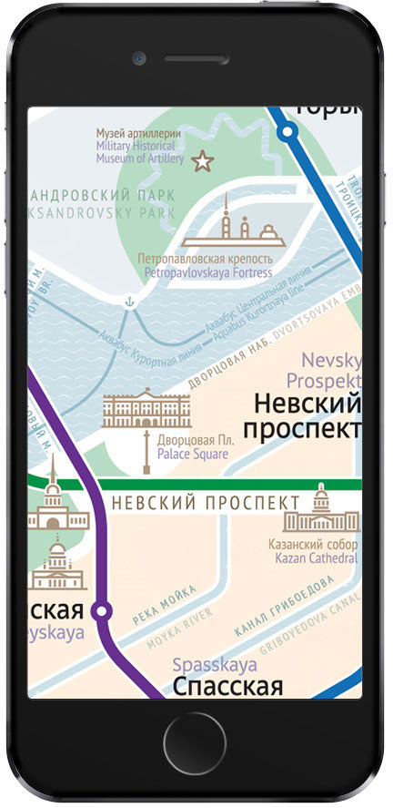
Saint Petersburg has unique topography: located on the shore of the Gulf of Finland, the city spans several islands and is crossed by a multitude of canals and small rivers that form its unique landscape. Thanks to the precise reproduction, Vasilievsky and Krestovsky Islands are clearly displayed as islands on the map. Main rivers (Fontanka and Moika) and canals (Griboyedova and Obvodny) are also shown.
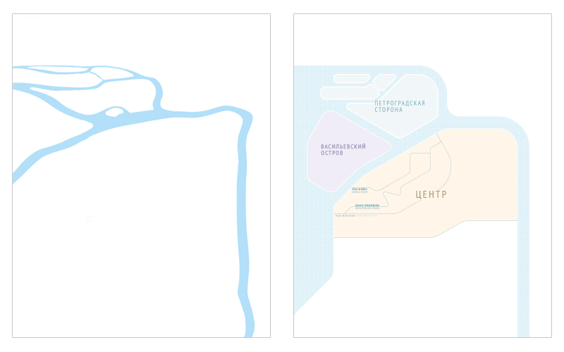
Three main parts of the city, Vasilievsky Island, Petrogradsky Island and the Historic Center, are also highlighted.
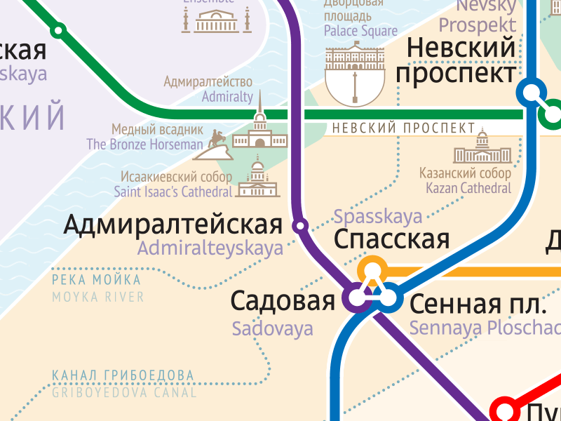
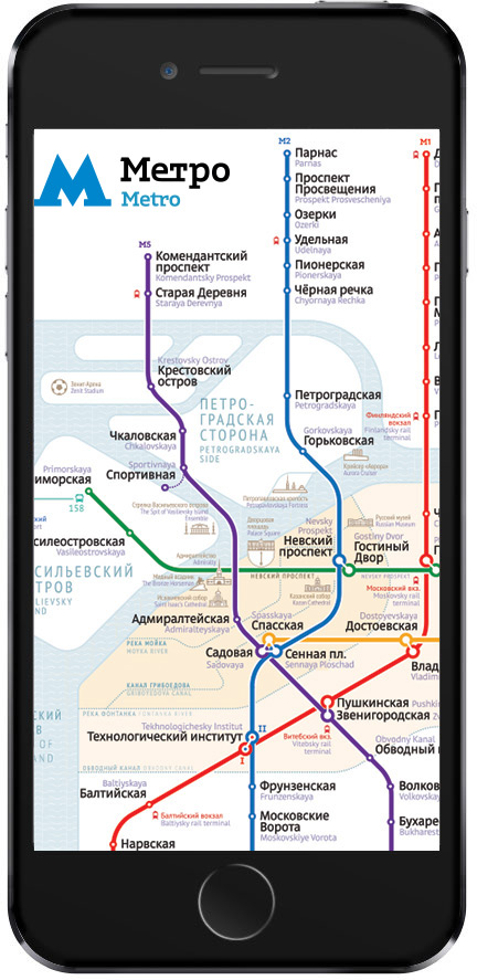
Parks and landmarks
The map also includes main parks and landmarks of the city which are displayed subtly on a separate information layer. Landmarks help tourists navigate the city while not interfering with the primary aim of the map—showing Metro lines and transfer stations. The Palace Square and Nevsky Prospekt are also included as secondary landmarks.
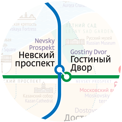
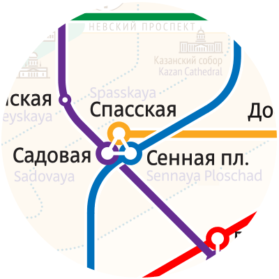
Transfer stations
Transfer hubs are depicted in a supercompact manner.

Proximity theory
In Saint Petersburg, Metro stations of the same transfer hub often have different names, such as Nevsky Prospekt and Gostiny Dvor. One of the aims of the map is to clearly show names of all transfer stations. On the new map, the names are written as close to the stations as possible and are recognized instantly.
Additional colors are used to visually distinguish different visual layers of the map, such as the text in English.
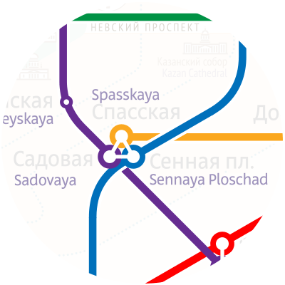
Similar to the Moscow Metro map, Russian names are positioned closer to the stations, with English names are secondary.
Formats and details
Depending on the medium size, the level of detail of the map and dimensions of certain elements can vary. When used on extremely small formats, the map can be printed with a slightly larger typeface and lack captions for landmarks or not include them at all. Bigger formats can include other central streets besides Nevsky Prospekt as well as bridges and embankments.
artistic director
art director
- Ludwig Bistronovsky
designer
proofreader
- Aleksandr Nosikov
translator
- Ekaterina Floyd
project managers
- Olga Kallaur
- Aleksandr Minakov
- Andrey Dyakov
