


archived |
|
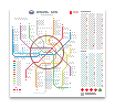
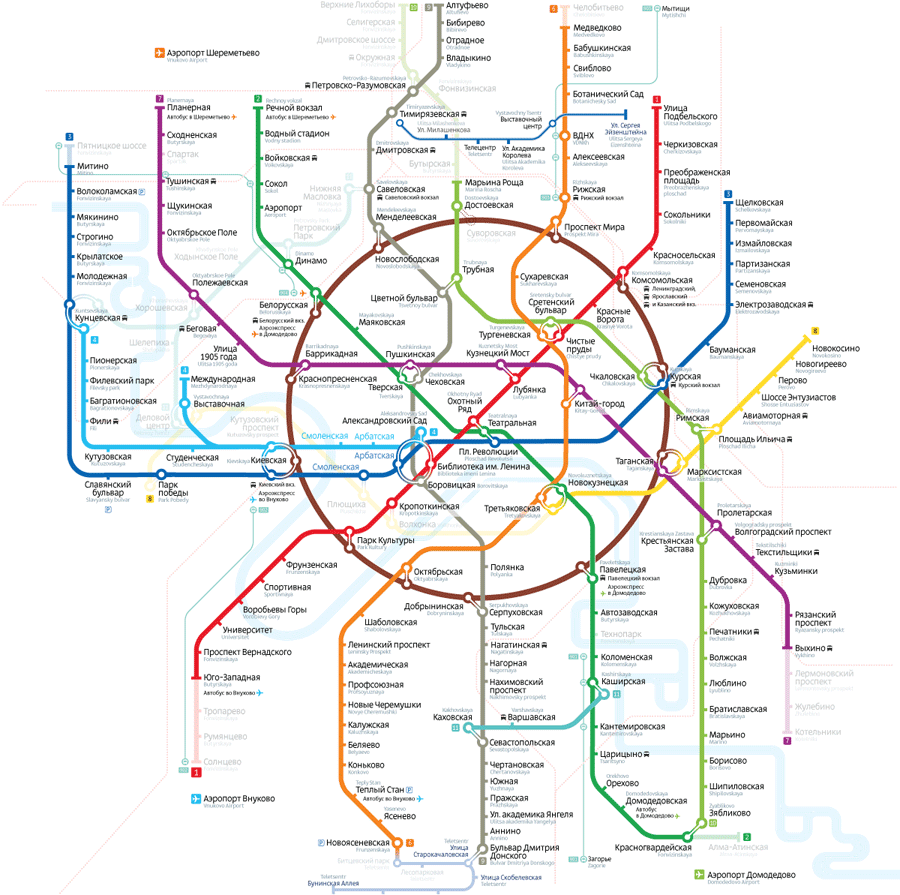
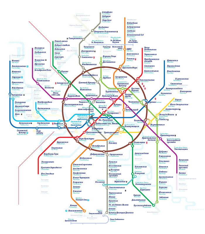
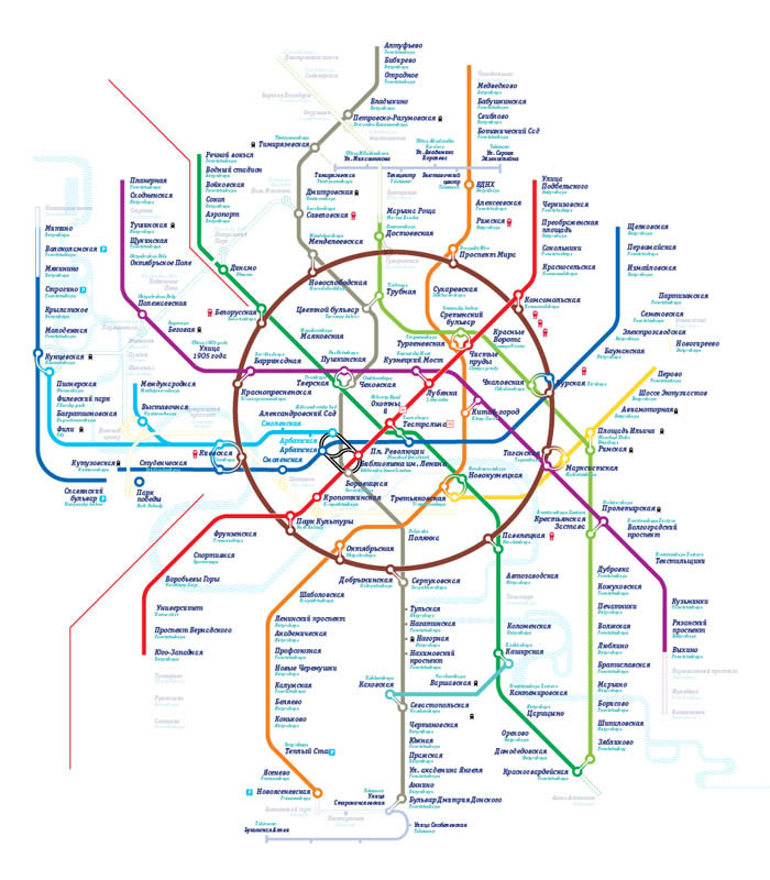
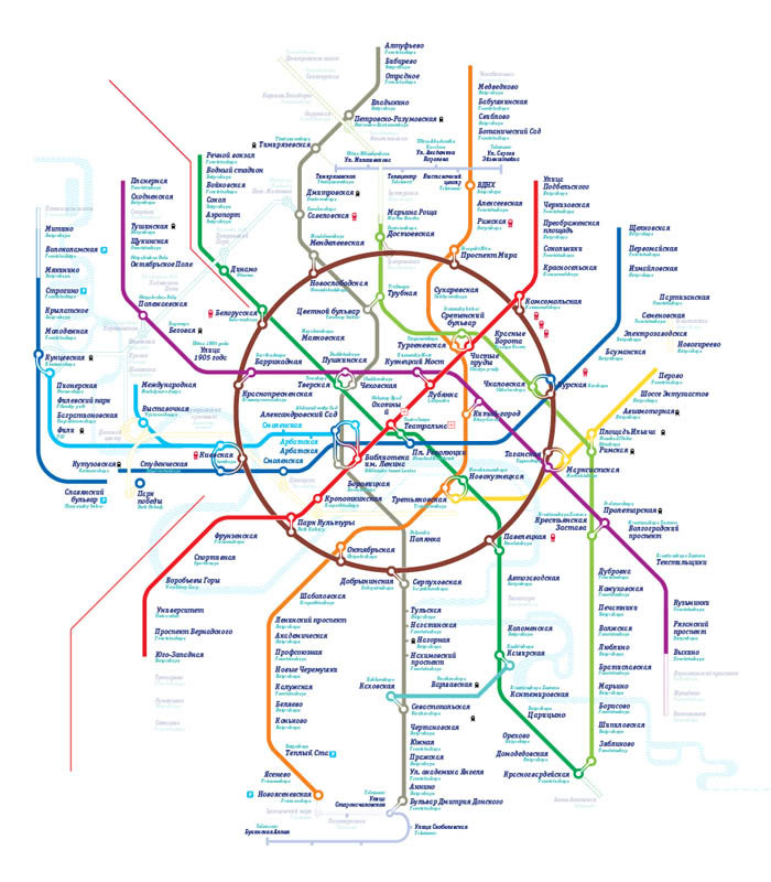
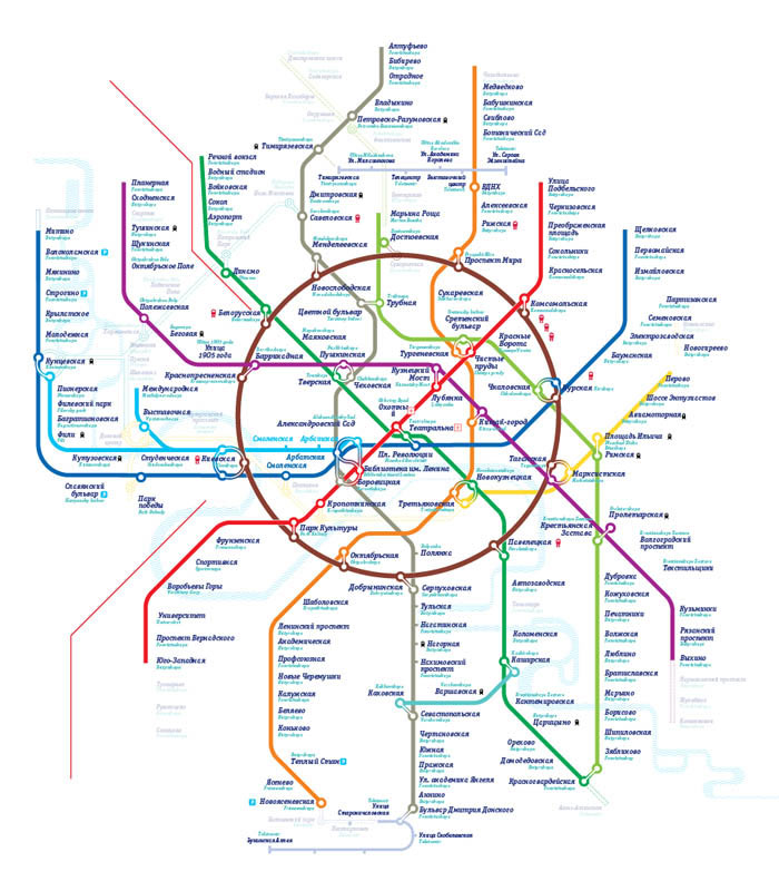
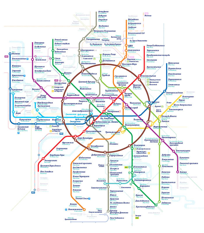
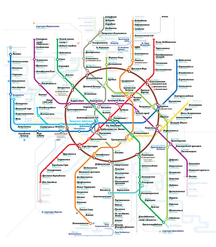
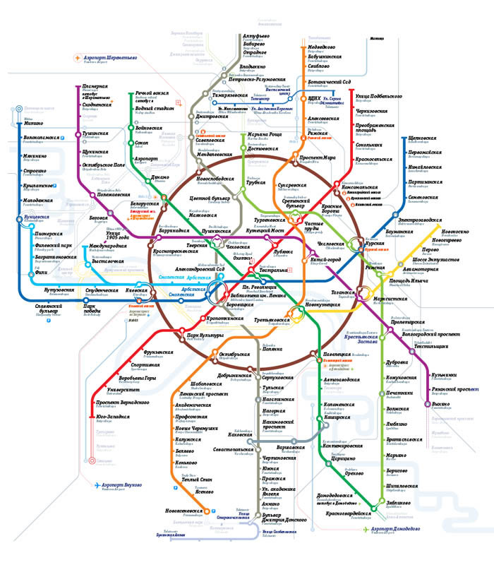
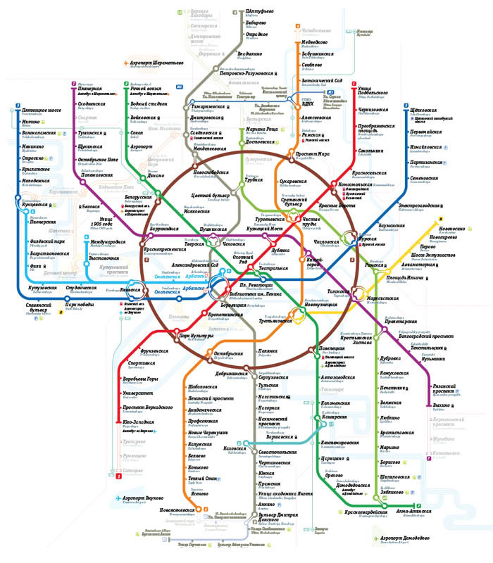
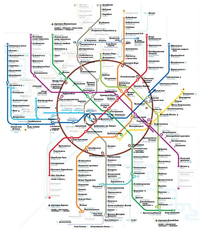
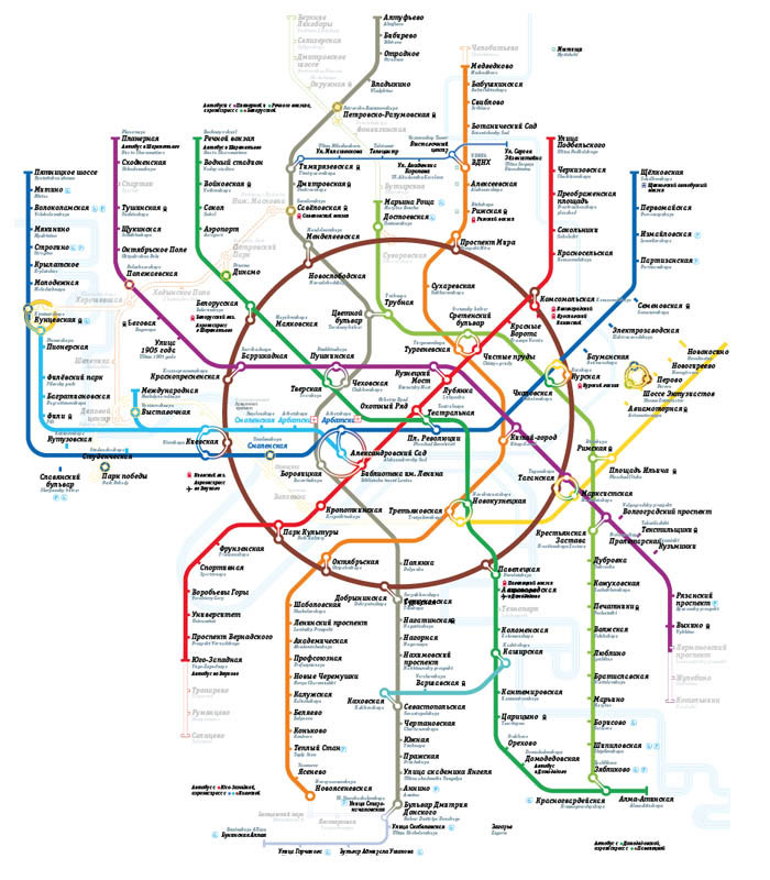
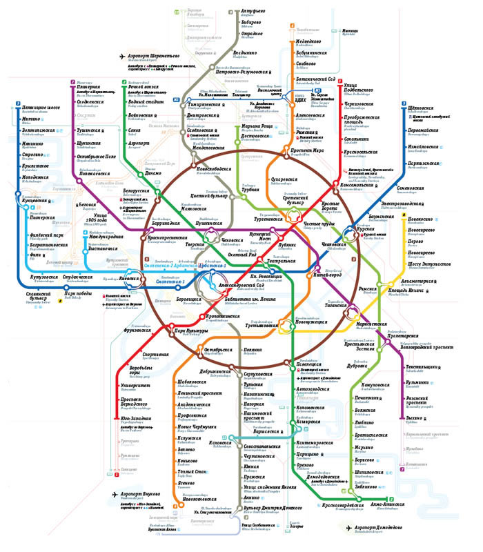
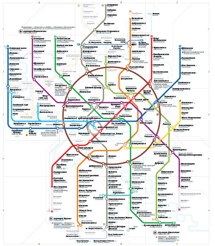
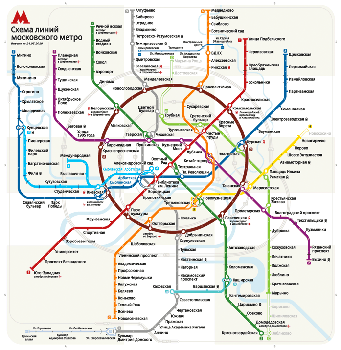
Official maps: | ||||||||
Main Pocket Multilingual Postcard
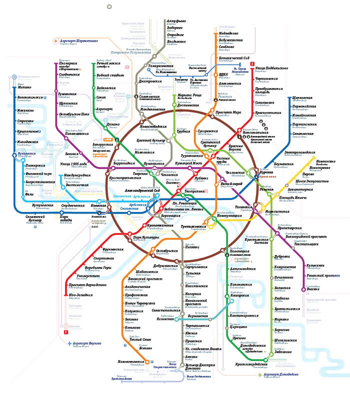
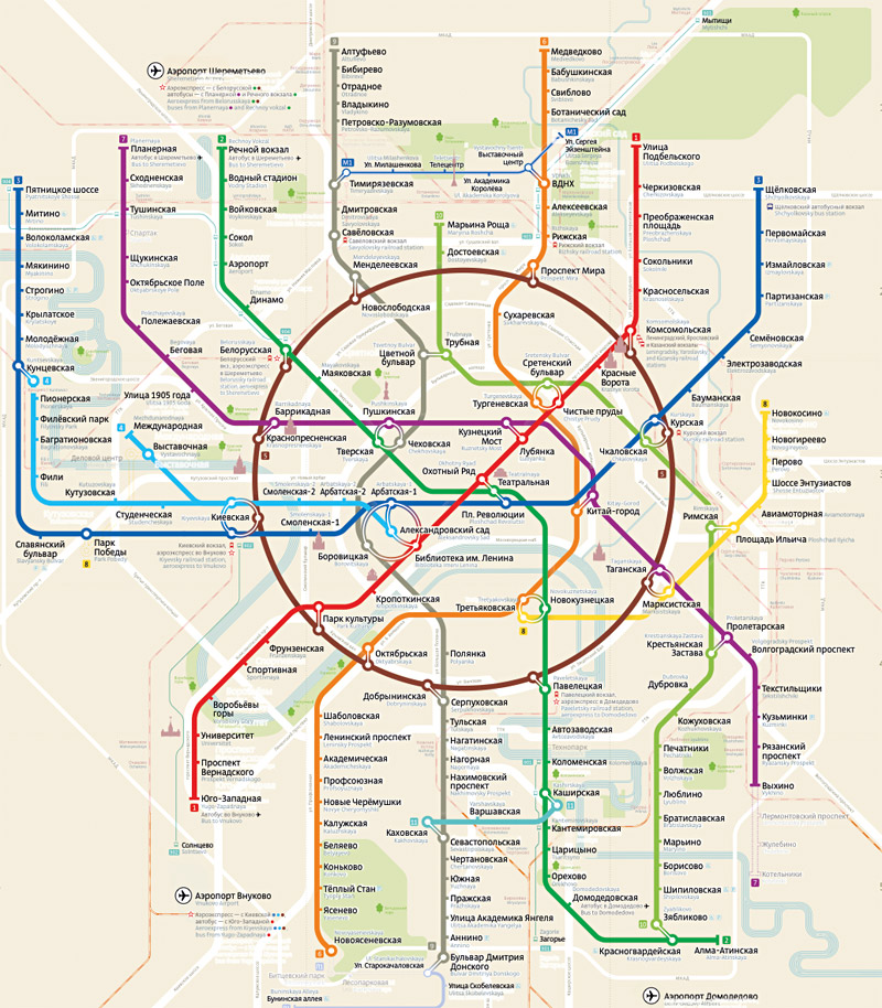
The making of the Moscow Metro map 2.0
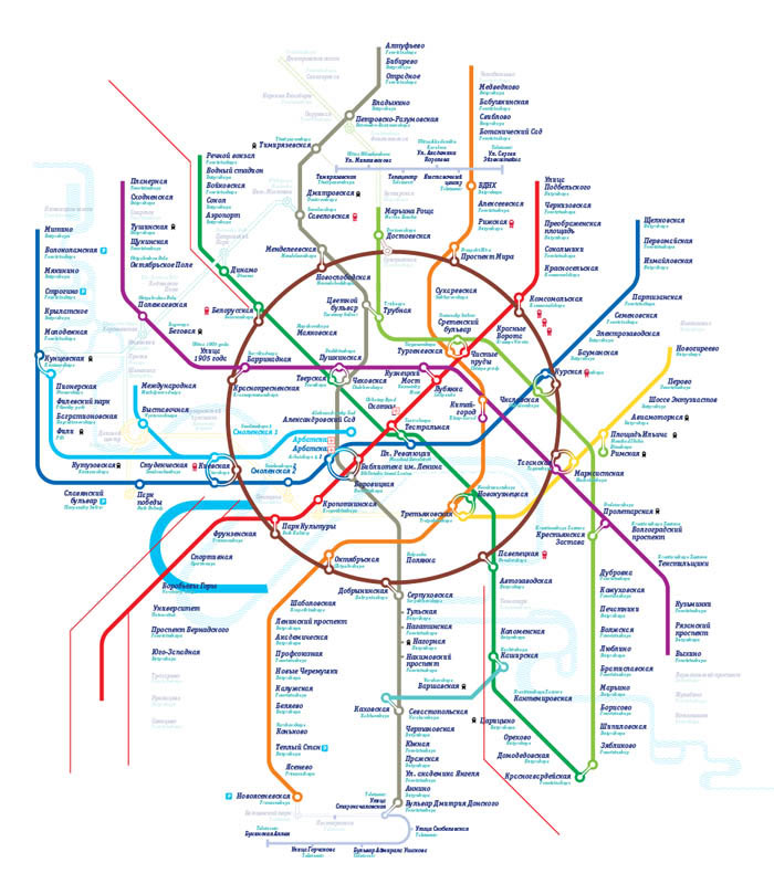
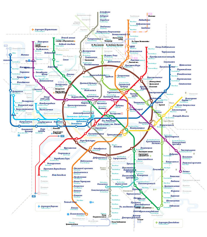
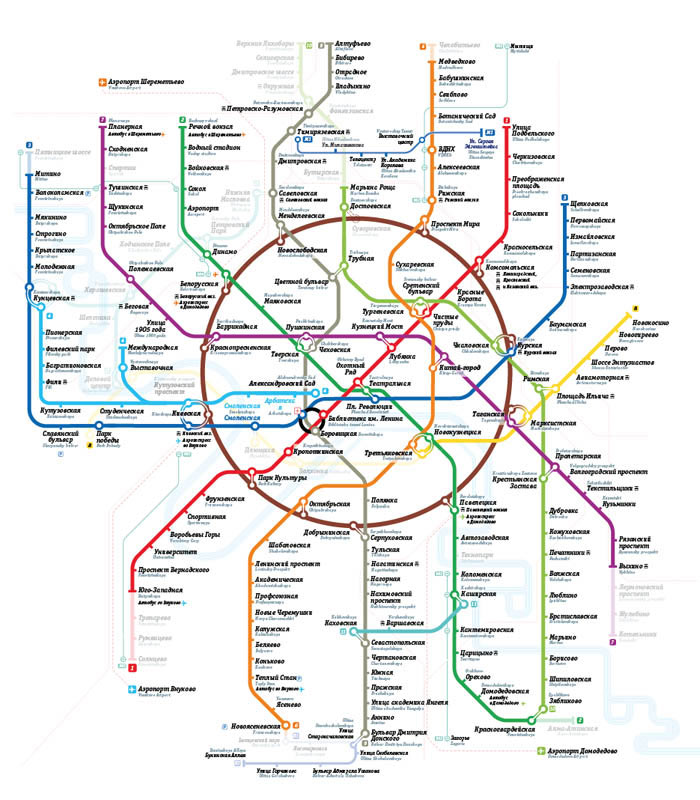
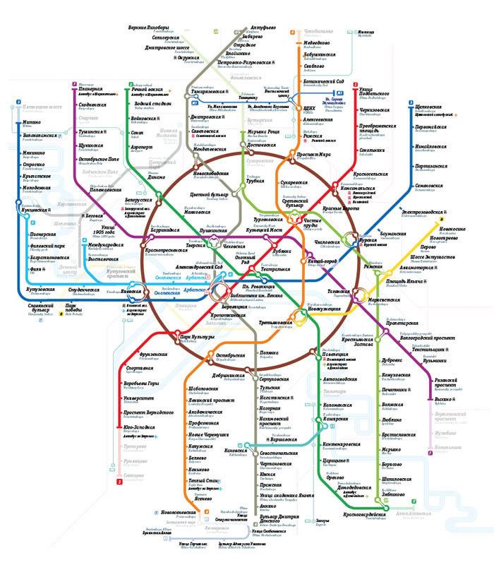
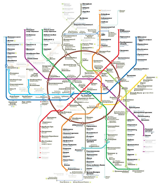
To start with, drawing the map from scratch. Why don’t we challenge the universe of 45 angles by making all ours with a
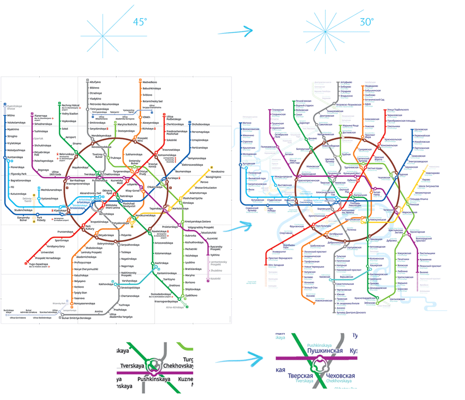
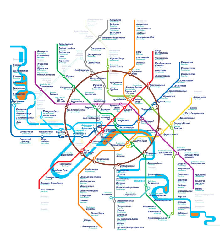
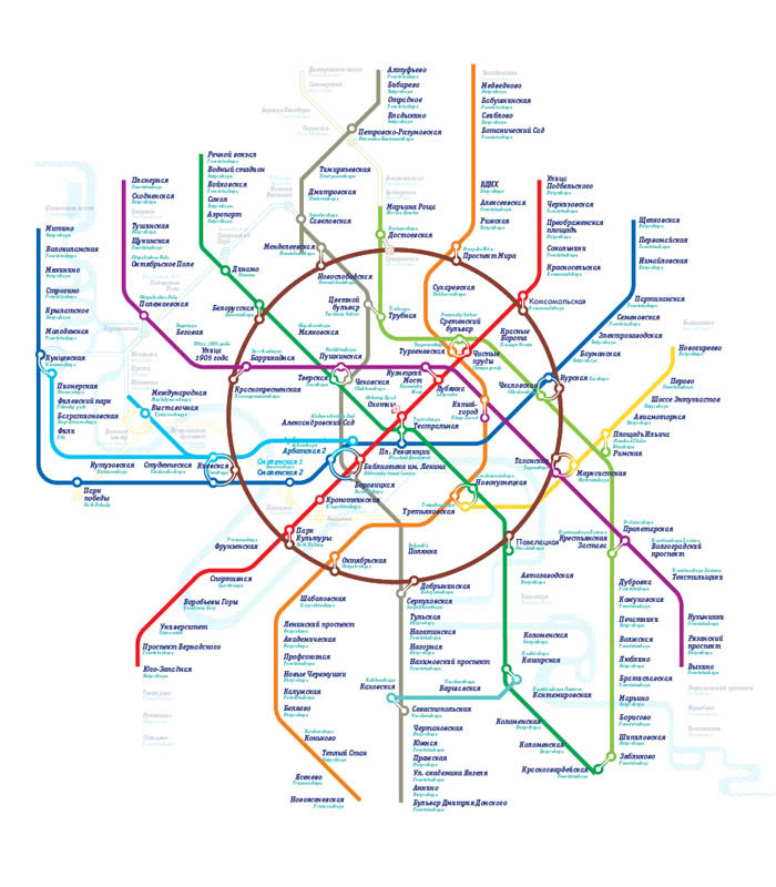
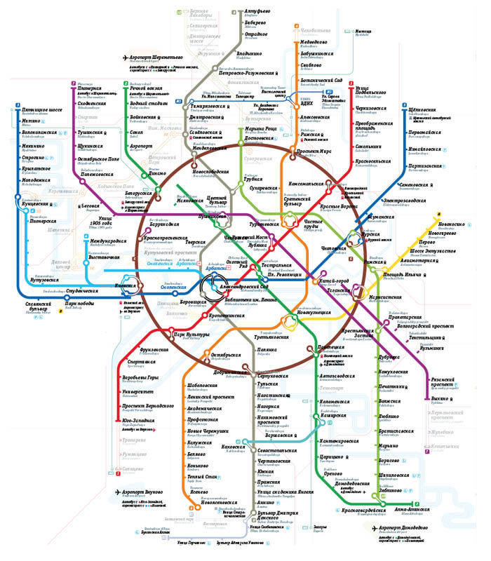
Not really. The centre is an a-grade mess and the lines outside the circle look like a punishing tornado survivors.
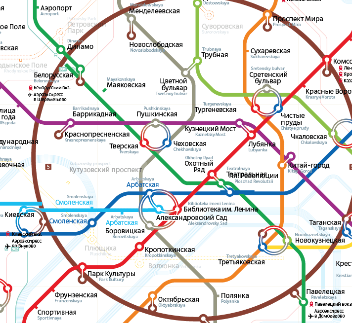
On the other hand, the Pushkinskaya—Tverskaya—Chekhovskaya connection looks five times cleaner, the weird bend of the grey line is gone with the wind, and a ninety-mile section between Annino and Bulvar Dmitriya Donskogo is not there either. Curiously, other designers often copy this strange piece in their maps :-)
Back to the forty-five degree world, we’ll now try to incorporate all the improvements discovered.
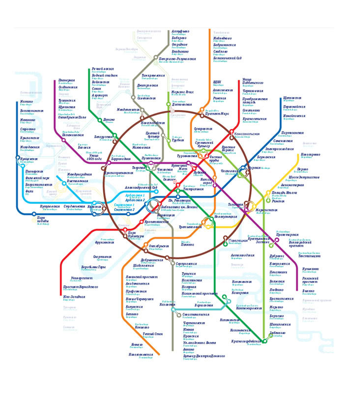
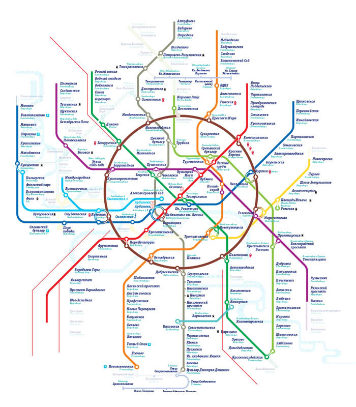
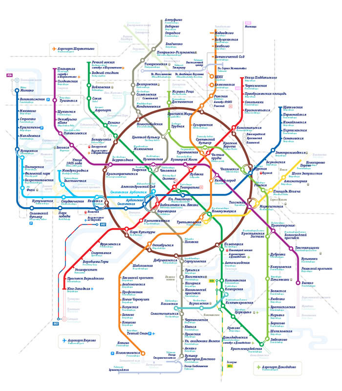
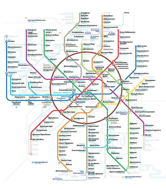
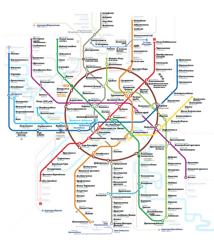
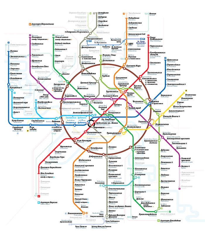
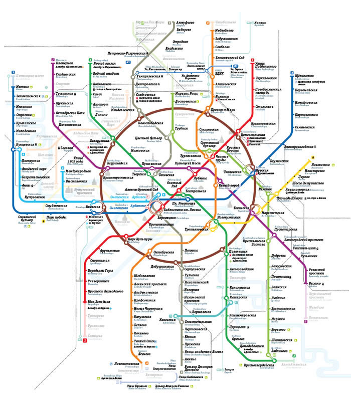
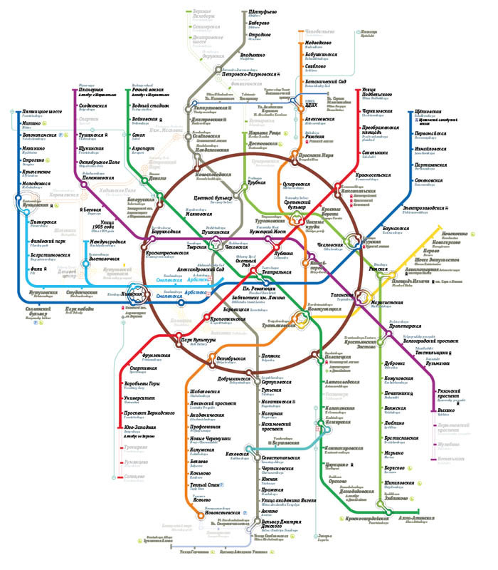
I love Moscow:
Well, almost:
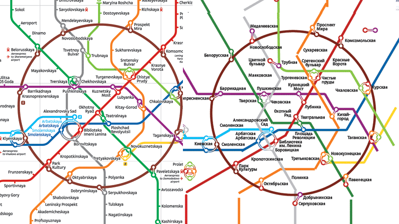
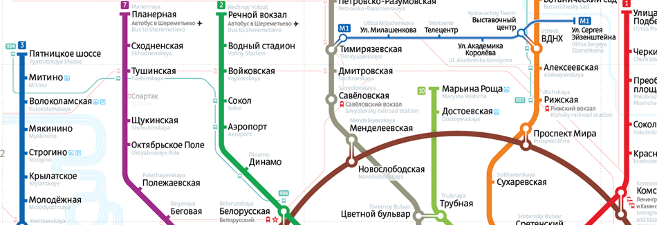
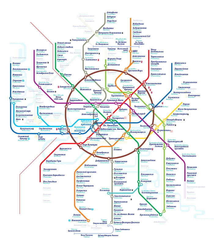
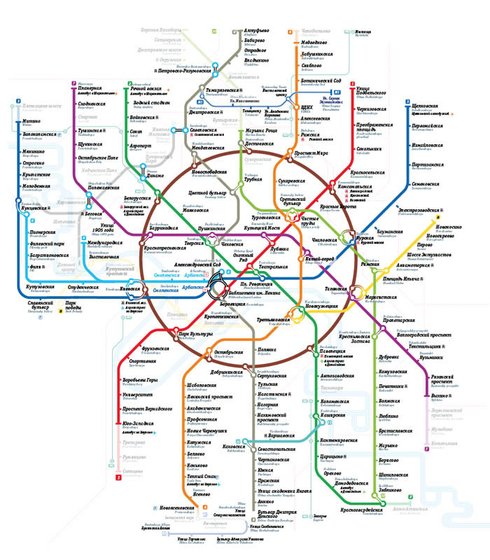
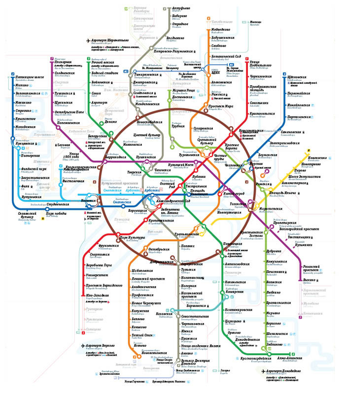
The addition of the river and the stations under construction Plyuschiha and Volhonka necessitated more room for Smolenskaya and Arbatskaya, thus deforming the Biblioteka Imeni Lenina connection from a perfect circle into a Moscow hippodrome-ish curve. It becomes unavoidable that the signature element of the previous edition map—the connection at Biblioteka—should go to trash and a new signature element is to be made.
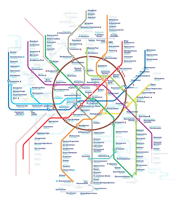
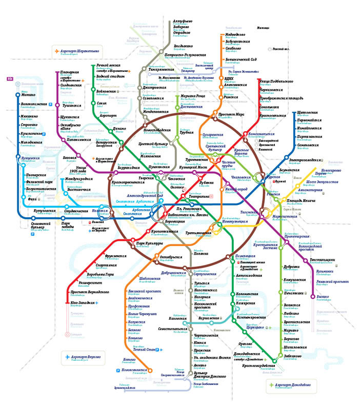
Drawing it out:
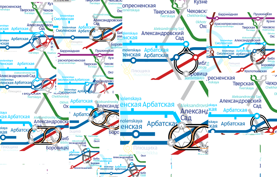
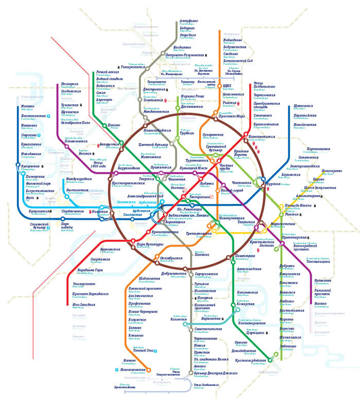
Yin & Yang construction is really attractive, but, to be honest, is no freaking legible.
At this very moment Ludwig shows up to sketch a steering wheel on a scrap of paper.
freaking awesome. The steering wheel is a keeper.
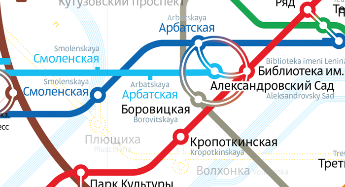
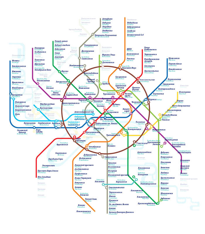
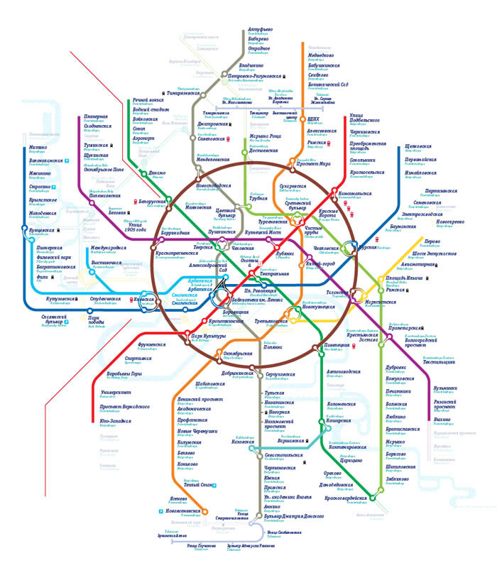
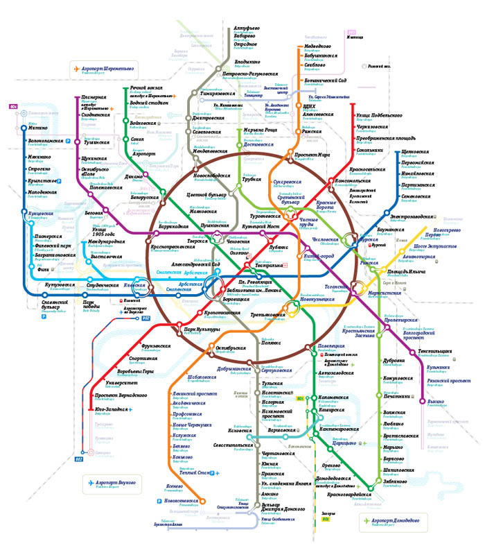
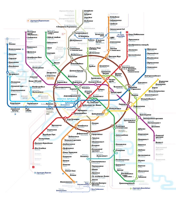
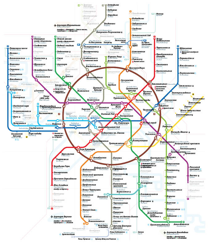
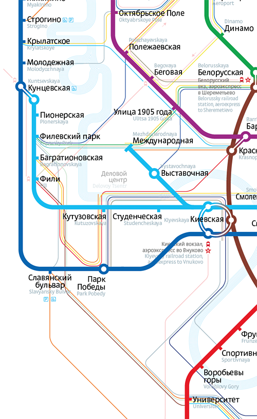
And while at it, deciding to bring all the connection circles to a consistent size. There used to be three of them: small (a connection between three stations with different names), medium (two stations with the same name and another one with a different name), and large (all three stations are named Kiyevskaya and you’re freaking supposed to somehow mark all of them.)
Trying to blow up all the circles to match the one at Kiyevskaya:
Nope. Undo.
Medium?
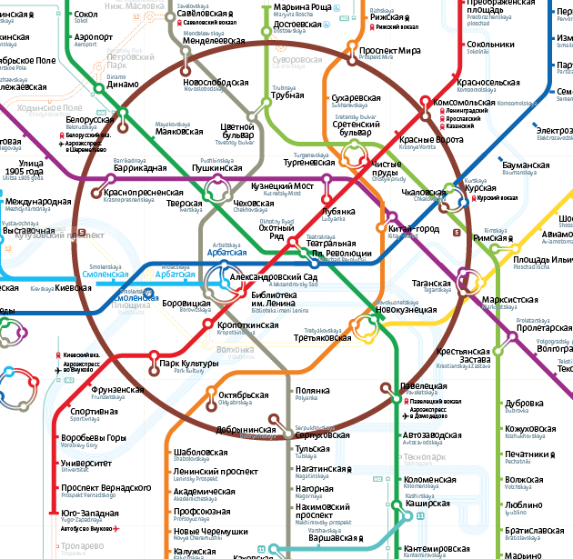
Oh, that might do. Leave the Kiyevskaya case as an exception. Enlarge the connection at Biblioteka about twice, per Tema.
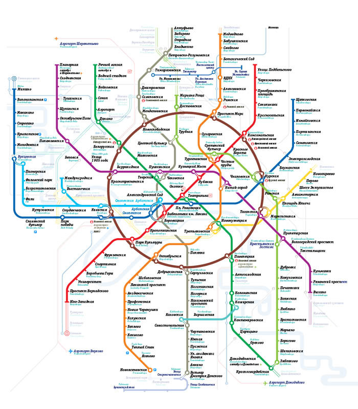
Meanwhile, thinking on how to represent the rail lines. The point is, that simply showing a connection from metro station Kuntsevskaya to rail platform Kuntsevo-1 is not enough. It’s much more helpful to also communicate that, when switching to the rail at Kuntsevskaya, you can go first to Fili metro station and then all the way to Belorusskaya metro station.
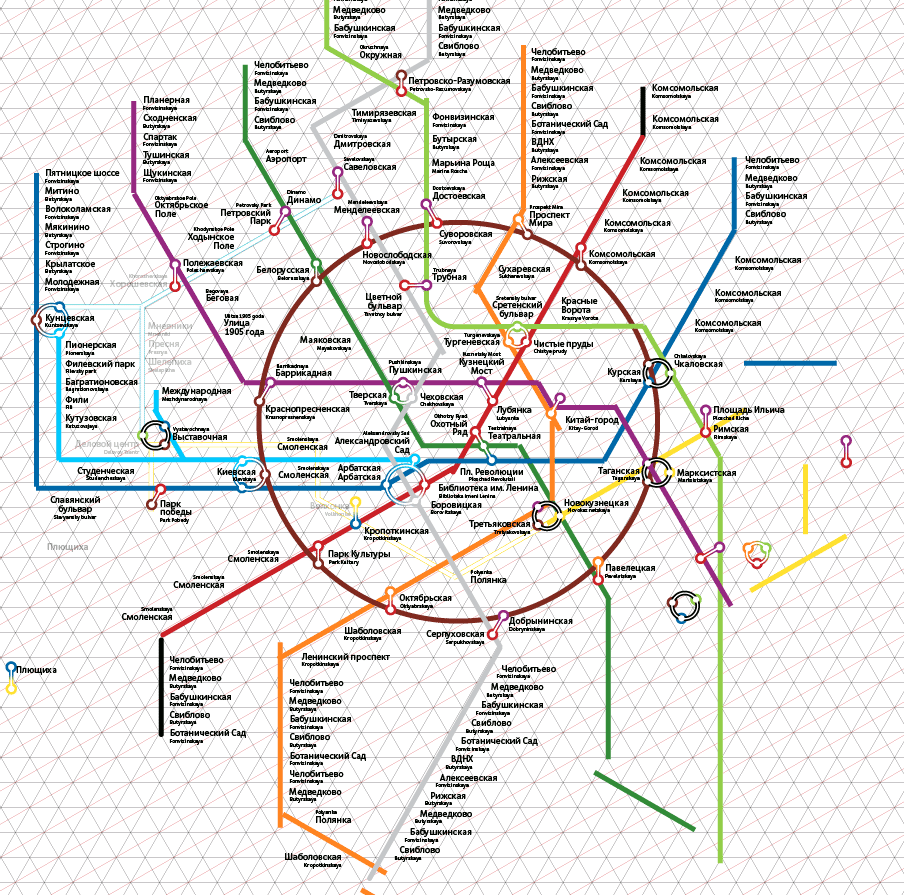
For a reference we take an official map of the Moscow City and Moscow Region Rail Map created by an anonimous designer based on our map 2010:
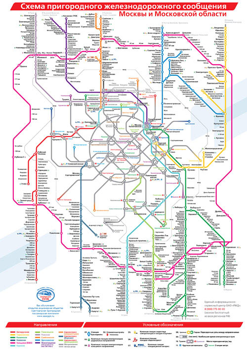
A classic rail dotted line is perfect and its meaning is instantly clear without any legend. Yet it makes you dizzy and unmodestly steals attention from the map’s prima donna—the metro system—which could only be forgiven in Stockholm.
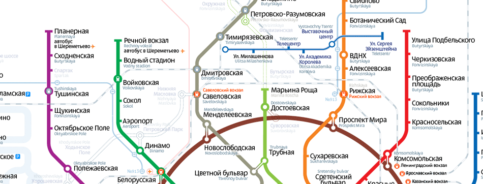
Delicate pink lines are just what we need: clearly defined without being overwhelming. They also pair like peas and carrots with the express bus lines (route
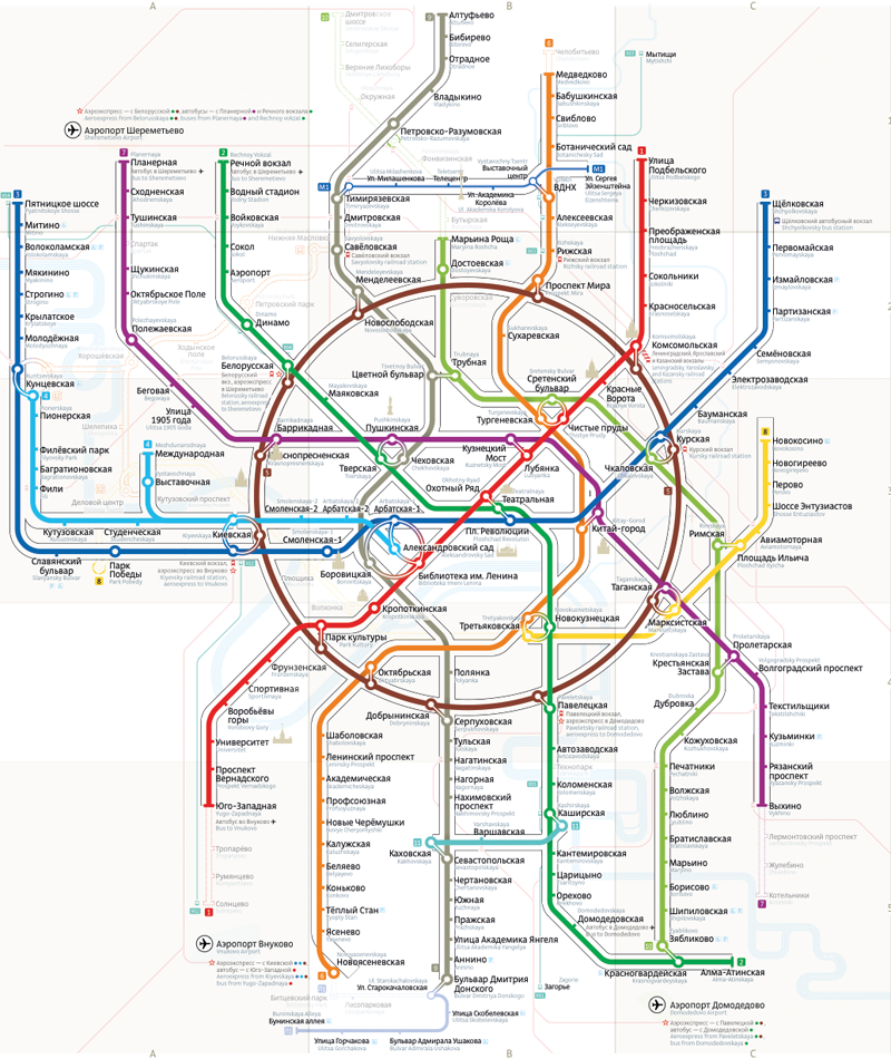
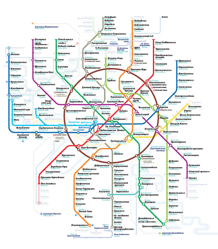
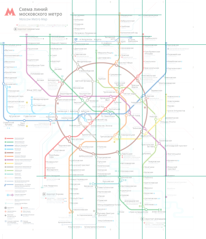
Building in the grid, index, and legend.
Checking the distance between the text and the station «stumps» on every line.
Submitting our entry to the Transportation Department’s open competition. Yegor Zhgun is catching a plane.
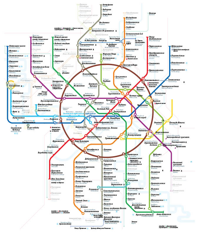
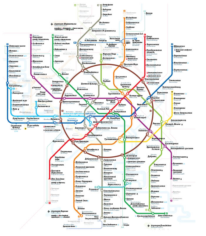
The map’s evolution in 95 images:

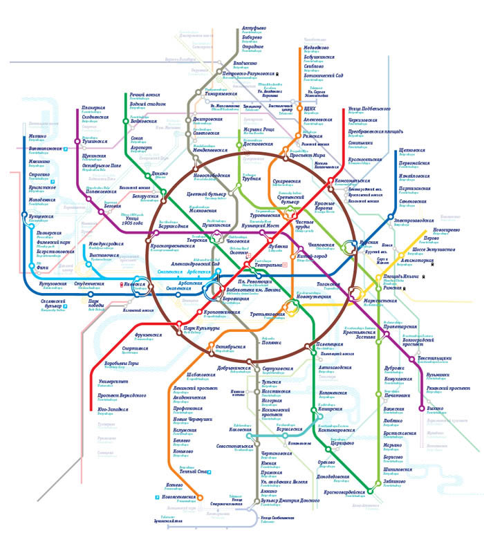


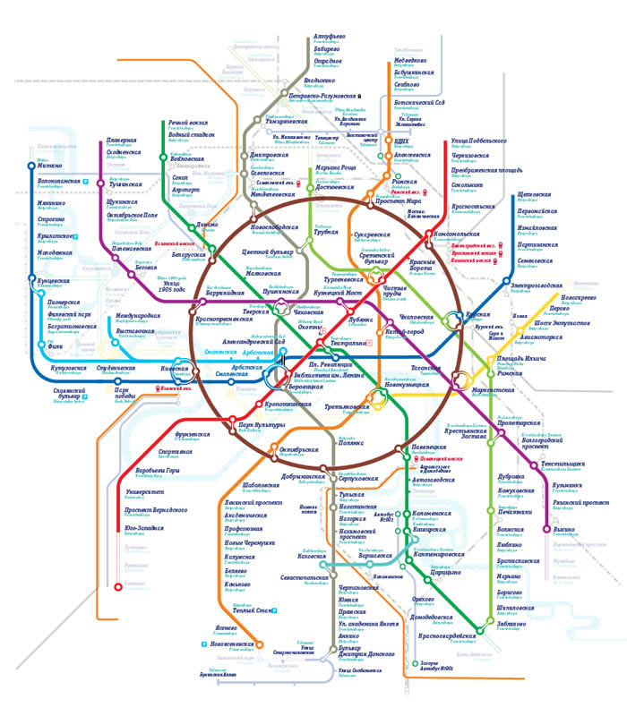
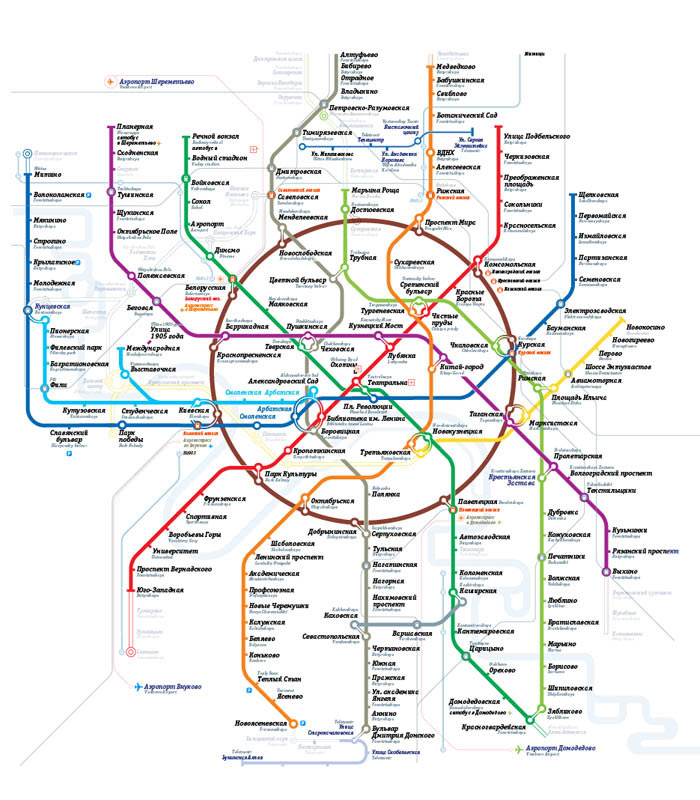
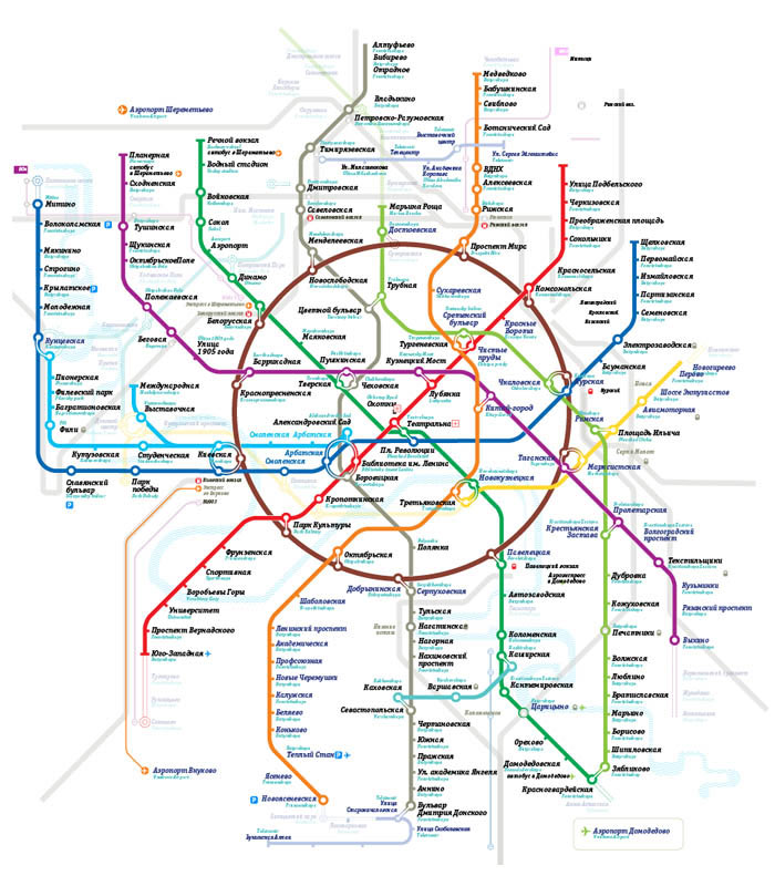

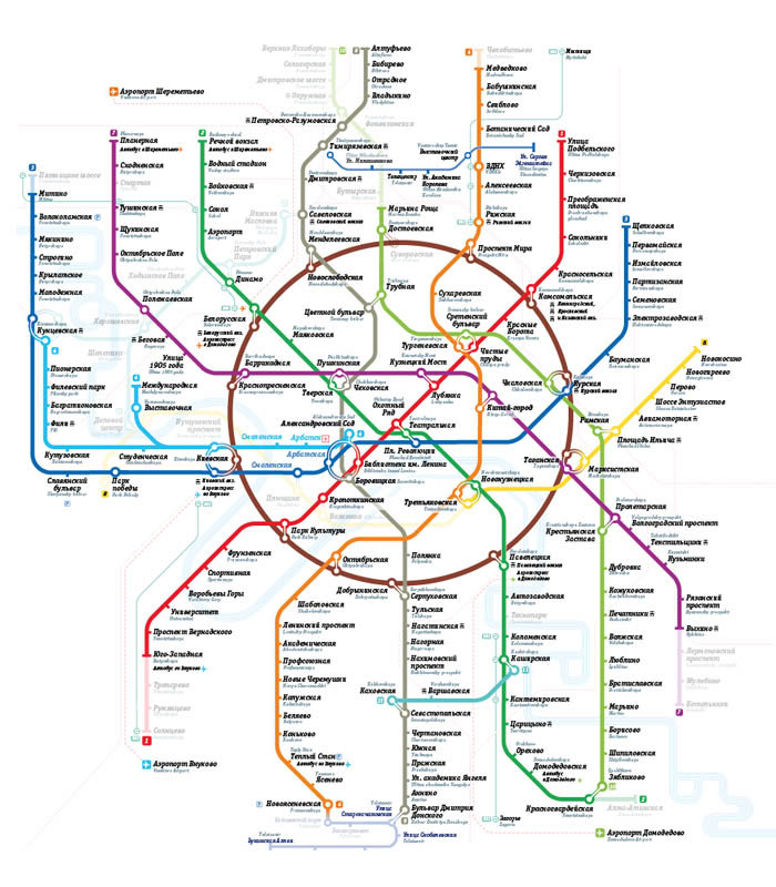


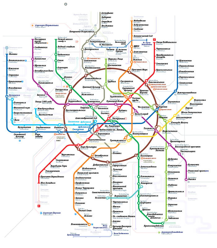


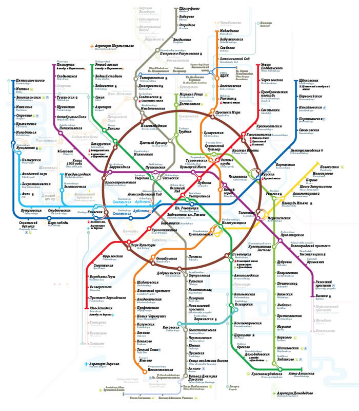
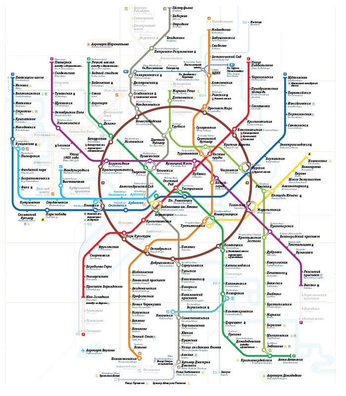


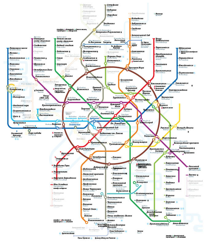


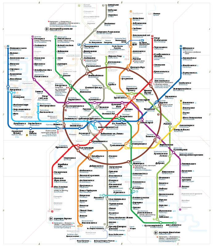


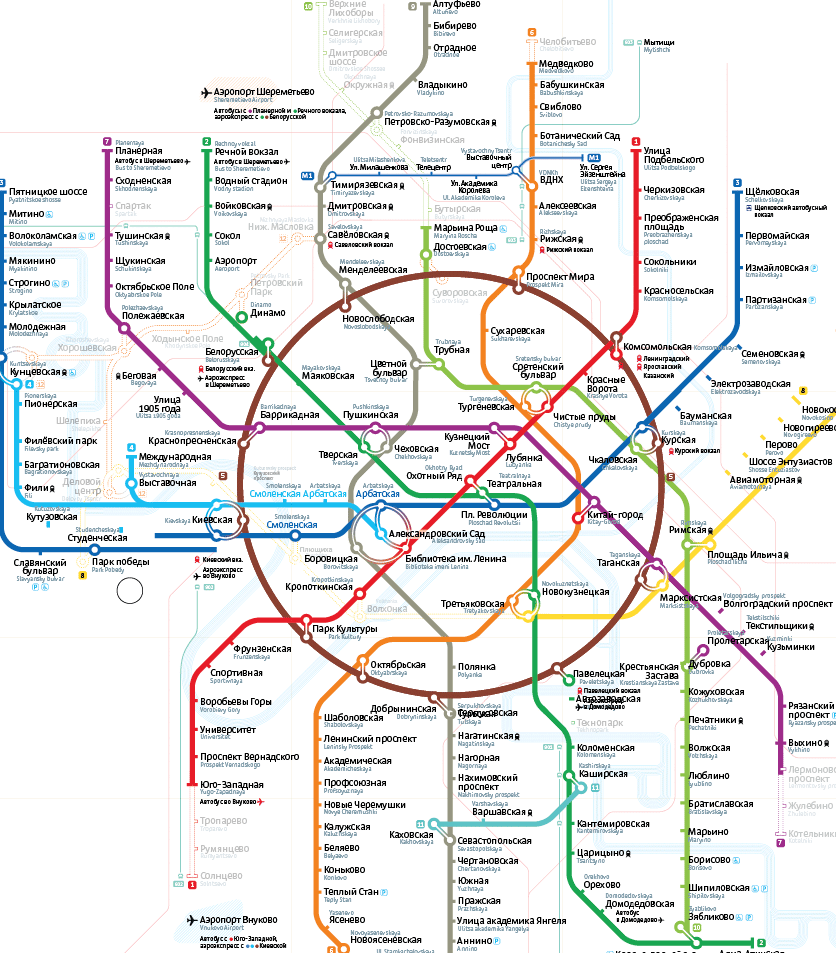
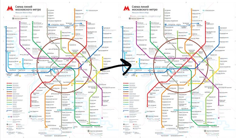
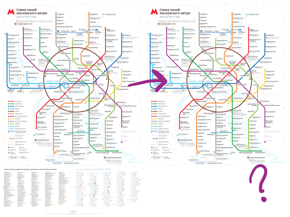
One of the reasons behind the creation of the second edition was our desire to combine it with the second group of connections which is currently under construction and also to extend the yellow line further west. Now we can delete it with the resulting map looking twice as clear:
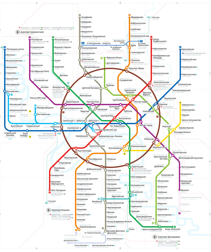
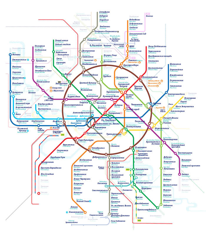
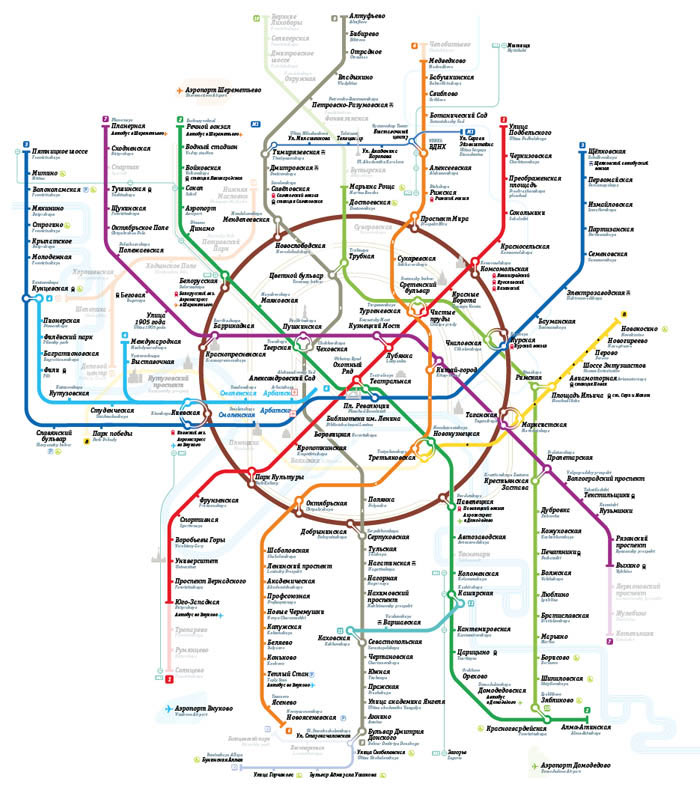
Express bus #903 will now home to Holmogorskaya Ulitsa instead of Mytischi and #902 to Novo-Peredelkino instead of Solntsevo:
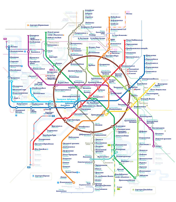
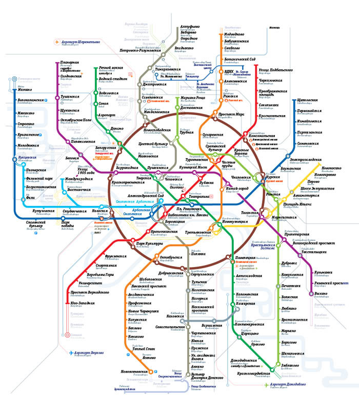
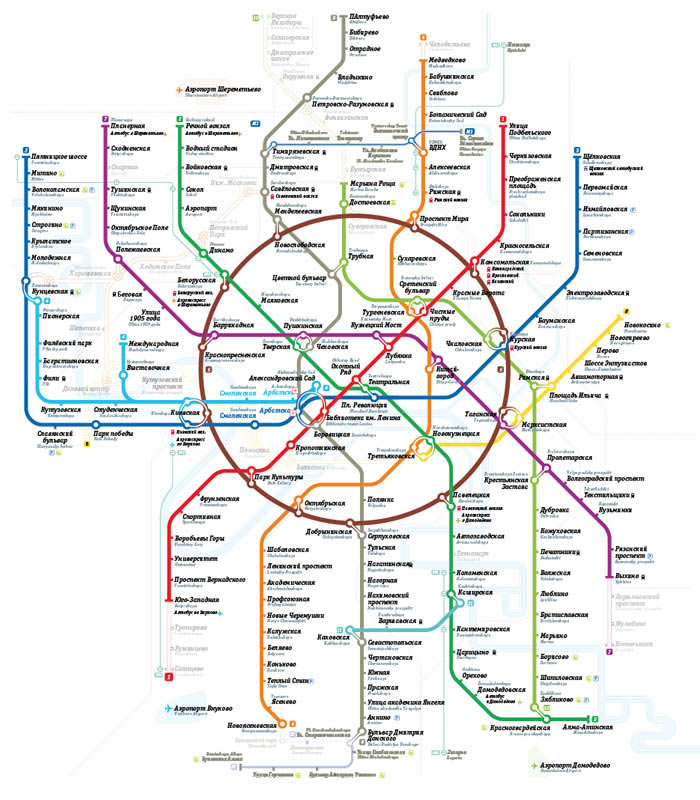
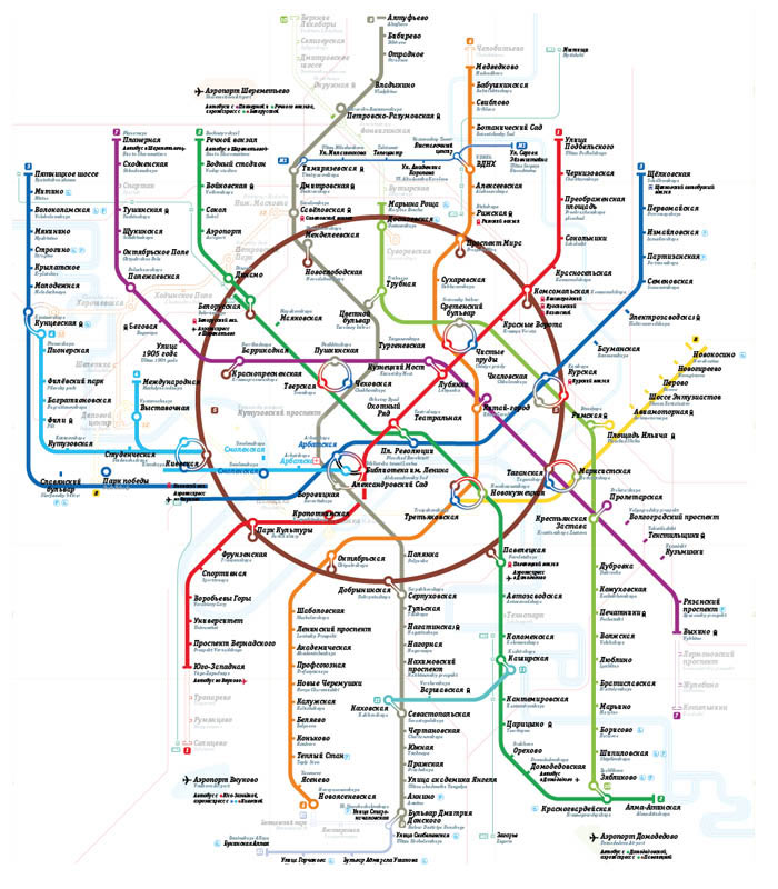
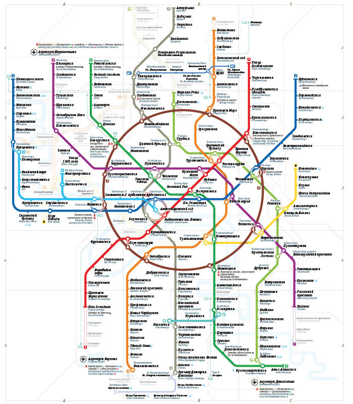
Straightening back the lines at the north section which originally compensated for the under-construction lines:
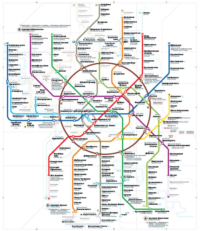
And now the same at the south section:
Almost there, just need to draw the last image and prepare the project’s page.
Should the final image be a picture of the bus lines in-between the peripheral metro stations?
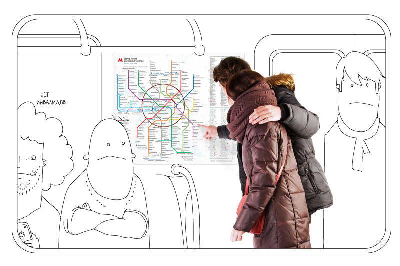
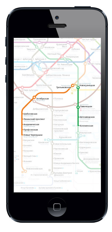
Or some outline graphics on iPhone?
Or a map showing the circle roads and cross-platform connections?
Or, instead, not just the circle roads, but the main highways and sights as well? And make it the first picture, not the last?
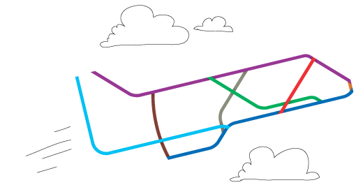
You can throw a moose in later on.
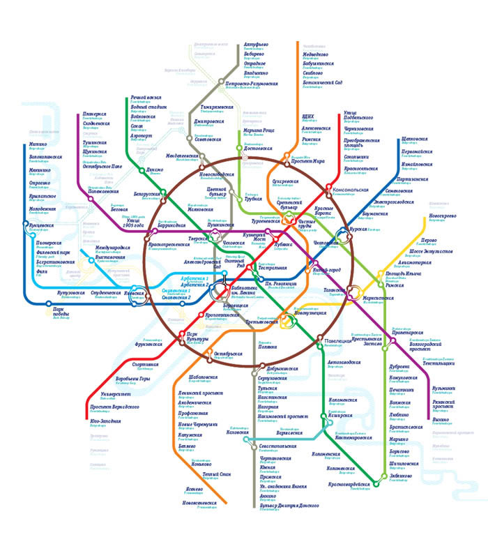
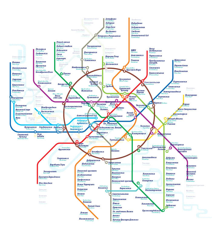
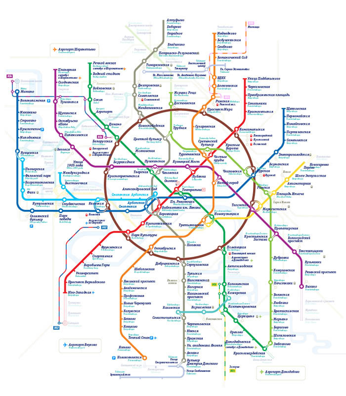
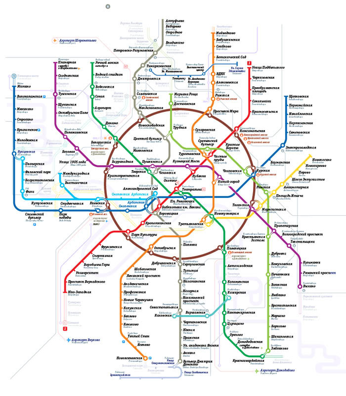
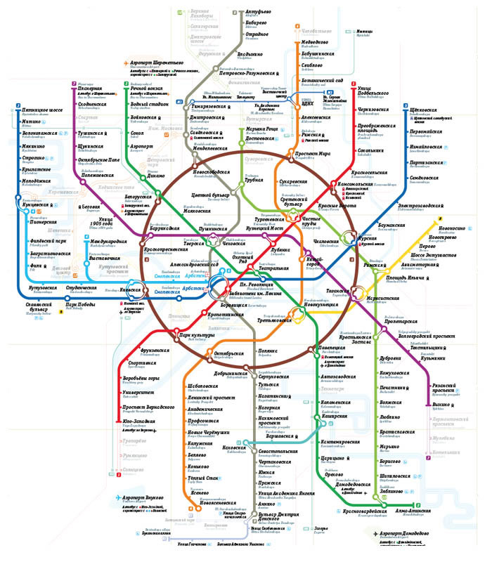
How about straightening the bend on the purple line?
Sure, this’s the way to go.
Ready to publish the project’s page.

Order a design...