A simple and easy to use map shows districts covered by key public transport routes. Lack of precise geography found on classic maps makes it easy to find the destination, understand the location of districts and plan the route. Only the routes going through several districts were chosen for the map and transliterated stop names were included to help foreign tourists find their bearings.
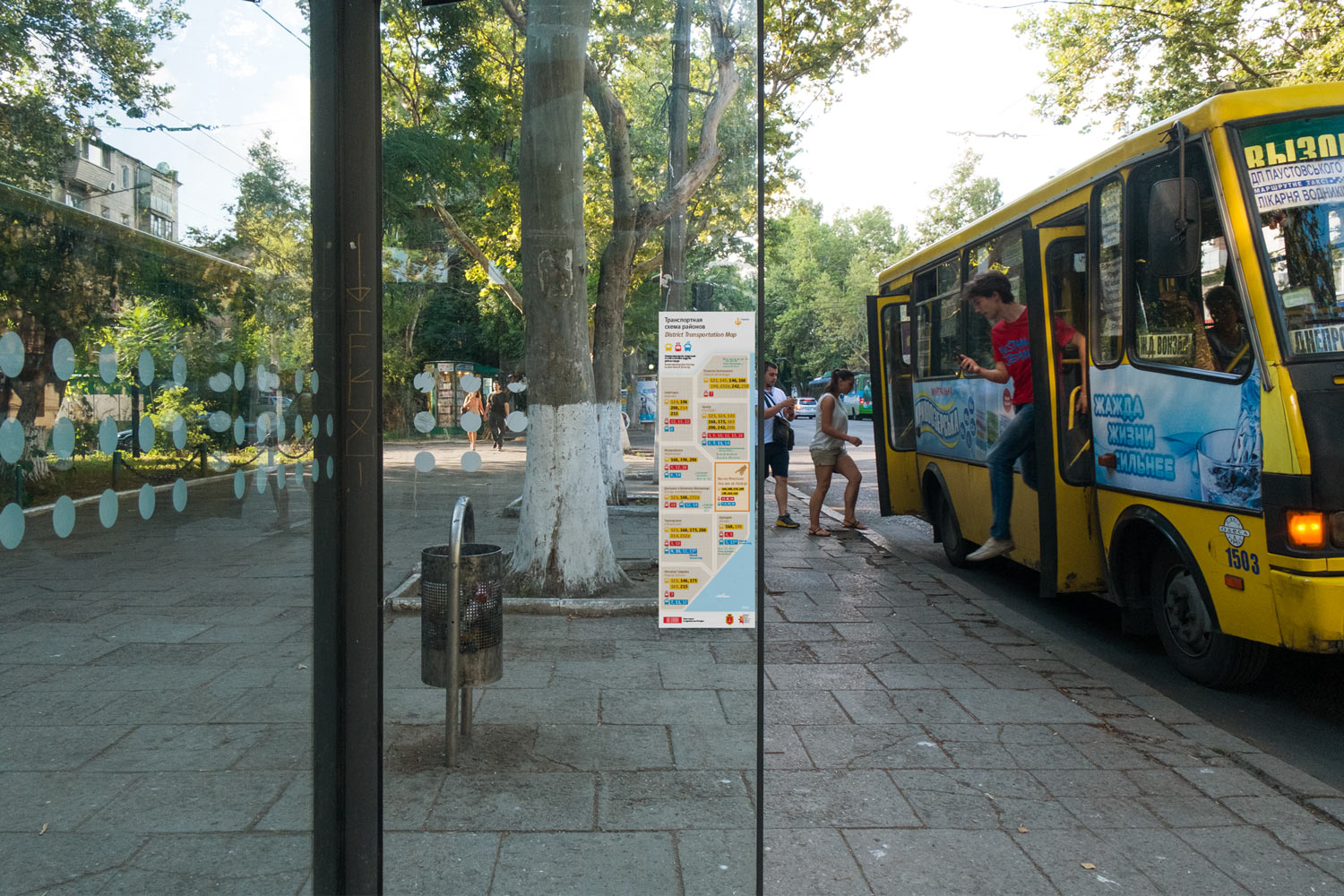
160 × 525 mm (6,3″ × 20,6″)
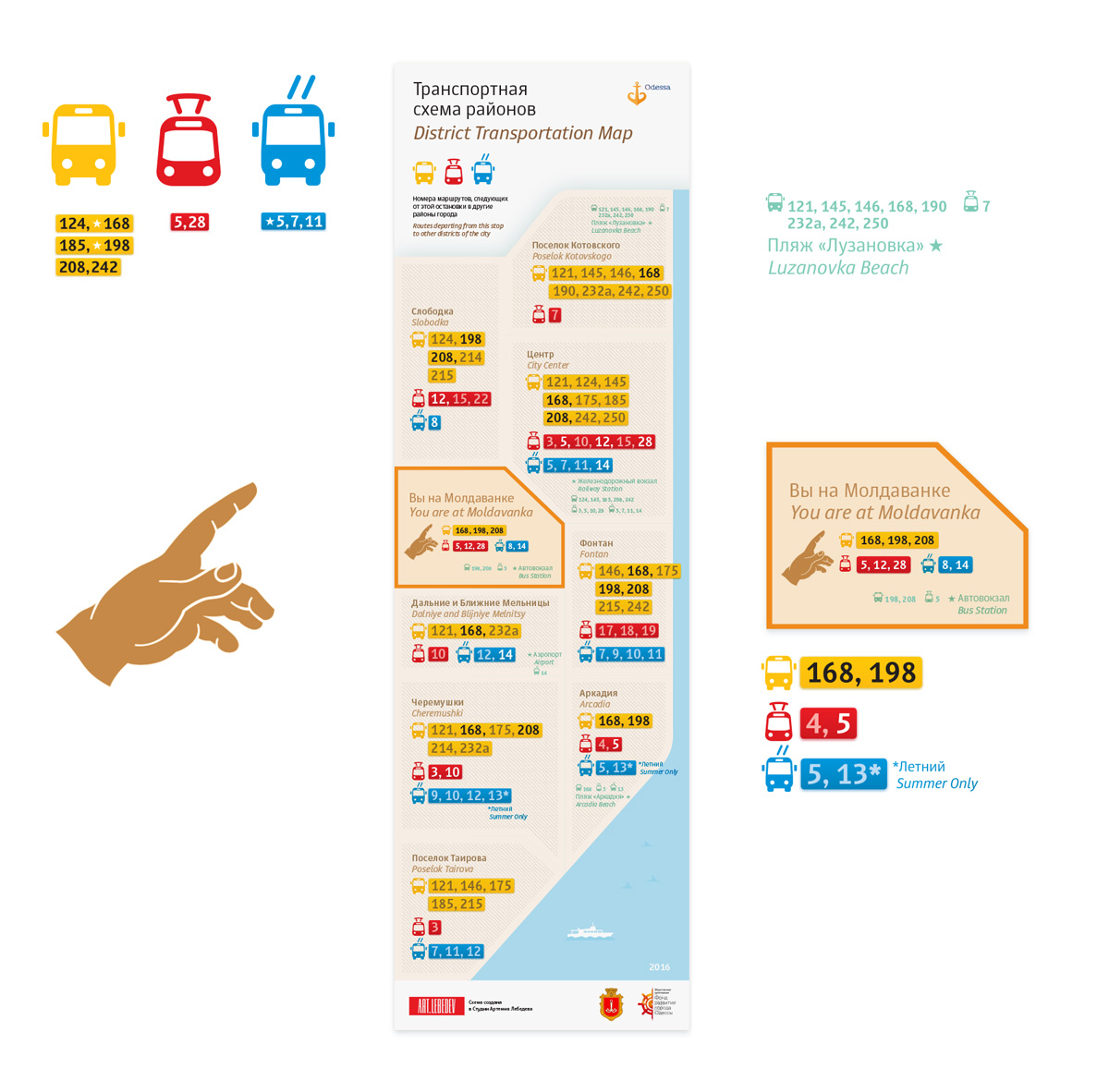
Key places are denoted by inserts with route numbers
Current location is marked on the map
Transport icons and route backgrounds are color coded
Routes of current districts are highlighted with a bright color, irrelevant routes are muted
Color codes match the traditional colors of public transport making it easy to memorize them.
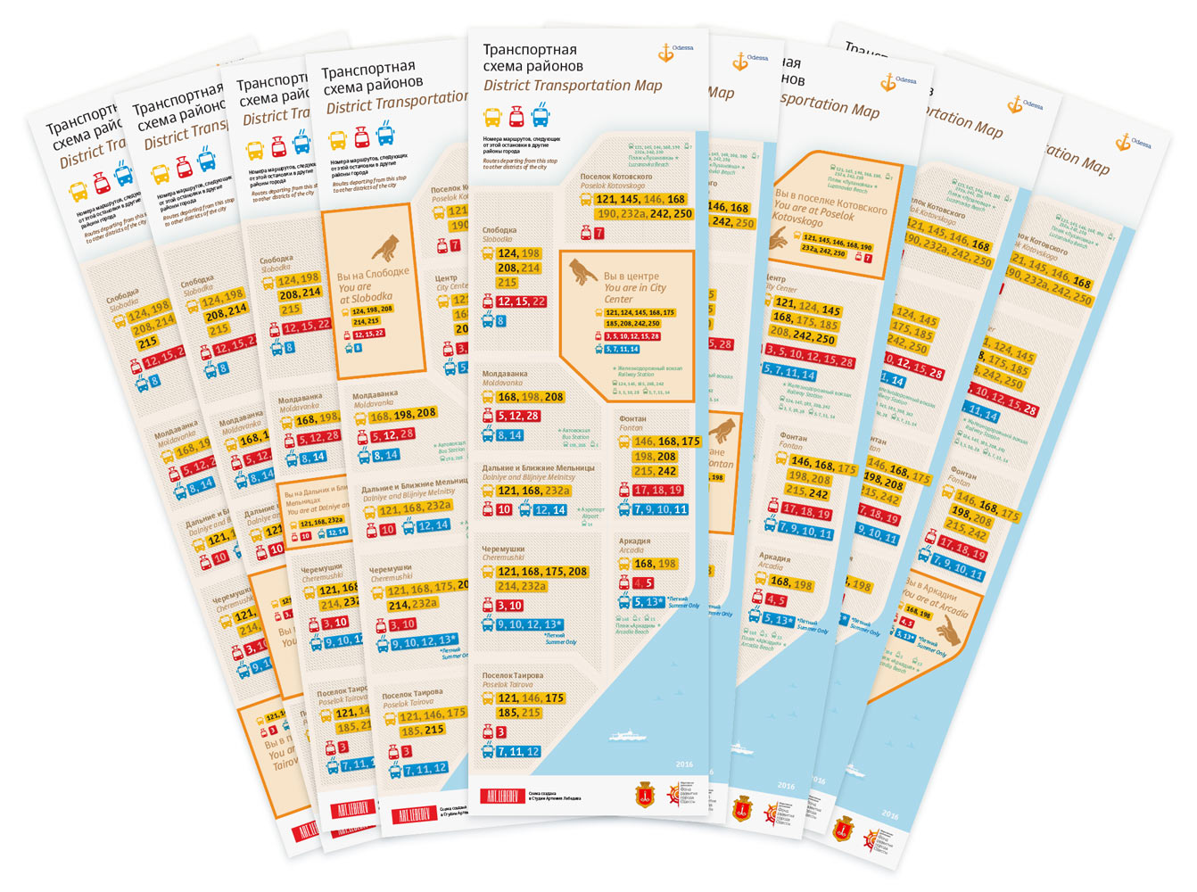
Each district has its own map
The map is printed on adhesive film which can be placed on glass aligned at the edge.
artistic director
art director
- Ludwig Bistronovsky
senior designer
- Sergey Steblina
designer
editor
- Aleksandr Nosikov
translator
- Tatiana Kozlova
project manager
- Yulia Nikolaeva
